Some drives are about the destination. These are about the sky. Every state has at least one road where the view above matters as much as the view ahead, where the clouds build into towers, the light shifts by the minute, and the weather itself becomes the scenery. For storm chasers, these are the roads where supercells cross the highway and lightning crawls across the horizon. For sky watchers who prefer their weather at a comfortable distance, these are the routes where the atmosphere puts on a show that no landscape alone can match.
The connection between driving and weather is fundamental. Roads follow valleys, cross passes, trace coastlines, and cut across plains, and every one of those terrains creates its own weather patterns. Mountain passes generate lenticular clouds and sudden squalls. Coastal highways run through fog banks and sea-spray storms. Plains roads put you underneath the biggest skies on Earth, where you can watch a thunderstorm develop from first cumulus to full anvil across a hundred miles of unobstructed horizon. The best sky-watching drives are the ones where the road itself puts you in the right position to see what the atmosphere is doing.
This list covers all 50 states, and the emphasis is on the driving experience rather than a single viewpoint. These are roads where the sky changes as you move, where every mile brings a different angle on the clouds, and where pulling over to watch the weather is not a delay but the whole point. Some of these drives are famous. Many are not. All of them will make you look up.
Alabama: Cheaha Skyway (Highway 281)
The Cheaha Skyway runs along the crest of the Talladega Mountains in eastern Alabama, climbing to Cheaha Mountain, the highest point in the state at 2,407 feet. The road is not high by western standards, but it sits above the surrounding Piedmont by enough that on unstable summer afternoons, you can watch thunderstorms build across the lowlands while standing in clear air on the ridgeline. The skyway follows the spine of the Appalachian foothills, and the views from the pullouts along the route look out over miles of forested valleys where convective cells develop, grow, and march across the landscape like slow-moving ships.
Summer is the prime season. Alabama’s warm, humid air mass produces some of the most prolific thunderstorm activity in the country, and the elevated position of the Cheaha Skyway puts you above the initial stages of development. You can watch cumulus clouds grow into cumulonimbus towers in real time, see the rain shafts dragging across the valleys below, and hear the thunder echoing off the mountain walls. The late-afternoon light, filtering through the storm clouds, produces colors across the forested ridges that shift from green to gold to deep violet as the storms move through. On clear days, the visibility from Cheaha extends for miles, and the sunrise and sunset views from Bald Rock, near the summit, are among the best in the state.
Cheaha State Park, at the high point, has a lodge, cabins, and a restaurant where you can watch storms roll through from the comfort of a screened porch. The Pinhoti Trail crosses the area for hikers who want to experience the sky from the ridgeline on foot. The drive from Talladega to Cheaha covers about thirty miles of mountain road with frequent pullouts, and on a summer afternoon when the atmosphere is active, every stop offers a different perspective on the weather theater unfolding below.
Alaska: Seward Highway (Anchorage to Seward)
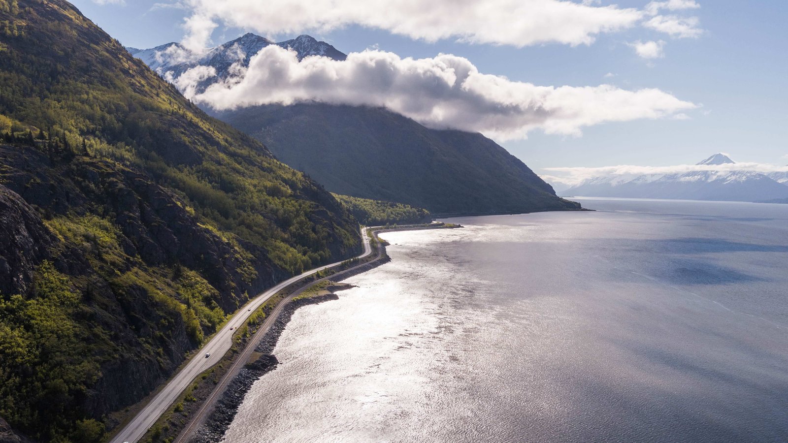
The Seward Highway runs 127 miles from Anchorage to the port town of Seward along one of the most dramatic landscapes in North America, and the weather along this route is as varied and spectacular as the terrain. The road begins along Turnagain Arm, a narrow fjord where the Chugach Mountains rise directly from the water’s edge, and the weather here can change from sunshine to driving rain to whiteout conditions in the space of a few miles. The arm funnels wind and moisture from the Gulf of Alaska into a narrow corridor, and the resulting weather phenomena include williwaws (sudden violent downdrafts), horizontal rain, and cloud formations that wrap around the mountain peaks in patterns that look like the atmosphere is being kneaded by invisible hands.
Beyond Turnagain Arm, the highway climbs over the Kenai Mountains through a series of passes where the clouds sit at road level and the visibility can shift from fifty miles to fifty feet without warning. The descent to the Kenai Peninsula opens up views of glacial valleys where the sky seems to stretch wider than anywhere in the lower 48. Exit Glacier, near Seward, has its own weather system, with cold air flowing off the ice and colliding with the warmer valley air to produce localized cloud formations and mist effects that are visible from the road.
The drive is spectacular in any weather, but storm days are when the Seward Highway reaches its visual peak. The combination of mountain terrain, maritime moisture, and glacial influence creates a weather laboratory where every atmospheric phenomenon is on display. Pullouts along Turnagain Arm and at the summit passes provide safe viewing areas. The Alaska SeaLife Center in Seward and the restaurants along the harbor provide warm refuge after a weather-watching drive. This is a road where the weather is not something you endure between destinations. It is the destination.
Arizona: Highway 191 (Alpine to Clifton)
Highway 191 through eastern Arizona drops nearly 5,000 feet from the cool pine forests around Alpine to the desert floor at Clifton, and the sky show along this route during monsoon season is one of the most dramatic in the American West. The road follows a winding path down the Mogollon Rim and through the transition zone between the high plateaus and the Sonoran lowlands, and this elevation gradient is exactly where monsoon thunderstorms are born. From July through September, the moist air flowing north from the Gulf of Mexico collides with the heated terrain along this corridor, producing afternoon thunderstorms that are violent, photogenic, and visible from enormous distances.
The upper sections of the drive, near Alpine at about 8,000 feet, offer views to the south and west where you can watch the storms develop over the lower terrain. The moisture columns, lightning, and rain curtains are visible against the desert backdrop like weather dioramas. As you descend, the road passes through the storm zone itself, and the experience shifts from observation to immersion. The monsoon storms here produce lightning of extraordinary intensity, and the combination of red rock, green copper-mine tailings, and purple storm clouds creates a color palette that no other driving route in America can match.
The road is famously curvy, with over 460 curves in the section sometimes called the Devil’s Highway, so the driving demands attention. But the pullouts along the descent provide safe places to stop and watch the sky. The small towns of Alpine and Clifton bookend the drive with basic services. Hannagan Meadow Lodge, near the top, offers rooms and food in a mountain setting where the monsoon storms arrive with theatrical grandeur. This drive is best done in late afternoon during monsoon season, when the storms are building and the low-angle light turns the clouds into sculptures of gold and grey.
Arkansas: Pig Trail Scenic Byway (Highway 23)
The Pig Trail winds through the Ozark National Forest between Ozark and Brashears, and while the road is famous for its curves, the sky views from the ridgetops along this route are what make it essential for weather watchers. The Ozark Mountains create their own weather patterns, and the ridgeline sections of the Pig Trail put you at the right elevation to watch storms approach from the west across the Arkansas River valley. On unstable spring and summer afternoons, the view from the high points along Highway 23 includes developing thunderstorms, shelf clouds rolling across the valley, and lightning displays that stretch from horizon to horizon.
The Ozarks sit in the transition zone between the Great Plains storm belt and the more stable air of the eastern forests, and the result is a storm season that runs from April through September with a peak in late spring that can produce severe weather. The Pig Trail’s ridgeline position is ideal for watching these systems develop without being directly in the path of the worst cells. The forested mountains channel the storms through the valleys, and from the high overlooks, you can see the rain bands moving across the landscape in real time. The fog and mist that fill the hollows on cool mornings add another atmospheric dimension, with the Ozark ridges rising above the clouds like islands.
The drive itself is about 20 miles of tight switchbacks and dramatic elevation changes through dense hardwood forest. The overlooks are not marked with formal pullouts, but the road shoulders at the ridge crossings provide places to stop safely. Turner Bend Store, along the Mulberry River at the base of the trail, is a gathering spot with basic food and canoe rentals. Ozark, at the northern end, has restaurants and lodging. The Pig Trail in storm season is the Ozarks at their most atmospheric, a road where the sky, the mountains, and the weather converge into something that storm chasers and casual sky watchers alike find unforgettable.
California: Pacific Coast Highway (Big Sur)
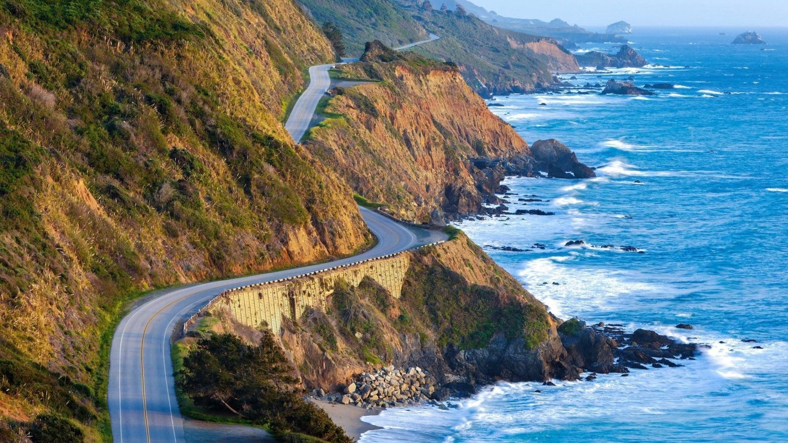
The Big Sur stretch of Highway 1 is famous for its cliffs and ocean views, but the weather along this coast is what elevates the drive from scenic to otherworldly. The marine layer that hugs the California coast from June through August produces fog banks that roll in from the Pacific and pour over the coastal mountains like slow-motion waterfalls. Driving through Big Sur in fog is an experience where the road disappears into white, the redwoods drip with moisture, and then suddenly the fog breaks and you are standing in sunshine above a cloud sea that fills the canyon below. The interplay between fog, sun, and the steep terrain creates a weather show that changes with every curve in the road.
Winter is the other prime season, when Pacific storms make landfall along this coast with dramatic force. The waves crash against the cliffs at heights that are difficult to believe, the wind drives rain sideways across the highway, and the breaks between storm bands produce rainbows, crepuscular rays, and cloud formations that photographers wait days to capture. The Bixby Creek Bridge, one of the most photographed bridges in the world, is especially dramatic in storm light, with the concrete arch framing views of the churning ocean below and storm clouds stacking above.
Pullouts along Highway 1 provide safe stopping points for weather watching. Julia Pfeiffer Burns State Park has a trail to an overlook where the coastal fog dynamics are especially visible. Nepenthe, the famous restaurant perched on the cliff, offers food and views from a position where the fog, the ocean, and the mountains create a constantly shifting backdrop. Big Sur in weather is not the postcard version of the drive. It is better. The fog, the storms, and the light make the landscape feel alive in a way that clear-sky days, as beautiful as they are, simply cannot match.
Colorado: Trail Ridge Road (Rocky Mountain National Park)
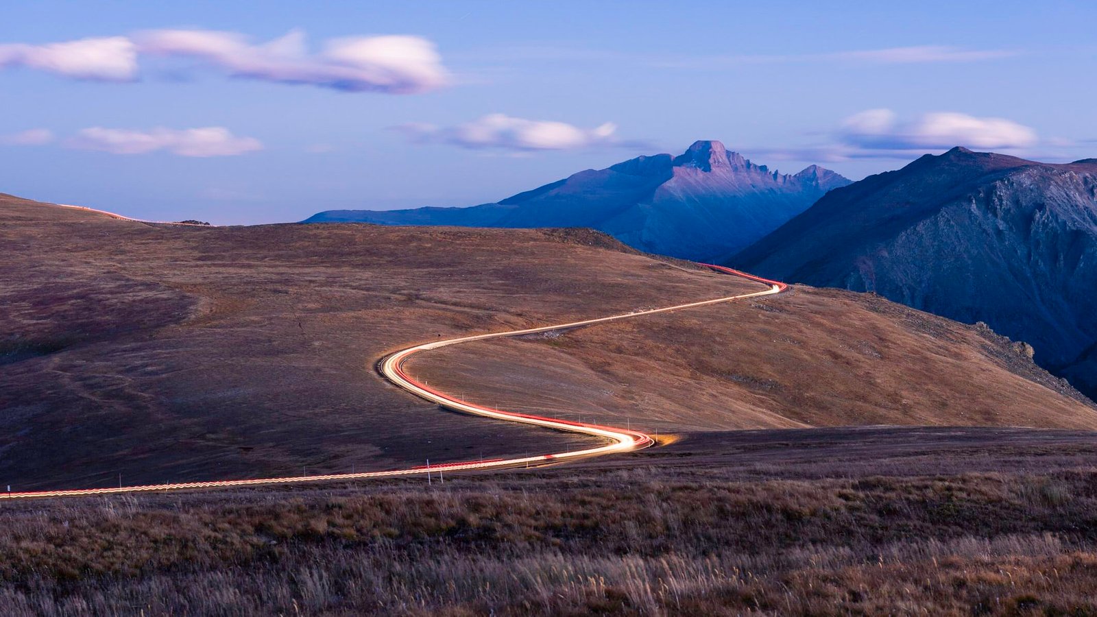
Trail Ridge Road crosses the Continental Divide at over 12,000 feet, making it the highest continuous paved road in North America, and the weather at that elevation is a spectacle that the lower-elevation drives in Colorado cannot approach. The road climbs from the Estes Park entrance through montane forest and subalpine meadows into alpine tundra above treeline, where the sky is closer, the clouds are at eye level, and the weather can shift from sunshine to hail to snow in a single hour. The thunderstorms that build over the Divide on summer afternoons are visible from the alpine pullouts as they develop, with the anvil clouds towering above the peaks and the lightning striking the ridge just miles away.
The morning hours, before the afternoon convection starts, offer the clearest views and the most stable conditions. The sunrise from the Alpine Visitor Center or from the Rock Cut pullout looks out over a sea of peaks that stretches to the horizon, and the early light creates patterns across the cloud formations that are different every day. As the morning warms, cumulus clouds begin building over the peaks, and the progression from fair-weather puffs to towering thunderheads is visible in real time. By early afternoon, the storms are often overhead, and the park rangers recommend descending below treeline, but the thirty minutes of watching the storms develop from the Alpine Ridge Trail, where you are literally inside the cloud base, is one of the most immersive weather experiences available from any road in America.
The drive from Estes Park to Grand Lake covers about 48 miles, and the road is typically open from late May through mid-October. The park charges an entrance fee and can be crowded in summer, but the weather observations are best done early, before the crowds arrive and the storms build. Estes Park has extensive dining and lodging. The Trail Ridge Store at the Alpine Visitor Center serves basic food at 11,796 feet. This is the drive where you watch weather being made in real time, from the same elevation where the storms are born.
Connecticut: Route 169 (Canterbury to Woodstock)
Connecticut is a small, densely settled state without dramatic terrain, but Route 169 through the Quiet Corner of northeastern Connecticut offers something that the more developed parts of the state cannot: open farmland with unobstructed sky views in a landscape that feels unchanged from the 18th century. The road runs about 32 miles through rolling pastures, stone-walled fields, and small villages between Canterbury and Woodstock, and the agricultural openness of the corridor means the sky is the dominant visual element. When thunderstorms approach from the west, the view from the hilltop sections of Route 169 includes the full development of the storm front across miles of open terrain.
The Quiet Corner gets its name from being the least developed part of Connecticut, and that lack of development translates directly into sky access. The light pollution is lower here than anywhere else in the state, making this also the best corridor for watching lightning displays after dark. Summer thunderstorms move through the Connecticut River valley and cross this area with regularity, and the combination of the open fields, the scattered farmsteads, and the storm clouds produces a visual composition that feels more like the Midwest than New England. The autumn sky in this corridor, with high cirrus clouds above the fall foliage, offers a gentler but equally rewarding visual experience.
Route 169 was designated a National Scenic Byway, and the villages along the route provide stopping points with local character. The Golden Lamb Buttery in Brooklyn was a legendary farm restaurant. Woodstock has the Roseland Cottage, a bright pink Gothic Revival house that stands out against whatever the sky is doing. The Inn at Woodstock Hill provides dining and lodging. For a state where open sky is hard to find, Route 169 delivers the closest thing Connecticut has to a big-sky drive, and on storm days, the view from these hilltop pastures is more dramatic than anyone expects.
Delaware: Route 9 (New Castle to Dover)
Delaware is flat, small, and bordered by water on its eastern side, and Route 9, which follows the Delaware Bay shore from New Castle south through the marshlands, offers the most unobstructed sky views in the state. The road passes through tidal marshes and agricultural flatlands where nothing stands between you and the horizon, and the combination of the bay to the east and the open fields to the west creates a panoramic sky view that is rare on the densely developed East Coast. When thunderstorms approach from the west, the entire development of the storm front is visible, from the first anvil cloud to the rain curtain to the clearing behind.
The Delaware Bay marshes produce their own atmospheric effects. Sea fog rolls in from the bay on cool mornings and burns off as the day warms, creating a progression of visibility and light that transforms the landscape by the hour. The evening light over the marshes, when the sun drops low and the sky turns orange and pink above the flat water, is the kind of natural light show that landscape photographers plan around. Bombay Hook National Wildlife Refuge, along the route, has observation towers that provide elevated views across the marshes where the sky and the water merge at the horizon and the weather systems are visible in their full horizontal extent.
Route 9 is a quiet road through a landscape that most Delaware residents drive past on their way to the beach. The small communities along the route have limited services, but New Castle, at the northern end, has a historic downtown with restaurants and lodging. Dover, at the southern end, has full services. The route is best driven slowly, with frequent stops at the marsh pullouts where the sky opens up and the view becomes almost entirely atmospheric. For a state without mountains or dramatic coastline, this is Delaware’s best sky-watching drive, and the marshland horizon gives the weather more room to perform than anywhere else in the region.
Florida: Overseas Highway (US 1, Florida Keys)
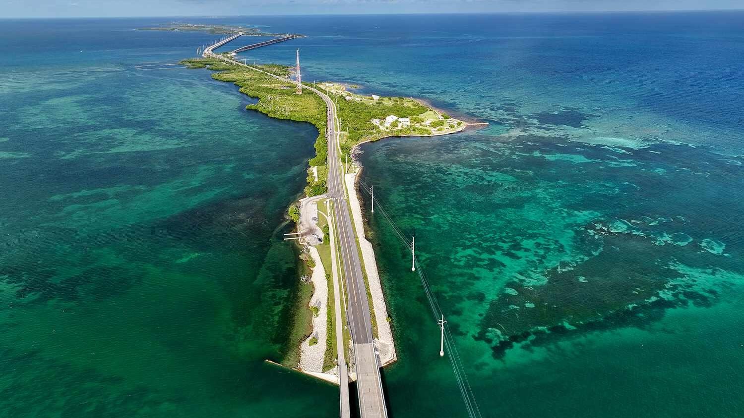
The Overseas Highway runs 113 miles from the Florida mainland to Key West across a chain of islands connected by 42 bridges, and for the entire length of the drive, the sky is the dominant feature. The road sits just a few feet above sea level, with open water on both sides for much of the route, and the unobstructed horizon extends 360 degrees at the major bridge crossings. The Florida Keys produce their own weather, and the contrast between the warm Gulf of Mexico to the west and the slightly cooler Atlantic to the east creates convective activity that is visible from the road as isolated thunderstorms pop up, drift across the water, and dissipate, all within view.
The afternoon thunderstorms in the Keys are among the most photogenic in the country. The storms develop vertically over the open water, and from the Seven Mile Bridge or the Bahia Honda Bridge, you can watch the full lifecycle of a convective cell: the initial tower, the anvil spreading out at the tropopause, the rain shaft dropping to the water, and the lightning flickering inside the cloud mass. The light during these storms is extraordinary. The combination of the tropical sun, the storm clouds, and the reflective water surface produces colors that range from turquoise to deep violet, and the rainbow frequency after afternoon storms is higher here than almost anywhere in the country.
The waterspouts that form over the shallow waters of the Keys are another weather phenomenon visible from the highway. These tornadoes over water are generally weaker than their land-based cousins but are strikingly photogenic, with the funnel descending from a dark cloud base to the water surface in full view. The drive has numerous places to pull over and watch, and the old bridge at Bahia Honda State Park provides a walking platform with open-water views. Key West, at the end of the drive, is famous for its sunset celebrations at Mallory Square, where the evening sky over the Gulf is the main entertainment.
Georgia: Russell-Brasstown Scenic Byway
The Russell-Brasstown Scenic Byway loops through the mountains of northeastern Georgia, climbing to Brasstown Bald, the highest point in the state at 4,784 feet, and the sky views from the summit and the ridgeline road are the best in the state for watching weather develop across the southern Appalachians. The drive covers about 41 miles through the Chattahoochee National Forest, and the upper elevations provide a platform above the valley fog and haze that characterize the lower terrain. On unstable summer days, the view from Brasstown Bald includes thunderstorms building across the Blue Ridge in multiple directions, with the anvil clouds visible from above as they spread across the sky.
The southern Appalachians produce orographic weather, where moist air from the Gulf of Mexico is forced upward by the mountain terrain and condenses into clouds and rain on the windward slopes. From Brasstown Bald, you can see this process in action, watching the clouds form along the ridgelines to the south and west as the warm air rises. The storms that develop here are often isolated cells rather than the organized squall lines of the plains, and the view from the mountain allows you to watch individual storms drift across the valleys, dropping rain on one ridge while the next ridge over sits in sunshine.
The road to Brasstown Bald includes a steep access road from the byway to the summit parking area, and a shuttle or a short hike takes you to the observation deck at the top. The visitor center has interpretive displays about the regional weather and ecology. The surrounding towns of Blairsville and Hiawassee have restaurants and lodging. The byway is best driven on summer afternoons when the convection is active, and the combination of mountain elevation and atmospheric instability creates a weather-watching experience that is unmatched in the Southeast.
Hawaii: Hana Highway (Maui)
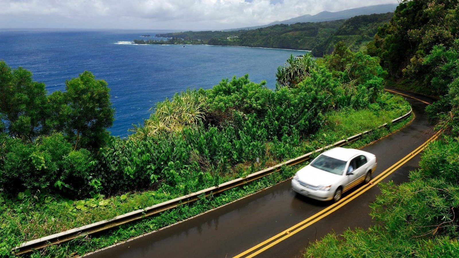
The Hana Highway on Maui covers 64 miles of the island’s northeastern coast, and the weather along this route is as dramatic and varied as any drive in the country. The road follows the windward side of Haleakala, where the trade winds push moisture-laden air against the mountain and produce rain that can be torrential, localized, and stunningly beautiful. The drive passes through 59 bridges and about 620 curves, and the weather changes at nearly every one. You can drive through a downpour that reduces visibility to a few feet, emerge into blazing sunshine a mile later, see a rainbow arcing over a waterfall, and then enter another rain band, all within a thirty-minute stretch.
The waterfalls along the Hana Highway are fed by this weather, and after heavy rain, they multiply from a few dozen to hundreds, with cascades streaming down every cliff face and ravine along the coast. The interplay between the rain, the sun, and the volcanic landscape creates light conditions that change by the minute. The clouds above the highway are at different elevations on the mountain slope, and looking upward from the road, you can see multiple cloud layers moving in different directions, with gaps between them that send shafts of light down to the ocean surface below.
The drive requires patience and attention, as the road is narrow, winding, and often shared with oncoming traffic. But the weather spectacle rewards the slow pace. Pullouts at the major waterfalls and viewpoints provide safe places to stop and watch the sky. Ke’anae Peninsula, about halfway along the route, has a lookout where the view includes the open ocean, the cloud-wrapped mountain, and the taro fields that the rain sustains. Hana town, at the end of the drive, has a few restaurants and the Hotel Hana-Maui. This is the drive where weather is not something you check before leaving. It is the experience itself.
Idaho: Highway 21 (Boise to Stanley)
Highway 21 climbs from Boise over a series of mountain passes before dropping into the Stanley Basin, and the sky show along this route combines alpine weather drama with some of the darkest skies in the lower 48. The road crosses two passes above 7,000 feet, and the weather at those elevations can produce sudden squalls, dramatic cloud formations around the peaks, and thunderstorms that develop over the Sawtooth Range with a speed and violence that the valley below never sees. The approach to Stanley, where the highway drops into a broad basin surrounded by the Sawtooth, White Cloud, and Boulder Mountains, opens up a 360-degree sky view where the clouds stack above the peaks in formations that change by the minute.
The Stanley Basin itself is one of the coldest inhabited places in the lower 48, and the temperature contrasts between the heated valley floor and the cold mountain air above produce thermals and convection that are visible as cumulus clouds forming above the peaks in a ring around the basin. On summer afternoons, the thunderstorms that develop over the Sawtooths are among the most dramatic in the inland Northwest, with lightning striking the granite peaks and the sound echoing across the basin. The Galena Summit overlook, at 8,701 feet on Highway 75 south of Stanley, provides a view down the valley where the weather systems are framed by the mountain walls.
The drive from Boise to Stanley covers about 130 miles and takes roughly three hours without stops, but the mountain passes and the basin views deserve frequent pulling over. Stanley has a few restaurants and lodges, including the Sawtooth Hotel and the Stanley Baking Company. Idaho City, along the route, is a historic mining town with basic services. Highway 21 is best driven on summer afternoons when the convection is active, and the combination of mountain weather and wilderness isolation makes this one of the most atmospheric drives in the American West.
Illinois: Great River Road (Highway 100, Alton to Grafton)
Illinois is flat and agricultural across most of its area, but the Great River Road along the Mississippi and Illinois River bluffs between Alton and Grafton provides the best sky-watching drive in the state. The road follows the base of limestone bluffs on one side and the broad river floodplain on the other, and the combination of the river valley’s open water surface and the flat floodplain creates an unobstructed view of approaching weather systems that is rare in the eastern United States. When storms approach from the west, the entire frontal structure is visible across the river, with the shelf clouds, rain curtains, and lightning displays framed by the bluff walls and reflected in the river surface.
The confluence area, where the Missouri, Illinois, and Mississippi Rivers meet near Alton, is a meteorological hotspot. The river valleys channel moisture and create temperature differentials that enhance thunderstorm development, and the storms that develop along the river corridors can be intense and photogenic. The view from the Meeting of the Great Rivers Scenic Route, particularly the stretch between Alton and Pere Marquette State Park, includes some of the widest river vistas in the Mississippi system, and the sky above the water is enormous. The fog that forms over the rivers on cool mornings, filling the valleys while the bluffs rise above, adds another atmospheric dimension.
The drive between Alton and Grafton covers about 20 miles and can be extended north along the Illinois River. Pere Marquette State Park, at the confluence, has a lodge with river views and a dining room where storm watching is a natural activity. Grafton has several restaurants and wine-tasting rooms along the waterfront. This is the Illinois drive where the flat terrain and the wide rivers work together to create a sky view that transforms weather from an inconvenience into a spectacle.
Indiana: Highway 62 (Ohio River Scenic Byway)

Southern Indiana’s Ohio River corridor follows a winding path along the river bluffs between the state’s western and eastern borders, and Highway 62 through the section from Corydon to the Hoosier National Forest offers the best sky-watching drive in the state. The road runs along ridgetops that overlook the Ohio River valley to the south, and the broad valley provides a natural theater for watching weather systems approach from the west and southwest. Indiana’s position in the transition zone between the Great Plains and the Appalachians means the state gets everything from severe supercells to gentle lake-effect clouds, and this elevated river road provides the vantage point to see them all.
The section through the Hoosier National Forest passes along ridgelines where the forest opens at the bluff edges to reveal panoramic views of the river and the Kentucky hills beyond. On unstable spring afternoons, the storms that develop along the river corridor are visible from these overlooks as they form, organize, and move through the valley. The low-angle light during storm passages, when the sun breaks under the cloud base and illuminates the rain-washed landscape, produces some of the most dramatic light in the Midwest. The caves and rock shelters in the area, including the Wyandotte Caves complex, create their own microweather, with cold air flowing from the cave entrances that you can feel as you pass on the road.
Corydon, the starting point, is Indiana’s first state capital and has a historic downtown with restaurants and a visitor center. The Overlook Restaurant in Leavenworth serves food with one of the most dramatic river valley views in the state. The Hoosier National Forest has camping and trails. This is the Indiana drive where the Ohio River valley opens up the sky in a state that most people think of as flat, and the storm watching from the bluff-top overlooks rivals anything available in the region.
Iowa: Loess Hills National Scenic Byway
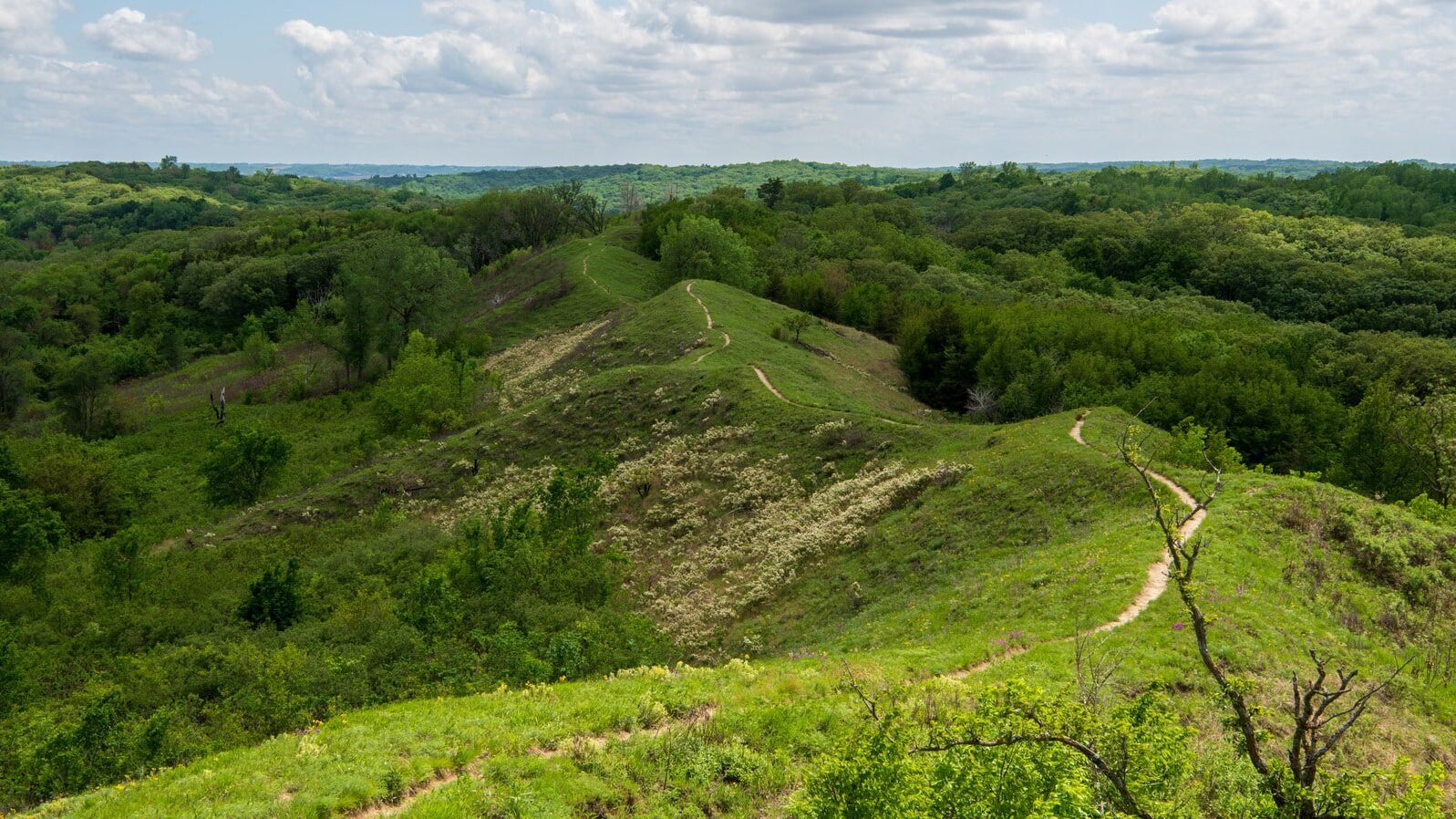
The Loess Hills of western Iowa are one of the most unusual geological formations in North America, and the scenic byway that runs along their crest provides a sky-watching drive that is uniquely suited to storm observation. The hills, formed from wind-deposited glacial silt, rise sharply from the Missouri River floodplain on the west to a narrow ridgeline that offers unobstructed views in both directions. To the west, the view extends across the Missouri River into Nebraska, where the Great Plains begin and the thunderstorms that sweep eastward are visible from enormous distances. The ridgeline position means you can watch a storm approach for an hour before it arrives.
Western Iowa sits at the eastern edge of the severe thunderstorm belt, and the spring and summer storm seasons here produce supercells, squall lines, and the occasional tornado that are visible from the Loess Hills in their full development. The combination of the elevated ridgeline and the unobstructed western view creates a natural storm-observation platform that storm chasers consider one of the best in the Midwest. The sunset views from the Loess Hills, even on calm evenings, are spectacular, with the sun dropping behind the Nebraska horizon across the wide river valley and the sky cycling through colors that reflect off the steep, grass-covered hillsides.
The byway runs roughly 220 miles along the western edge of Iowa from Akron to Hamburg, and the best sky-watching sections are between Council Bluffs and the Waubonsie State Park area in the south. Preparation Canyon State Park, near Pisgah, has overlooks that provide some of the best vantage points. The small towns along the route have limited services, but Council Bluffs at the northern end has full amenities. The Loess Hills are the Iowa drive where the sky becomes the dominant element, and on storm days, the view from the ridgeline is as dramatic as anything on the Great Plains.
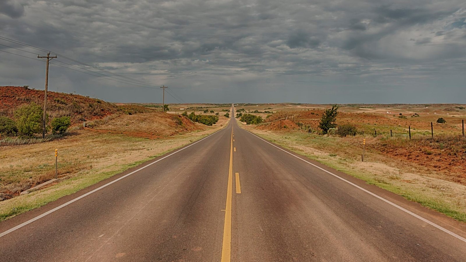
Kansas: Highway 177 (Flint Hills National Scenic Byway)
The Flint Hills of Kansas are the last remaining expanse of tallgrass prairie in North America, and the scenic byway through them on Highway 177 between Council Grove and Cassoday is the single best storm-watching drive in the United States. The statement is not hyperbole. The Flint Hills are treeless, the terrain is gently rolling, and the sky is so dominant that the landscape functions essentially as a viewing platform for the atmosphere. The horizon extends 360 degrees in every direction, and on an active storm day, you can see weather systems developing a hundred miles away as the first towers punch through the cap and begin their vertical ascent.
Kansas sits in the heart of Tornado Alley, and the spring storm season, from April through June, produces supercell thunderstorms that are the most powerful and photogenic on Earth. From the Flint Hills, the full architecture of a supercell is visible: the rotating updraft, the wall cloud, the rain-free base, the anvil spreading downwind, and the green-tinted light that signals hail. The sunsets after storm passage are equally extraordinary, with the retreating anvils backlit by the dropping sun in colors that run from gold to crimson to deep purple. The Tallgrass Prairie National Preserve, near Strong City, has overlook points where the sky and the grass meet at the horizon in a composition that is as simple and powerful as any landscape in the country.
The byway covers about 47 miles and has almost no development along its length, which is part of the appeal. Council Grove at the northern end and Cassoday at the southern end have basic services. The Hays House Restaurant in Council Grove has been serving meals since 1857. For lodging, Cottonwood Falls and Strong City have small inns and bed-and-breakfasts. The Flint Hills in storm season are a pilgrimage for storm chasers from around the world, and Highway 177 is the aisle seat to the greatest weather show on Earth.
Kentucky: Red River Gorge Scenic Byway (Highway 77)
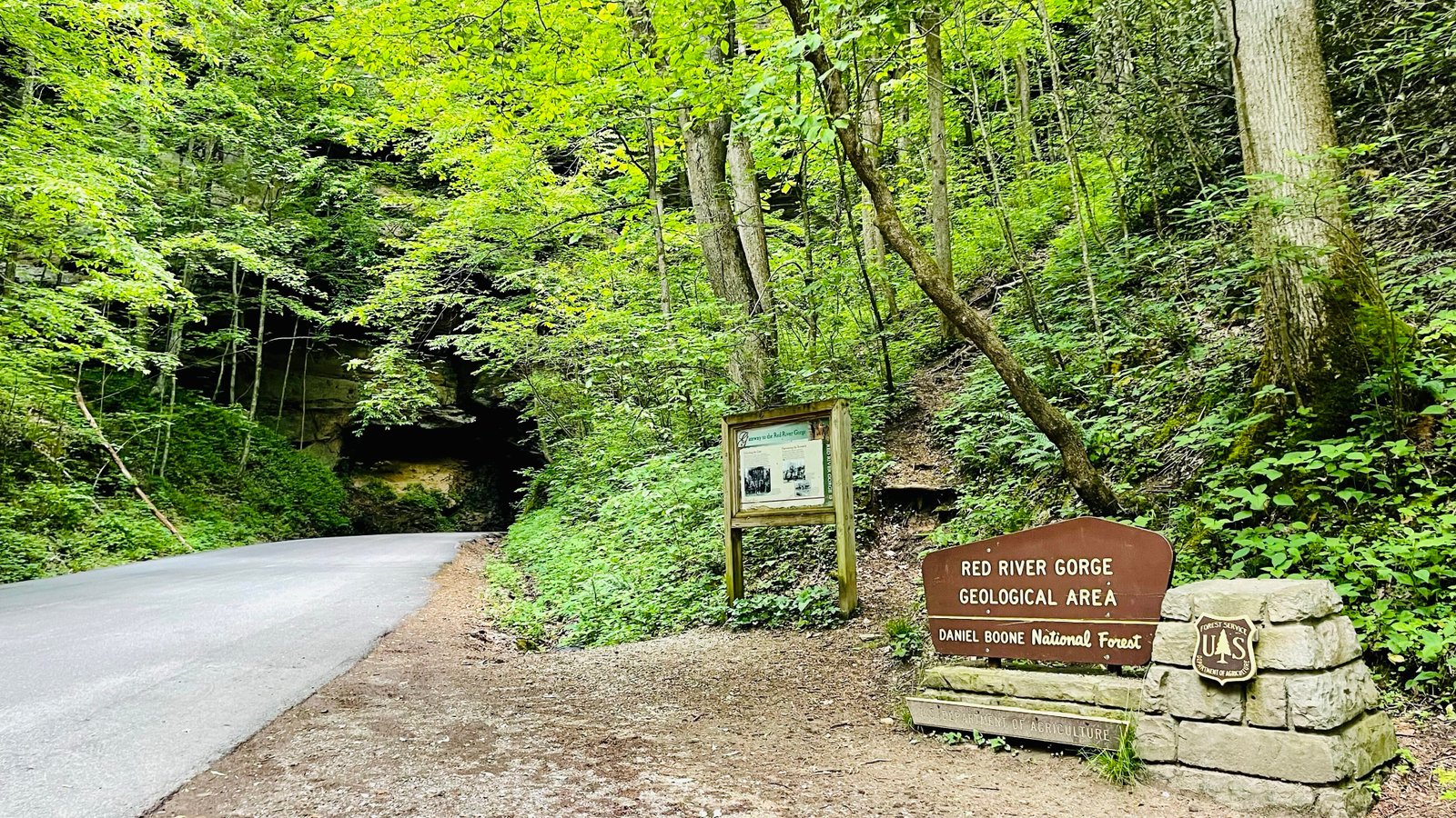
The Red River Gorge in eastern Kentucky is a landscape of deep sandstone canyons and forested ridges, and the scenic byway through it on Highway 77 offers a sky-watching experience that is more about the interplay of weather and terrain than wide-open vistas. The gorge creates its own microweather, with fog filling the canyons on cool mornings, mist rising from the forest canopy after rain, and clouds forming along the ridgelines as moisture lifts over the terrain. The result is a drive where the atmosphere is intimate rather than panoramic, where the weather wraps around you rather than spreading across the horizon.
The overlooks along the byway provide elevated views into the gorge where the weather phenomena are at their most visible. Sky Bridge, a natural arch accessible from the road, offers a vantage point where you can see fog and cloud formations at eye level and below, looking down into a misty gorge that can appear and disappear as conditions shift. After thunderstorms, the gorge fills with mist that rises from the forest floor and drifts through the rock formations in patterns that change by the minute. The lightning during storms is channeled by the gorge walls, and the echoing thunder reverberating through the narrow canyons creates a sound experience that flat-terrain storms cannot match.
The Nada Tunnel, a one-lane passage through the rock along the byway, is a unique feature that adds to the atmospheric quality of the drive. The Red River Gorge area has restaurants and lodging in the surrounding communities of Pine Ridge and Slade. Miguel’s Pizza, at the base of the gorge, is a gathering spot for climbers and hikers. The Natural Bridge State Resort Park has a lodge and dining. This is the Kentucky drive where the weather is not something you watch from a distance but something you move through, and the gorge amplifies every atmospheric effect into something more dramatic than the open sky would produce.
Louisiana: Highway 82 (Creole Nature Trail)
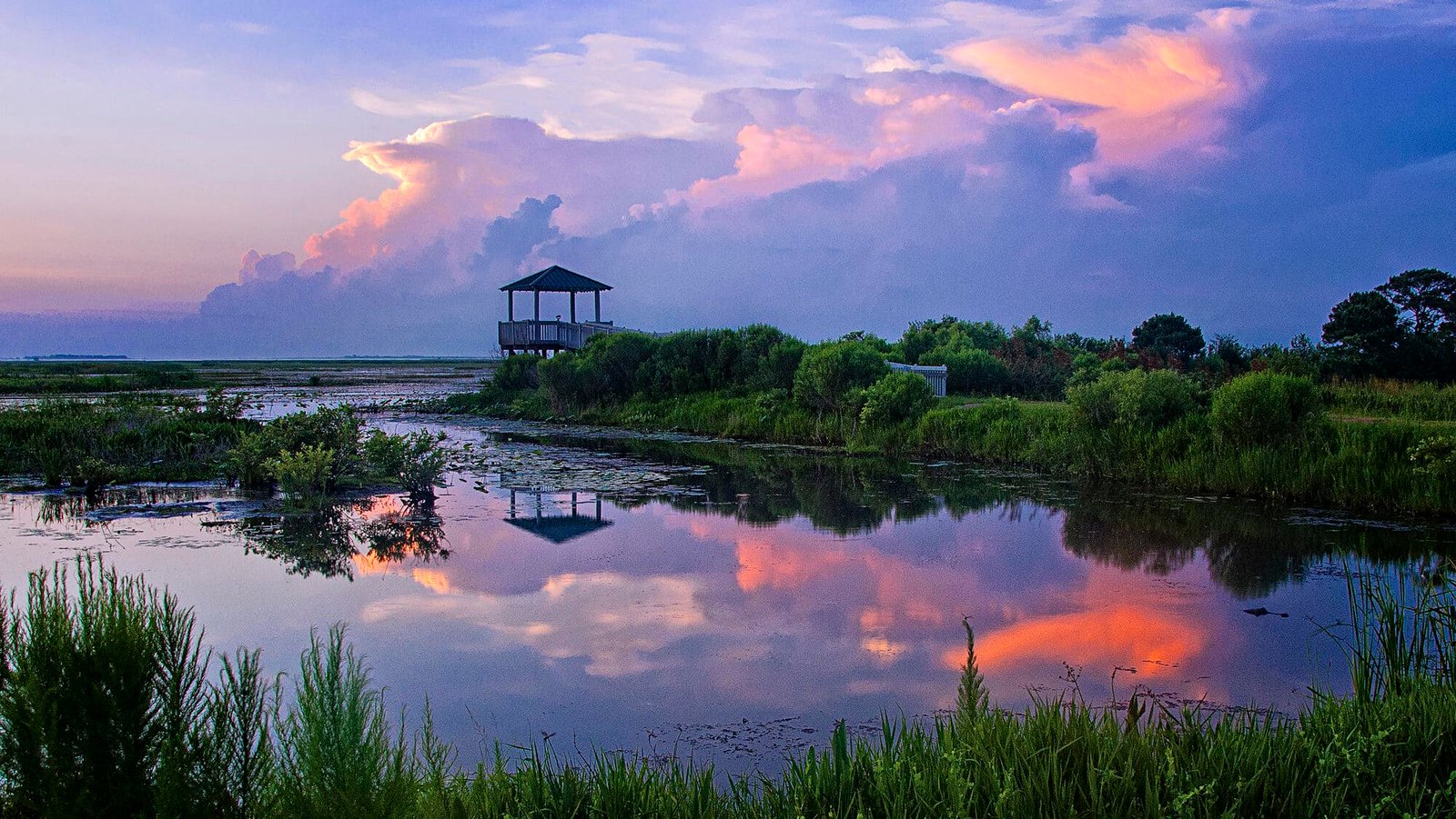
The Creole Nature Trail, following Highway 82 through the coastal marshes of southwestern Louisiana, puts you in a landscape so flat and open that the sky occupies roughly 80 percent of your visual field. The road runs through the Cameron Prairie National Wildlife Refuge and along the Gulf of Mexico shoreline, and the combination of marsh, open water, and minimal vegetation creates an unobstructed dome of sky that is among the most expansive on the Gulf Coast. The weather along this route, driven by the warm Gulf moisture and the flat terrain, produces some of the most dramatic thunderstorm activity in the southeastern United States.
Summer afternoon thunderstorms along the Louisiana coast build rapidly and can produce lightning of extraordinary intensity. From the elevated sections of Highway 82, the storms are visible as they develop over the Gulf and move inland, with the rain curtains dropping from dark cloud bases into the marsh below. The waterspouts that form over the shallow Gulf waters are periodically visible from the road, and the shelf clouds that precede organized squall lines are as well-defined and photogenic as anything on the Great Plains. The sunrise and sunset views over the marshes, when the sky fills with color reflected in the standing water, add a visual dimension that is independent of storm activity.
The Creole Nature Trail is a 180-mile loop through Cameron and Calcasieu Parishes, and the coastal section between Holly Beach and the Sabine Pass is the most sky-exposed stretch. The communities along the route are small and have limited services. The town of Cameron has basic dining. Lake Charles, at the northern end of the loop, has full amenities. The Creole Nature Trail All-American Road Visitors Bureau provides maps and weather information. This is the Louisiana drive where the Gulf Coast sky is the feature, and the marsh landscape exists primarily as a mirror for whatever the atmosphere decides to do.
Maine: Route 1 (Ellsworth to Lubec)
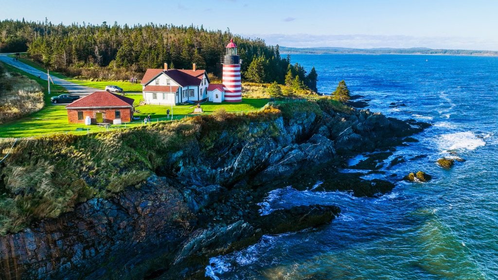
The Downeast coast of Maine, along Route 1 from Ellsworth to Lubec, sits at the end of the storm track that brings weather systems from the continental interior to the North Atlantic, and the sky along this coastline is one of the most dramatic in the northeastern United States. The Nor’easters that sweep up the coast produce cloud formations, wave action, and wind conditions that are visible from the coastal headlands in their full force. Even on calm days, the interplay between the marine layer, the forested coast, and the cold Gulf of Maine produces atmospheric effects that are constantly changing.
The fog along this coast is its own weather phenomenon. The sea fog forms when warm air passes over the cold Gulf of Maine water, and it moves inland in banks that can be hundreds of feet high and miles deep. Driving through the fog on Route 1, watching it thin and thicken and occasionally break to reveal the ocean below, is an atmospheric experience unique to this coast. The lighthouse at Quoddy Head State Park, the easternmost point in the United States, sits on a cliff where the fog rolls in from the Bay of Fundy and the weather systems are visible approaching from the open Atlantic. The tidal dynamics in this area, with some of the largest tide ranges in the world, create their own microweather as the cold water is exposed and covered twice daily.
The drive from Ellsworth to Lubec covers about 100 miles through a landscape of coastal villages, blueberry barrens, and rocky headlands. Machias has restaurants and lodging. West Quoddy Station offers rooms near the lighthouse. This is the drive where the North Atlantic weather meets the American coast at its most raw, and the fog, the storms, and the enormous tides create an atmosphere that is perpetually in motion.
Maryland: Chesapeake Country Scenic Byway (Route 33)
Maryland’s Eastern Shore is flat farmland and tidal marsh, and the roads that cross it provide sky views that are among the best on the mid-Atlantic coast. Route 33, running from Easton out to Tilghman Island, crosses a landscape where the Chesapeake Bay dominates the western view and the flat agricultural fields open up the eastern sky, creating a panoramic dome that makes approaching weather systems visible from enormous distances. The road crosses several creeks and inlets where the water amplifies the sky, and on storm days, the reflection of the clouds in the tidal water doubles the visual drama.
The Chesapeake Bay generates its own weather patterns, with sea breezes that develop on hot summer days and can collide with inland air masses to produce squall lines that march across the water with impressive speed. From Tilghman Island, at the end of the route, the western view across the bay is entirely open, and approaching weather systems are visible as complete structures, with the anvil top, the rain core, and the clear air behind all visible simultaneously. The Bay also produces some of the densest fog on the East Coast, and mornings when the route is wrapped in fog that gradually burns off to reveal the water and the sky are among the most atmospheric driving experiences in Maryland.
Tilghman Island has a working waterfront where skipjacks, the last commercial sailing fleet in North America, still operate. The Tilghman Island Inn serves food with bay views. Harrison’s Chesapeake House does traditional Eastern Shore seafood. St. Michaels, along the route, has the Chesapeake Bay Maritime Museum and additional restaurants and lodging. This is the Maryland drive where the water and the sky merge into a single canvas, and the weather systems that cross the Chesapeake are visible in their entirety from a landscape that exists at the exact intersection of land, water, and atmosphere.
Massachusetts: Route 6 (Outer Cape Cod)
The Outer Cape, from Orleans to Provincetown, is a narrow spit of sand bordered by the Atlantic Ocean on one side and Cape Cod Bay on the other, and Route 6, the only road through it, puts you in a landscape where the sky and the ocean dominate in every direction. The Cape Cod National Seashore occupies most of the land on either side of the road, and the combination of the Atlantic exposure, the bay influence, and the narrow geography creates weather patterns that are visible, dramatic, and constantly shifting. Nor’easters approach from the south and east with a ferocity that the protected mainland rarely sees, and the breaking waves and wind-driven sand transform the landscape during storm events.
The fog on the outer Cape is legendary. The sea fog rolls in from the cold Atlantic, sometimes advancing and retreating several times in a single day, and the experience of driving through alternating fog and sunshine on Route 6 is surreal. The Highland Light area in Truro sits on bluffs above the ocean where the fog dynamics are especially visible, with the fog bank hovering offshore, advancing, retreating, and occasionally engulfing the lighthouse in a way that makes the beam the only visible reference point. Race Point, at the tip of the Cape in Provincetown, faces the open Atlantic and catches every weather system that passes, with sunsets over the bay to the west that are Provincetown’s most famous attraction.
The drive from Orleans to Provincetown covers about 30 miles, and the pullouts at the National Seashore beaches provide viewing platforms for both ocean weather and bay weather. The Beachcomber in Wellfleet serves food and drinks in a former lifesaving station on the ocean beach. Provincetown has extensive dining and lodging. This is the Massachusetts drive where you are literally surrounded by the forces that create weather, with the ocean, the bay, and the atmosphere all converging on a strip of sand so narrow that you can see water on both sides.
Michigan: Tunnel of Trees (Route 119)
Route 119 between Harbor Springs and Cross Village along the Lake Michigan shore is famous as a scenic drive through a dense canopy of overhanging trees, but the sky-watching along this route comes not from open vistas but from the dramatic contrast between the enclosed forest canopy and the sudden openings where the bluff edge falls away to reveal the lake and the sky in panoramic views. The Lake Michigan weather is visible from these openings as complete systems, with squall lines crossing the lake, lake-effect cloud bands streaming off the water, and the enormous cumulus towers that build over the warm water on summer afternoons visible against the dark frame of the surrounding forest.
The Tunnel of Trees itself creates weather effects. Fog drifts through the canopy on cool mornings, the canopy drips after rain in a secondary shower that can last hours, and the filtered light through the leaves gives the road an underwater quality during overcast weather. When you emerge from the tunnel at one of the bluff-edge clearings, the visual contrast between the enclosed forest and the open lake is disorienting, and the scale of the Lake Michigan sky, visible from horizon to horizon, feels even larger for having been hidden. The lake-effect weather that Lake Michigan produces is unique to the Great Lakes, with cloud bands that form over the warm water and stream onshore in patterns that are visible from these bluffs as organized rows of cumulus stretching from the horizon.
The drive covers about 20 miles and is narrow, winding, and best driven slowly. Legs Inn in Cross Village, a restaurant built with driftwood and stone in a Polish-folk art style, serves food with lake views from its outdoor terrace. Harbor Springs has full services at the southern end. Good Hart, roughly halfway, has the Good Hart General Store. This is the Michigan drive where the sky is revealed rather than always present, and the interplay between the forest enclosure and the lake-sky openings creates a weather-watching rhythm that no open-terrain drive can replicate.
Minnesota: Highway 61 (North Shore Scenic Drive)
Highway 61 along the North Shore of Lake Superior from Duluth to Grand Marais is one of the great storm-watching drives in America. Lake Superior is the largest freshwater lake in the world by surface area, and its weather is more oceanic than lacustrine. The storms that cross the lake are visible from the shore as complete systems, with the cloud structures, rain curtains, and lightning displays backlit against the enormous expanse of water. The North Shore sits on a series of volcanic ridges that rise sharply from the lake, and the elevated viewpoints along Highway 61 provide vantage points where you look out over the water at weather that appears to be happening at eye level or below.
The lake produces its own weather phenomena. The “Superior vortex,” a cold-core low-pressure system that can form over the lake’s surface, generates gale-force winds and dramatic wave action that are visible from the shore. In fall and winter, the lake-effect snow bands that form over the warm water and stream onshore produce cloud formations that are mesmerizing from the highway overlooks. The Nor’easters that sweep across the lake in autumn produce waves that crash against the North Shore cliffs with an intensity that rivals ocean storms, and Split Rock Lighthouse, perched on the cliff face, was built specifically because these storms destroyed so many ships.
The drive covers 150 miles along the lakeshore, with the entire route offering sky views. Gooseberry Falls State Park, Tettegouche State Park, and Temperance River State Park all have lake overlooks. Two Harbors and Grand Marais have restaurants and lodging. The Bluefin Bay Resort in Tofte provides rooms with lake views where storm watching can be done from bed. This is the drive where a freshwater lake behaves like an ocean, and the storms it produces are visible from the shore in their full, terrifying, beautiful architecture.
Mississippi: Natchez Trace Parkway
The Natchez Trace Parkway runs 444 miles from Natchez, Mississippi, to Nashville, Tennessee, but the Mississippi section, particularly the stretch from Natchez north through the loess bluffs and piney woods, offers the best sky-watching along the route. The parkway is a National Park Service road with no commercial traffic, no billboards, and a 50-mph speed limit, which means the driving pace allows for sky observation that faster highways do not. The route passes through rolling terrain where the forest breaks periodically at overlooks and clearings that provide views of the Mississippi weather systems approaching from the Gulf and the west.
Mississippi sits in the path of severe weather that tracks from the Gulf of Mexico through the Deep South, and the spring storm season produces squall lines and supercells that are visible from the parkway overlooks. The Jeff Busby overlook, at one of the highest points on the Mississippi section, provides a panoramic view where approaching weather is visible for miles. The combination of the warm Gulf moisture and the friction of the terrain creates thunderstorm development that is explosive, and watching a line of storms approach from the west while standing on a Trace overlook with the forest stretching below is a powerful weather experience.
The parkway has no services along its length in Mississippi, so fuel and food require detours to nearby towns. Natchez, at the southern end, has excellent restaurants and historic lodging. The parkway campgrounds at Rocky Springs and Jeff Busby offer basic facilities. The Natchez Trace is the Mississippi drive where the absence of commercial development and the unhurried pace create conditions for sky-watching that the interstates, with their noise and speed, cannot match.
Missouri: Highway 79 (Great River Road, Hannibal to Clarksville)
Highway 79 follows the Mississippi River bluffs through the section between Hannibal and Clarksville in northeastern Missouri, and the sky views from the bluff-top sections of this drive are the best in the state for storm watching. The road runs along the western bank of the Mississippi, and the river valley below is wide enough that approaching weather systems from the west are visible across miles of open terrain before they reach the river. The bluffs provide an elevated vantage point that puts you above the valley floor fog and haze and closer to the cloud structures that define the approaching weather.
Missouri sits in the southern end of the severe weather belt, and the spring storm season produces powerful thunderstorms that move through the Mississippi Valley with regularity. The view from the Highway 79 overlooks, particularly near Clarksville where the river makes a broad bend and the valley opens up, includes the full horizontal extent of approaching fronts. The squall lines that cross the river produce dramatic shelf clouds that are visible from edge to edge against the river backdrop, and the lightning displays during nighttime storms, reflected in the river surface, are among the most spectacular in the region. The river itself generates fog on cool mornings that fills the valley while the bluffs sit in clear air above, creating an atmospheric effect that transforms the landscape.
Clarksville, at the southern end, is a small river town with the Clarksville Skyride, a chairlift to the bluff top that provides storm-watching access without the hike. The Overlook at Clarksville serves food with river views. Hannibal, at the northern end, has full services and Mark Twain attractions. Louisiana, Missouri, between the two, has additional restaurants and a historic downtown. Highway 79 is the Missouri drive where the Mississippi River, the bluff-top elevation, and the Midwest storm season converge, and the result is sky-watching that is as good as anything available between the plains and the Appalachians.
Montana: Highway 2 (Hi-Line)
Highway 2 crosses northern Montana from the North Dakota border to Glacier National Park along a route that the locals call the Hi-Line, and the sky along this stretch of the northern Great Plains is among the most enormous and dramatic in the country. The road runs through wheat fields, rangeland, and small railroad towns where the terrain is so flat and the vegetation so low that the sky occupies nearly the entire visual field. On the active storm days that characterize the Montana summer, from June through August, the thunderstorms that develop along the northern edge of the Great Plains storm belt are visible from this road as complete structures, with the updraft towers, anvil tops, and rain shafts all visible against the unobstructed horizon.
The storms in northern Montana have a character distinct from those in Kansas and Oklahoma. They tend to be high-based, with the cloud bases well above the surface, which means the entire lower structure of the storm is visible, including the dry downdrafts that send dust plumes across the prairie and the virga, the rain that evaporates before reaching the ground and hangs from the cloud base like translucent curtains. The sunset light after storm passage is extraordinary along the Hi-Line, with the retreating storm cells backlit in colors that range from gold to deep purple and the flat horizon stretching the color display across 180 degrees.
The drive from the North Dakota border to Glacier covers about 430 miles, with the most dramatically flat and open sections between Glasgow and Havre. The small towns along the route, including Glasgow, Malta, and Havre, have basic services and a western character. Browning, near Glacier, is the headquarters of the Blackfeet Nation. Glacier National Park, at the western end, provides mountain weather that contrasts dramatically with the plains sky to the east. Highway 2 across the Hi-Line is the Montana drive where the Great Plains sky reaches its maximum scale, and the storms that cross this landscape are visible from so far away that you can watch their entire lifecycle from birth to death.
Nebraska: Highway 2 (Sandhills Scenic Byway)
The Nebraska Sandhills cover about 19,000 square miles of grass-stabilized sand dunes in the central and western part of the state, and Highway 2, which crosses through them between Grand Island and Alliance, passes through a landscape where the sky is the overwhelming visual presence. The Sandhills are treeless, sparsely populated, and gently rolling, with grass-covered dunes that rise and fall in a rhythm that provides just enough elevation change to give the sky depth without obstructing the view. On a clear day, the visibility can exceed a hundred miles in every direction. On a storm day, the atmospheric show is staggering.
Nebraska sits in the heart of the severe weather belt, and the storms that develop over the Sandhills are visible from Highway 2 in their full vertical and horizontal extent. The supercells that form along the dryline, where the moist air from the Gulf meets the dry air from the high plains, are among the most photogenic on Earth, and the Sandhills provide a viewing platform with no obstructions, no trees, and no development to block the view. The green light that precedes hail, the mammatus clouds that hang from the underside of the anvil, the tornado vortex descending from the wall cloud: everything is visible in its entirety from this road. The night sky over the Sandhills, when storms are not active, is among the darkest in the lower 48, and the Milky Way is visible as a luminous band stretching from horizon to horizon.
The drive from Grand Island to Alliance covers about 260 miles, and the most isolated section, between Thedford and Hyannis, can go 50 miles without a town. Services are sparse, and carrying extra fuel and water is advisable. Thedford has the Sandhills Motel and a few restaurants. Valentine, north of the route, has more options. Arthur, the county seat of the least-populated county in the state, has a courthouse made of straw bales and almost nothing else. Highway 2 through the Sandhills is the drive where the Great Plains sky reaches its most vast and the storms are the biggest show the atmosphere puts on anywhere in the world.
Nevada: Highway 50 (The Loneliest Road in America)
Highway 50 across central Nevada earned its nickname from a 1986 Life magazine article that warned drivers they might not see another car for miles, and that isolation is exactly what makes it one of the best sky-watching drives in the West. The road crosses a series of basin-and-range valleys, each one separated by a mountain pass, and the valleys are broad enough that the sky fills the view from horizon to horizon. The high desert air is dry and clear, with visibility that can exceed a hundred miles, and the storms that develop over the mountain ranges in summer are visible as isolated cells that march across the basins in stately procession, trailing rain curtains and lightning behind them.
The virga over the Nevada desert is among the most photogenic in the country. The rain falls from the cloud base in streaks that catch the sunlight and glow against the darker clouds above, but evaporates before reaching the ground, creating columns of translucent moisture that hang in the air like gauze. The desert thunderstorms produce lightning against a background of empty sky and distant mountains that is cleaner and more dramatic than the cluttered horizons of the East. The sunset along Highway 50, when the storm cells are retreating to the east and the western sky is clearing, produces light shows that last an hour and paint the basin floors in colors that shift from gold to crimson to deep indigo.
The drive across Nevada on Highway 50 covers about 287 miles between Fallon and the Utah border, with long stretches between towns. Austin, Eureka, and Ely are the main service stops, each one a small former mining town with basic restaurants and motels. The Highway 50 Survival Kit, offered by the state tourism office, adds a playful element to the driving experience. This is the drive where the sky and the silence combine to create an atmospheric awareness that more populated areas cannot produce, and the storms over the Nevada desert are visible with a clarity that the humid eastern air never allows.
New Hampshire: Mount Washington Auto Road
The Mount Washington Auto Road climbs 7.6 miles from the base at Pinkham Notch to the 6,288-foot summit of Mount Washington, and the weather along this road is among the most extreme and dramatic accessible by automobile in the eastern United States. Mount Washington holds the world record for the highest wind speed ever recorded at a surface weather station, 231 miles per hour in 1934, and the summit weather observatory continues to record conditions that are more akin to Antarctica than New England. The drive takes you from the sheltered forest at the base through the treeline and into the alpine zone, where the exposure to wind, fog, rain, and even snow is possible in any month of the year.
The cloud formations around Mount Washington are extraordinary. The summit is above the cloud base more often than not, and driving through the cloud layer on the auto road, watching the visibility drop to zero and then break into patches where the valleys below are visible through gaps in the clouds, is an immersive weather experience. Lenticular clouds, caused by the mountain wave that forms in the lee of the summit, sit above the peak in stationary lens shapes that can persist for hours. The rime ice that forms on the summit structures, even in summer when conditions align, creates an otherworldly landscape where the weather has literally remade the environment.
The auto road is privately operated and charges a toll. The summit has the Mount Washington Observatory’s Sherman Adams building, with a museum, a snack bar, and interpretive displays about the mountain’s weather history. The Cog Railway, ascending from the western side, offers an alternative for those who prefer not to drive. The base area at Pinkham Notch has an AMC lodge with dining and rooms. The Mount Washington Auto Road is not just a sky-watching drive. It is a drive into the sky itself, where the weather is not observed from a distance but experienced directly, and the line between the road and the atmosphere disappears at the summit.
New Jersey: Palisades Interstate Parkway
The Palisades Interstate Parkway runs along the top of the Palisades cliffs above the Hudson River in Bergen County, and while the road is short and the terrain is not dramatic by western standards, the sky views from the cliff-top overlooks are the best storm-watching vantage points in the most densely developed corridor in the country. The Palisades rise 300 to 500 feet above the Hudson, and the overlooks at State Line Lookout and the Alpine area provide westward views across the river and over the New York City metro area where approaching weather systems are visible against the backdrop of the skyline and the urban landscape below.
The thunderstorms that move through the New York metro area are funneled through the Hudson Valley and accelerated by the convergence of the valley terrain, and from the Palisades, these storms are visible approaching from the west with the city skyline in the foreground. The lightning over Manhattan, seen from the Palisades at night, is one of the most dramatic urban weather views in the world. The fog that fills the Hudson Valley on cool mornings, with the Palisades rising above it and the city towers visible through the mist, adds another atmospheric dimension. The autumn and winter Nor’easters that affect the region are visible from the parkway as organized cloud systems moving up the coast.
The parkway runs about 12 miles from the George Washington Bridge north to the state line, with several overlooks and parking areas. State Line Lookout has a cafe and trails along the cliff edge. The Alpine Boat Basin, at the base of the cliffs, provides a different perspective from river level. Englewood Cliffs and Alpine have restaurants nearby. The Palisades Parkway is the New Jersey drive where the sky meets the city, and the weather systems that cross the most populated region in America are visible from a clifftop that makes even routine storms look dramatic.
New Mexico: Highway 60 (Plains of San Agustin)
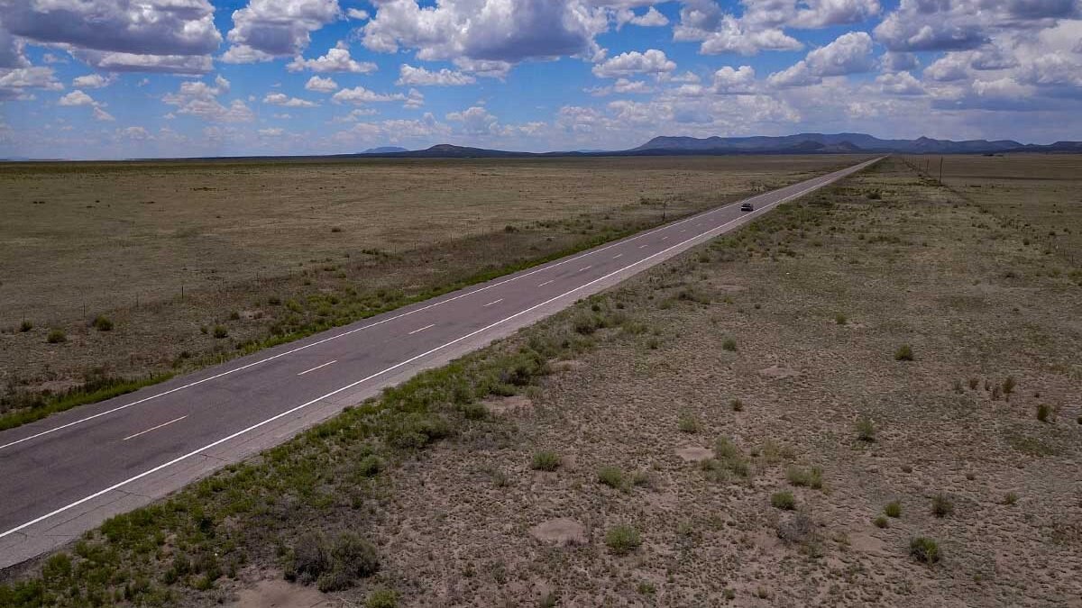
The Plains of San Agustin in central New Mexico are a flat, dry lakebed surrounded by mountain ranges on all sides, and Highway 60, which crosses them between Socorro and Datil, passes through the Very Large Array radio telescope complex and a landscape where the sky is as vast as anything on the Great Plains. The plains sit at about 7,000 feet, high enough that the summer monsoon storms develop directly overhead rather than approaching from a distance, and the show from the highway is a front-row seat to the atmospheric convection that defines the New Mexico summer.
The monsoon season, from July through September, transforms the afternoon sky over the Plains of San Agustin into a theater of vertical development. The storms build rapidly over the surrounding mountains and then drift across the basin, and from Highway 60, the full structure is visible: the explosive updraft, the spreading anvil, the dark curtain of rain dropping from the base, and the lightning that arcs between cells. The Very Large Array, with its 27 radio antennas arranged in a Y pattern across the plain, provides an otherworldly foreground for the storm photography. The combination of the massive technological structures and the even more massive natural structures overhead creates images that look like science fiction.
The drive from Socorro to Datil covers about 80 miles, with the VLA roughly at the midpoint. The VLA Visitor Center has exhibits on the science of the array and is worth a stop. The town of Magdalena, between Socorro and the VLA, has a few businesses. Datil, at the western end, has a motel and a small store. The Plains of San Agustin are the New Mexico drive where the monsoon sky and the radio telescopes create a landscape that is simultaneously ancient and futuristic, and the storms overhead are so dramatic that they make the antennas, which are 82 feet in diameter, look small.
New York: Route 28 (Catskill Mountains)
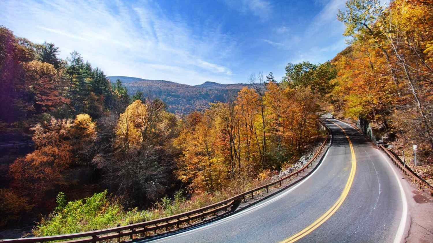
Route 28 runs through the heart of the Catskill Mountains from Kingston on the Hudson River west to Oneonta, and the sky along this mountain corridor offers weather watching that combines the valley fog and mountain cloud effects of the Appalachians with the storm systems that track through the Mohawk and Hudson Valleys. The Catskills are high enough, with peaks above 4,000 feet, to create orographic weather effects, where moisture-laden air is pushed upward by the terrain and condenses into clouds, rain, and sometimes snow even when the surrounding lowlands are clear. Driving through the Catskills on a day when the mountains are generating their own weather is like watching the atmosphere in slow motion.
The Ashokan Reservoir, visible from Route 28 near Boiceville, provides a flat water surface that reflects the sky and doubles the visual impact of passing weather. The valley sections of the route are prone to dense fog that fills the hollows on cool mornings, and the experience of driving through alternating fog and clear air, with the mountain peaks visible above the mist, is one of the atmospheric highlights. Belleayre Mountain, accessible from the route, has a summit area where the weather is noticeably more dramatic than the valleys below, with wind, rain, and cloud formations that reflect the mountain’s exposure to the prevailing storm track.
The drive from Kingston to Oneonta covers about 80 miles and passes through the villages of Phoenicia, Pine Hill, and Margaretville. The Catskills have a deep hospitality tradition, and restaurants and lodging are available throughout the corridor. Phoenicia Diner serves food in a renovated classic diner. The Emerson Resort and Spa in Mt. Tremper provides upscale lodging. This is the New York drive where the mountain weather and the valley atmosphere combine into a continuous show, and the Catskills’ position on the storm track makes every passage of weather visible from the road.
North Carolina: Blue Ridge Parkway (Waterrock Knob section)
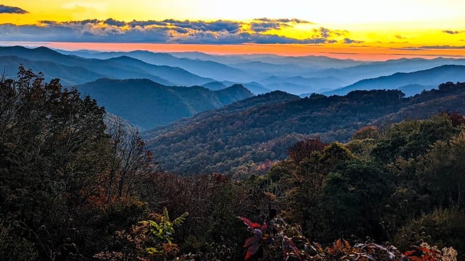
The entire 469-mile Blue Ridge Parkway is a sky-watching drive, but the section near Waterrock Knob in the Balsam Mountains of western North Carolina, between mileposts 441 and 460, offers the most dramatic weather viewing on the route. Waterrock Knob, at 6,292 feet, is one of the highest points accessible from the parkway, and the summit trail provides a 360-degree view that includes the Great Smoky Mountains, the Black Mountains, and the Plott Balsams. On unstable summer days, the thunderstorms that develop over the surrounding ranges are visible from this vantage point in multiple directions simultaneously, and the lightning during evening storms flickers across the mountain horizon in a display that stretches from north to south.
The Blue Ridge creates its own weather through orographic lifting, and the clouds that form along the ridgeline are at eye level from the parkway at this elevation. Driving through the cloud base, with visibility dropping to near zero and then suddenly breaking to reveal the valleys below filled with cotton-like clouds, is a common experience along this section. The temperature inversions that trap warm air above the cold valleys produce fog effects that make the mountain peaks appear to float above an ocean of white. The “blue” in Blue Ridge refers to the isoprene haze emitted by the trees, which gives the mountains their characteristic blue appearance on humid days and adds a color dimension to the sky that is unique to this region.
The Waterrock Knob Visitor Center, at milepost 451, has parking and a half-mile summit trail. The nearby town of Waynesville has restaurants and lodging. The parkway itself has no services in this section, so fuel and food should be arranged in advance. This is the North Carolina drive where the altitude of the parkway puts you inside the weather rather than below it, and the mountain sky show from Waterrock Knob is the best free theater in the southern Appalachians.
North Dakota: Highway 85 (Western North Dakota)
Highway 85 runs through the western half of North Dakota from Belfield south to the South Dakota border and north from Belfield through the badlands to Watford City, and the sky along this route is Great Plains sky at its most expansive. The terrain is rolling prairie and badlands, treeless and open, and the horizon extends unbroken for distances that are difficult to grasp until you have driven through them. North Dakota sits at the northern edge of the severe weather belt, and the summer storm season produces thunderstorms that are visible from this road in their full development, from the first wispy tower to the mature supercell with its rotating structure and trailing anvil.
The badlands section near Theodore Roosevelt National Park adds a visual dimension that flat-terrain drives lack. The eroded buttes and coulees create a foreground of dramatic geology against which the sky drama plays out, and the combination of ancient landforms and active atmosphere produces photographs that are compositionally richer than the open-prairie drives. The wild horses and bison in the park add another element, with storm-lit wildlife scenes that are unique to this landscape. The sunset over the badlands, when the low-angle light catches both the eroded terrain and the cloud structures above, produces some of the most extraordinary light in the northern plains.
Highway 85 between Belfield and the South Dakota border passes through open range country with minimal services. Bowman, at the southern end, has basic dining and lodging. Watford City, to the north, has more options. Theodore Roosevelt National Park has campgrounds and the Rough Riders Hotel in Medora. This is the North Dakota drive where the Great Plains sky and the badlands terrain create a weather-watching stage that is both vast and textured, and the storms that cross this landscape do so with a visual drama that the flat prairie alone cannot match.
Ohio: Hocking Hills Scenic Byway (Highway 374)
Ohio is not a state with dramatic sky-watching terrain, but the Hocking Hills Scenic Byway through the forested gorge country of southeastern Ohio offers an atmospheric experience focused on the intimate rather than the vast. The road passes through sandstone gorges where fog collects, mist rises from the forest floor after rain, and the narrow canyon walls channel weather effects into concentrated experiences. The waterfalls along the route, including the cascades at Old Man’s Cave and Ash Cave, create their own mist zones where the weather and the terrain interact at close range.
The ridgetop sections of the byway provide the sky views that the gorges cannot, and on unstable days, approaching thunderstorms are visible across the forested hills of the Hocking Valley. The combination of the enclosed gorge atmosphere and the open ridgetop views creates a rhythm of intimate and panoramic weather watching that is unique to this drive. The fog that fills the hollows on autumn mornings, with the ridges rising above the mist and the sun breaking through in shafts, is one of the atmospheric highlights of the Midwest. The lightning during summer storms, reflecting off the wet sandstone walls of the gorges, produces a visual and auditory experience that amplifies the power of even modest storms.
The Hocking Hills State Park area has restaurants and lodging. The Inn and Spa at Cedar Falls serves food in a forested setting. Hundreds of rental cabins surround the park. Logan, the nearest town, has additional services. The Hocking Hills Scenic Byway is not a big-sky drive, but it is a drive where the weather is felt as much as seen, and the gorge-amplified effects of fog, mist, and storm create an atmosphere that makes even Ohio’s modest weather feel dramatic.
Oklahoma: Highway 412/Highway 64 (Cherokee Outlet)
Oklahoma is storm-chasing country, and the northern part of the state, along the Highway 412/Highway 64 corridor through the Cherokee Outlet, provides some of the best storm-watching driving in Tornado Alley. The terrain here is gently rolling wheat fields and rangelands, with minimal tree cover and an unobstructed view of the sky in every direction. The road runs east-west across the state, and on active storm days from April through June, the weather developing to the southwest and west is visible from this corridor in its full development. Oklahoma averages more tornadoes per square mile than any other state, and the storms that produce them are among the most photogenic atmospheric phenomena on Earth.
The dryline, where the dry air from the high plains meets the moist air from the Gulf of Mexico, frequently sets up in western Oklahoma, and the storms that fire along this boundary are visible from Highway 412 as explosive towers punching through the cap and developing into supercells within minutes. The classic storm structure, with the tilted updraft, the wall cloud rotating beneath the rain-free base, and the anvil streaming downwind for dozens of miles, is visible in its entirety from this road. The green light that precedes hail, the sound of the storm core, and the sudden temperature drop as the downdraft arrives are all experienced from the roadside in a way that few other locations on Earth can match.
The towns along this corridor, including Enid, Alva, and Woodward, have basic services. Enid is the largest and has the most dining and lodging options. The Great Salt Plains State Park, near Cherokee, has a lake and flat salt flats that provide an additional sky-viewing platform. Highway 412 across northern Oklahoma is the drive where Tornado Alley earns its name, and the storm-watching from this road during the active season is as close as most people will ever come to the raw power of the atmosphere.
Oregon: Highway 101 (Southern Oregon Coast)
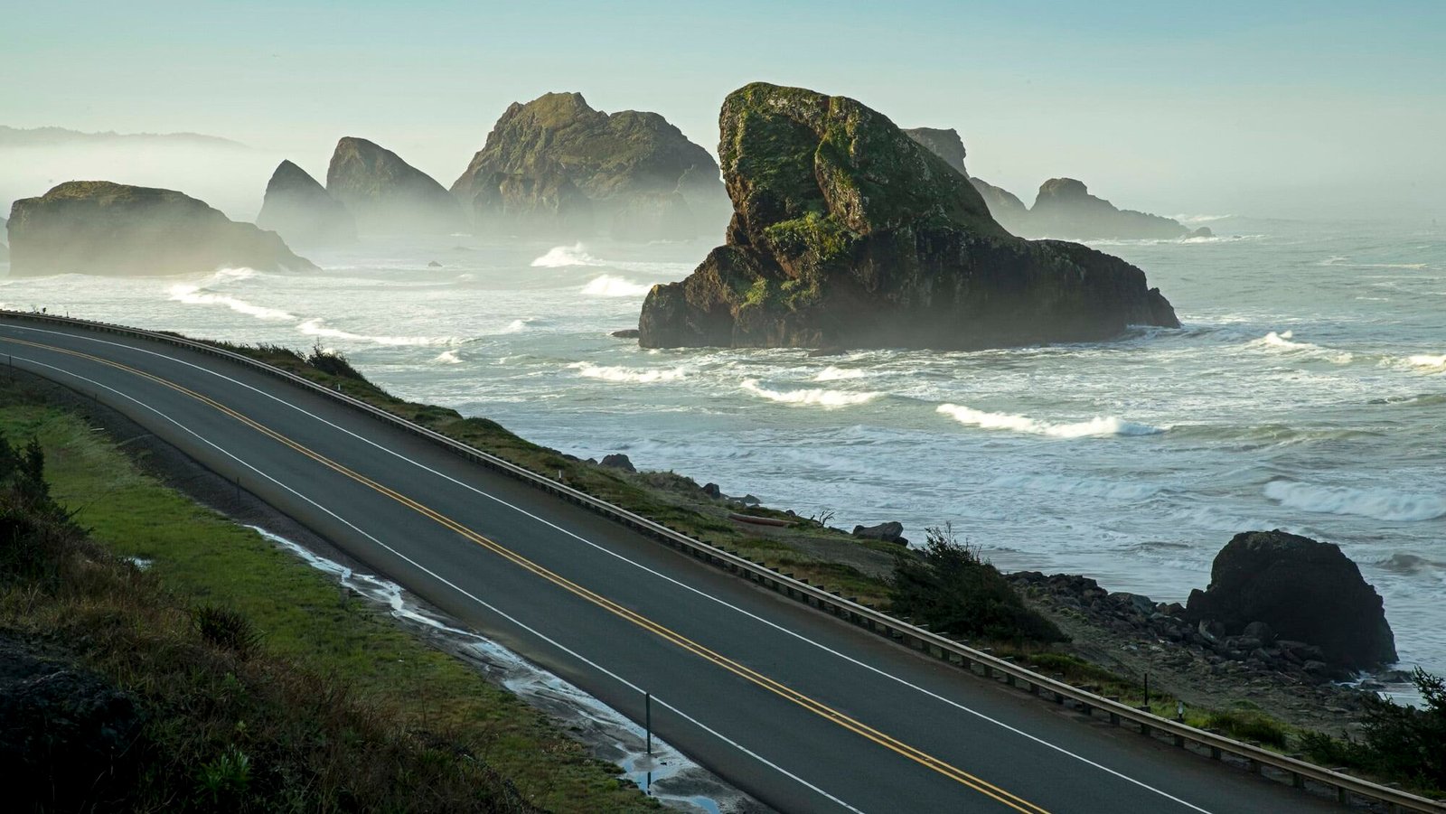
The southern Oregon coast between Brookings and Florence sits directly in the path of Pacific storm systems that make landfall with dramatic force from October through March, and Highway 101 along this stretch provides storm watching that is among the best on the West Coast. The coastline here is a mix of sea stacks, rocky headlands, and long sandy beaches that take the full impact of the Pacific waves, and during winter storms, the wave heights can exceed 30 feet at the headlands, with spray reaching heights that are visible from the highway. The combination of the rocky coast, the crashing waves, and the dark storm clouds creates a visual intensity that calm-weather driving cannot approach.
The headlands and viewpoints along the route provide safe storm-watching platforms. Shore Acres State Park, near Coos Bay, has a cliff-top observation area specifically designed for storm watching, and the winter waves that crash against the sandstone cliffs below send spray fifty feet or more into the air. Cape Blanco, the westernmost point in Oregon, catches every storm that passes, and the lighthouse, battered by more than a century of Pacific weather, stands as evidence of what the atmosphere can do. The fog along this coast, particularly in summer, produces atmospheric effects that are their own form of weather watching, with the marine layer pouring through the gaps between the headlands and filling the coastal valleys.
The drive from Brookings to Florence covers about 150 miles, with the entire route offering coastal and atmospheric views. Gold Beach, Port Orford, Bandon, and Florence all have restaurants and lodging. The Bandon Dunes Golf Resort, while famous for golf, also has rooms with ocean views that are ideal for storm watching. This is the Oregon drive where the Pacific storms meet the coast with an energy that is visible, audible, and occasionally terrifying, and the winter storm-watching season is as dramatic as anything the atmosphere produces in the continental United States.
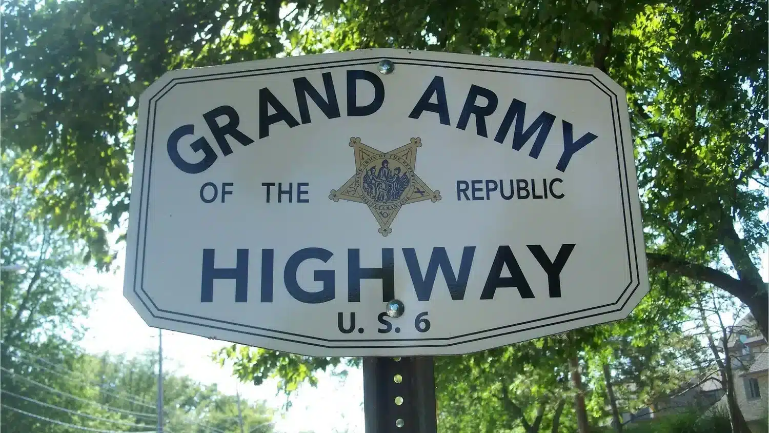
Pennsylvania: Route 6 (Grand Army of the Republic Highway)
Route 6 crosses northern Pennsylvania from east to west through a landscape of forested mountains, deep valleys, and open farmland that provides the best sky-watching corridor in the state. The road traverses the Allegheny Plateau, and the terrain alternates between wooded ridgetops and open valley floors where the sky opens up. The Pine Creek Gorge, sometimes called the Grand Canyon of Pennsylvania, is the most dramatic section, where the road approaches the rim of a 1,000-foot-deep gorge and the sky above the gorge, framed by the canyon walls, creates a natural frame for cloud formations and approaching weather.
Northern Pennsylvania sits in the path of weather systems that track through the Great Lakes region, and the lake-effect weather generated by Lake Erie affects the western end of the Route 6 corridor. The cloud bands that stream off the lake in autumn and winter are visible from the hilltop sections of the route as organized rows of cumulus stretching inland from the lake. The thunderstorms that develop along the Allegheny Front in summer are visible from the open valley sections, and the combination of the mountain terrain and the valley openings creates a rhythm of sky exposure that keeps the weather watching interesting for the entire length of the drive.
Route 6 runs 400 miles from Milford on the Delaware River to the Erie area. The best sky-watching sections are in the central part, around the Pine Creek Gorge and Coudersport. Wellsboro, near the gorge, has the Penn Wells Hotel and several restaurants. Coudersport has the Potter County Historical Society and basic services. The Pine Creek Gorge overlooks at Colton Point and Leonard Harrison State Parks provide the most dramatic sky-framing views. Route 6 across Pennsylvania is the drive where the northern Appalachian weather and the Allegheny terrain combine, and the gorge views elevate the sky watching from observation to art.
Rhode Island: Ocean Drive (Newport)
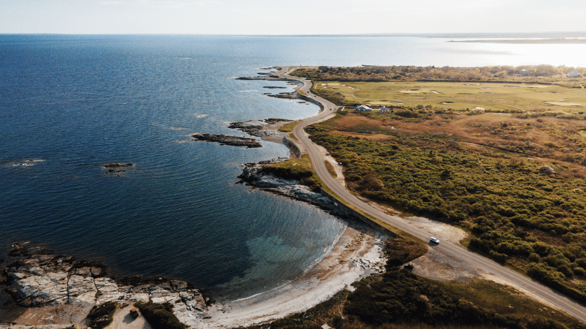
Rhode Island is the smallest state, and its sky-watching options are limited by both scale and development. But the Ocean Drive loop in Newport, a ten-mile road that follows the rocky coastline at the southern tip of Aquidneck Island, provides marine weather watching that is among the best in the Northeast for its concentration and accessibility. The drive passes Brenton Point State Park, where the Rhode Island coast faces the open Atlantic, and the weather systems that approach from the south and east are visible as complete structures over the water before they make landfall. The coastal exposure here is genuine, with the Atlantic waves hitting the rocks with force during storms and the sea spray reaching the road on the worst days.
The fog along the Newport coast is dramatic and frequent. Narragansett Bay generates sea fog that can make the Ocean Drive feel like driving through clouds, with the mansions and cliffs appearing and disappearing as the fog shifts. The Nor’easters that affect the New England coast produce their most visible effects along exposed coastlines like this one, and the wave action at Brenton Point during a strong Nor’easter, with the sea crashing over the rocks and the wind driving the spray inland, is an experience that brings storm watching to a visceral level. The sunset from the western-facing section of the drive, particularly when filtered through the cloud layers of an approaching system, produces light effects across the water that are Newport’s best free entertainment.
The Ocean Drive is a public road with pullouts along the coast. Brenton Point State Park has parking and viewing areas. Castle Hill Inn, at the mouth of the harbor, serves food with coastal views and offers lodging. Newport’s Thames Street has extensive dining options. The Ocean Drive in storm weather is the Rhode Island experience where the small scale of the state becomes an advantage, concentrating the atmospheric drama into a compact loop where the weather is always within view and always meeting the coastline.
South Carolina: Highway 174 (Edisto Island)

The road to Edisto Island follows Highway 174 through the ACE Basin, one of the largest undeveloped estuaries on the East Coast, and the sky over the marshes and tidal creeks along this route is among the most expansive in the Southeast. The road crosses miles of salt marsh where the cordgrass flattens to the horizon and the sky takes over, and on summer afternoons when the sea-breeze front collides with the heated inland air, the thunderstorms that develop are visible in their full vertical extent against the flat marsh background. The lightning over the marshes, reflected in the tidal water, is especially photogenic.
The ACE Basin’s combination of open water, tidal marsh, and minimal development creates conditions where the weather is the dominant sensory experience. The sea fog that rolls in from the Atlantic through the tidal inlets produces morning drives where the road passes through alternating zones of clarity and mist, with the live oaks along the road appearing as ghostly shapes in the fog. The afternoon thunderstorms build rapidly over the warm marsh surface, and the isolated cells can produce downpours that are visible from miles away as dark columns connecting the cloud base to the marsh. The marsh acts as a natural reflector, doubling the visual impact of every cloud and color change in the sky above.
Edisto Island, at the end of the road, is a low-key beach community with restaurants and rental properties. The Old Post Office Restaurant serves Lowcountry cuisine. Whaley’s does casual seafood. Edisto Beach State Park has camping and beach access where the open-ocean sky adds to the weather-watching options. Highway 174 is the South Carolina drive where the marsh sky and the coastal weather combine, and the ACE Basin provides a landscape that is essentially a mirror for the atmosphere above it.
South Dakota: Badlands Loop Road (Highway 240)
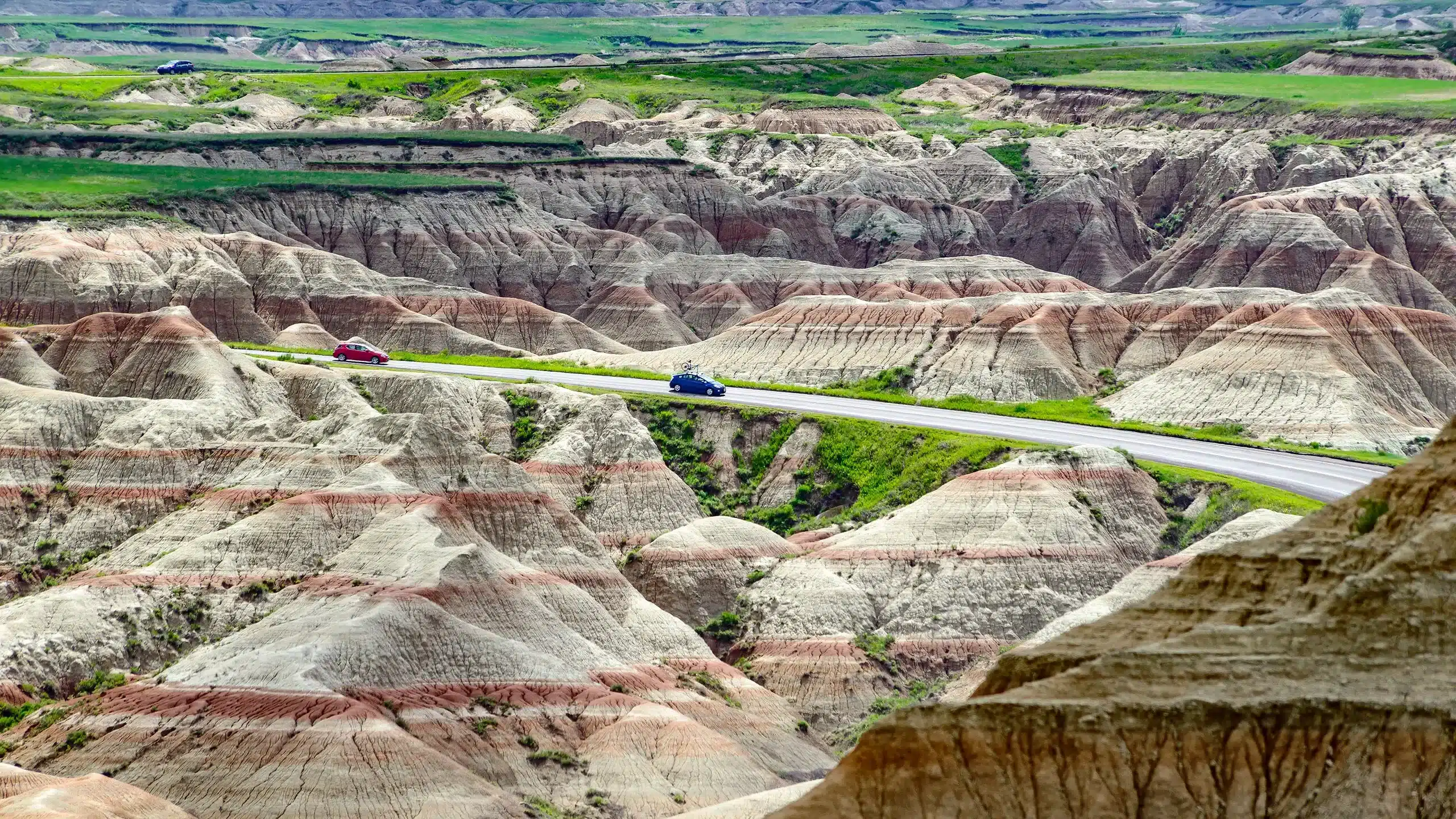
The Badlands Loop Road through Badlands National Park passes through some of the most otherworldly terrain in the lower 48, and the sky above this eroded landscape is Great Plains sky at its most dramatic. The road follows the rim of the badlands formations, where the terrain drops away into a maze of spires, pinnacles, and layered sedimentary walls, and the unobstructed view to the south and west extends across the White River basin for distances that make approaching weather visible from an hour or more away. The combination of the ancient geology below and the active atmosphere above creates a contrast that is difficult to experience anywhere else.
South Dakota’s storm season, from May through July, produces supercells and severe thunderstorms that cross the badlands with dramatic regularity. The storms approaching from the west are visible from the overlooks along the loop road as complete systems, with the tilted updraft tower catching the afternoon sun while the rain core and hail shaft drop from the base in the shadow below. The light during storm passage, when the sun breaks under the cloud base and illuminates the badlands formations in warm tones while the sky remains dark overhead, produces one of the most dramatic juxtapositions of light and landscape in the American West. The lightning over the badlands at night, illuminating the formations in brief flashes that reveal their shape against the darkness, is a photography subject that draws weather enthusiasts from around the world.
The loop road covers about 30 miles and connects to Interstate 90 at both ends. The Ben Reifel Visitor Center has exhibits on the park’s geology and climate. The Cedar Pass Lodge has a restaurant and rooms. Wall, at the northern junction, has restaurants and the famous Wall Drug. The Badlands Loop Road is the South Dakota drive where the Great Plains weather and the ancient terrain converge, and the storms above the badlands are framed by a landscape that makes them look even more powerful than they already are.
Tennessee: Cherohala Skyway
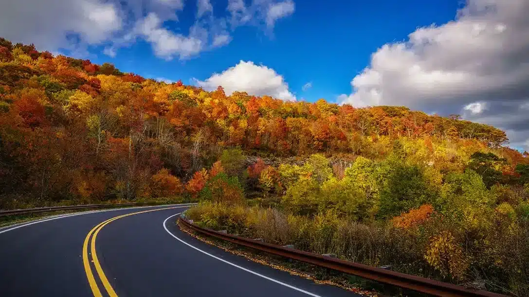
The Cherohala Skyway climbs from the town of Tellico Plains in southeastern Tennessee to Robbinsville, North Carolina, reaching elevations above 5,400 feet along a route that was built for scenic driving and delivers sky views that rival anything on the Blue Ridge Parkway. The skyway follows the ridgeline of the Unicoi Mountains, and the overlooks along the route provide 360-degree views across the southern Appalachians where the weather systems are visible developing over the mountain terrain. On unstable summer afternoons, the thunderstorms build over the ridges in every direction, and the elevated position of the skyway puts you at cloud level where the formations are not observed from below but met at eye level.
The mountain weather along the Cherohala Skyway includes fog that fills the valleys below while the ridgeline sits in clear air, producing a cloud-sea effect that is among the most dramatic in the Southeast. The orographic clouds that form along the ridge crest drift across the road itself, and driving through the cloud base with the overlook views alternating between clear mountain panoramas and total whiteout is an immersive weather experience. The fall and spring provide the most active frontal weather, when the cold and warm air masses collide along the mountain terrain and produce dramatic cloud formations and precipitation events.
The skyway covers about 36 miles between Tellico Plains and Robbinsville. Tellico Plains has a few restaurants and a visitor center. Robbinsville, at the eastern end, has basic services. The overlooks along the skyway have parking areas but no services, so preparation is necessary for the drive. The Cherohala Skyway is the Tennessee drive where mountain elevation and atmospheric instability combine to create weather watching at altitude, and the ridgeline position provides views that make the sky feel close enough to touch.
Texas: Highway 118 (Fort Davis to Study Butte)
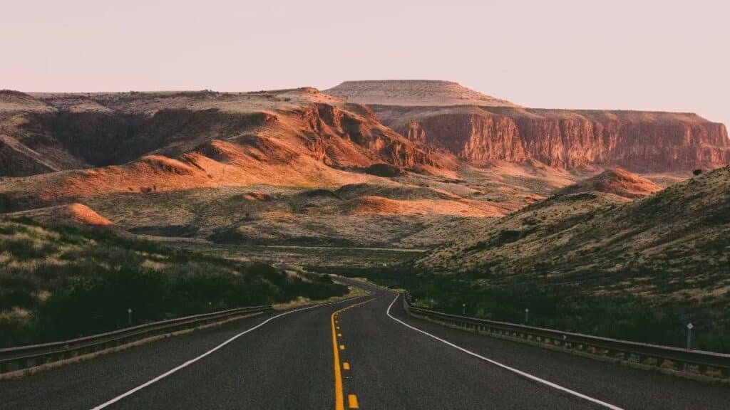
Highway 118 through the Trans-Pecos region of far west Texas runs from the mountain town of Fort Davis south through the Chihuahuan Desert to Study Butte at the entrance to Big Bend National Park, and the monsoon sky along this route during July, August, and September is the most dramatic in Texas. The road crosses a landscape of desert basins and volcanic mountains where the summer monsoon moisture from the Gulf of Mexico collides with the heated terrain to produce afternoon thunderstorms of extraordinary violence and beauty. The storms here are high-based and visible in their entirety against the clear desert air, with lightning, virga, and rain curtains all visible simultaneously from the road.
The Davis Mountains, near the northern end of the route, are high enough to generate their own orographic storms, and the combination of the mountain-generated cells and the basin-bred thunderstorms creates a sky show that is uniquely western. The McDonald Observatory, on Mount Locke in the Davis Mountains, hosts star parties that take advantage of the dark skies but also provide a vantage point for monsoon lightning displays that are visible across hundreds of miles of desert. The descent from the Davis Mountains toward Big Bend passes through increasingly dramatic desert terrain where the storm cells are visible as isolated pillars of rain and lightning against the backdrop of the Chisos Mountains.
Fort Davis has the Hotel Limpia and a few restaurants. Study Butte and Terlingua, at the southern end, have restaurants and lodging with a desert-outpost character. The Starlight Theatre in Terlingua serves food and music in a partially roofless building where the sky is literally part of the decor. Highway 118 is the Texas drive where the monsoon desert sky reaches its full intensity, and the storms over the Trans-Pecos are visible with a clarity and drama that the humid, hazy air of eastern Texas can never produce.
Utah: Highway 12 (Scenic Byway 12)
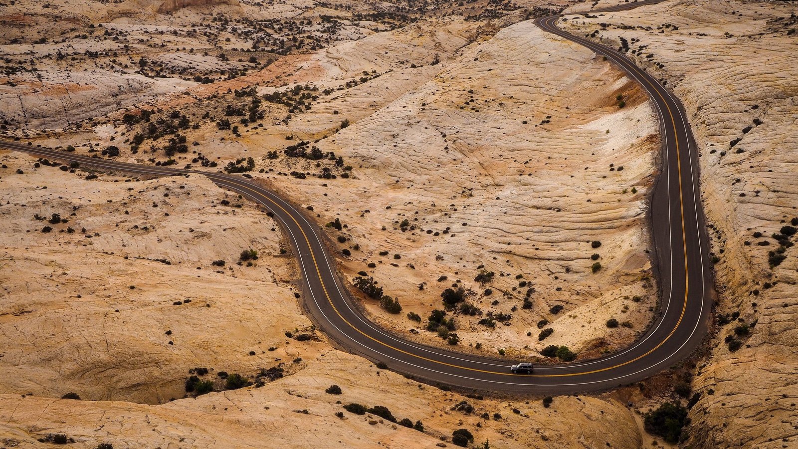
Scenic Byway 12 in southern Utah runs 122 miles from Bryce Canyon to Capitol Reef through a landscape of red rock, slot canyons, and slickrock plateaus that is among the most visually dramatic in the American West. The sky above this terrain adds another dimension. The route crosses Hogsback Ridge, a narrow spine of rock where the road runs along a knife-edge with thousand-foot drops on both sides, and the sky above this exposed position is visible from horizon to horizon. During monsoon season, the storms that build over the Aquarius Plateau and the Waterpocket Fold are visible from the byway as dark masses of rain and lightning against the red-rock backdrop in a color combination that exists nowhere else.
The monsoon storms in southern Utah are often isolated cells that move across the landscape like spotlights, dropping rain on one canyon while the next canyon sits in sunshine. The virga, the rain that evaporates before reaching the ground, is especially common and photogenic in this dry air, and the streaks of moisture descending from the cloud base against the red-rock walls create compositions that have made this area a destination for weather and landscape photographers. The flash floods that the storms produce are another weather phenomenon specific to this terrain, where a storm miles away can send a wall of water down a slot canyon with devastating force.
The drive from Bryce Canyon to Capitol Reef takes about three hours without stops but deserves a full day. The towns of Escalante and Boulder have restaurants and lodging. The Hell’s Backbone Grill in Boulder does farm-to-table cuisine. Bryce Canyon Lodge and the Capitol Reef area have additional accommodations. Highway 12 is the Utah drive where the red rock and the monsoon sky create a weather-watching experience that combines the drama of the atmosphere with the drama of the geology, and the storms over this landscape produce light and color combinations that are unique in the world.
Vermont: Route 100 (Green Mountain Byway)
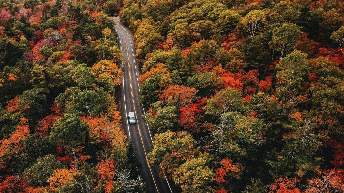
Route 100 runs the length of Vermont’s Green Mountains, following a valley corridor between the main spine of the range and the eastern foothills, and the sky along this route reflects the mountain weather that gives Vermont its character. The road passes through a landscape of narrow valleys, covered bridges, and small villages where the Green Mountains rise on both sides, and the weather that crosses the range is funneled through the gaps and valleys in patterns that are visible from the road. The cloud formations along the ridgelines, the fog that fills the valley on cool mornings, and the snow squalls that sweep through in winter are all part of the driving experience.
Vermont’s mountain weather is primarily driven by the interaction between the prevailing westerly winds and the Green Mountain terrain. The clouds that form on the windward side of the range and pour over the ridgeline are visible from Route 100 as waterfalls of mist descending into the valleys. The valley fog that forms on clear nights, trapping cold air in the hollows while the ridges sit above in sunshine, creates a layered atmospheric effect that transforms the morning drive into a journey through alternating zones of mist and light. The thunderstorms that develop along the mountain crest in summer are channeled through the valleys, and the combination of the narrow terrain and the storm energy produces concentrated weather events that are more intense than the open-terrain storms of the plains.
Route 100 runs about 200 miles through the state, and the entire length offers weather watching. The villages along the route, including Stowe, Warren, and Wilmington, have restaurants and lodging. The Warren Store is a classic Vermont country store. Stowe has Hen of the Wood and other restaurants. This is the Vermont drive where the mountain weather and the valley landscape create an atmospheric experience that is intimate, constantly changing, and uniquely New England.
Virginia: Skyline Drive (Shenandoah National Park)
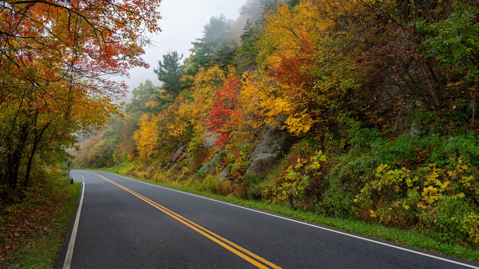
Skyline Drive runs 105 miles along the crest of the Blue Ridge through Shenandoah National Park, and the weather from this ridgeline position is the best in Virginia for atmospheric observation. The drive follows the spine of the mountains at elevations between 2,000 and 3,600 feet, with overlooks on both sides that provide views into the Shenandoah Valley to the west and the Virginia Piedmont to the east. The weather systems that cross the Blue Ridge are visible from these overlooks in their full structure, approaching from the west across the valley, climbing the mountain, and breaking apart or intensifying as they cross the ridgeline.
The fog and cloud effects along Skyline Drive are the main atmospheric attraction. The valley fog that fills the Shenandoah Valley on cool mornings, leaving the mountain peaks as islands above a white sea, is one of the most photographed weather phenomena in the eastern United States. The orographic clouds that form along the ridgeline as moisture is pushed upward by the terrain create effects where the road passes through the cloud base and the overlook views alternate between clear panoramas and near-zero visibility. The thunderstorms that develop along the Blue Ridge in summer are visible from the overlooks as they march across the valley, and the lightning displays during evening storms are dramatic from the elevated position.
Skyline Drive requires a Shenandoah National Park entrance fee and has a 35-mph speed limit that encourages the slow pace appropriate for weather watching. Big Meadows Lodge and Skyland Resort, both along the drive, have dining and rooms with ridgeline views. The overlooks are numbered and many have interpretive signs. This is the Virginia drive where the Blue Ridge weather and the ridgeline elevation combine to create an atmospheric experience that runs the full length of the park, with every overlook offering a slightly different angle on whatever the sky is doing.
Washington: Highway 20 (North Cascades Highway)
The North Cascades Highway crosses Washington’s most rugged mountain terrain between Burlington in the Skagit Valley and Twisp in the Methow Valley, climbing over two passes above 4,000 feet through a landscape where the weather can change from Pacific marine influence to continental dryness in the space of fifty miles. The western approach, through the Skagit Valley and up to Ross Lake, passes through some of the wettest terrain in the lower 48, where the annual precipitation can exceed 100 inches, and the clouds hang in the valleys and cling to the mountain walls in formations that shift by the minute.
The passes, Washington and Rainy, sit at the boundary between the wet west side and the dry east side of the Cascades, and the weather transition is often visible as a wall of cloud that ends at the pass and gives way to blue sky on the eastern descent. The mountain terrain generates its own weather, with lenticular clouds forming over the peaks, rotor clouds spinning in the lee of the ridges, and cascade clouds pouring over the crest like slow-motion waterfalls. The glaciated peaks of the North Cascades, visible from multiple overlooks along the highway, create their own microweather, with cold air flowing down the glacier surfaces and colliding with the warmer valley air to produce localized fog and cloud formations.
The highway covers about 130 miles and is typically open from late April through November. The western section has the Skagit Valley dining options, and Marblemount has a few services. The Methow Valley on the eastern side has restaurants and lodging in Winthrop and Twisp. The Ross Lake area has campgrounds. The North Cascades Highway is the Washington drive where the mountain weather is the most dramatic and varied in the Pacific Northwest, and the transition from the wet side to the dry side of the range, visible in the sky as you cross the passes, is a weather lesson that no classroom can replicate.
West Virginia: Highland Scenic Highway (Route 150)
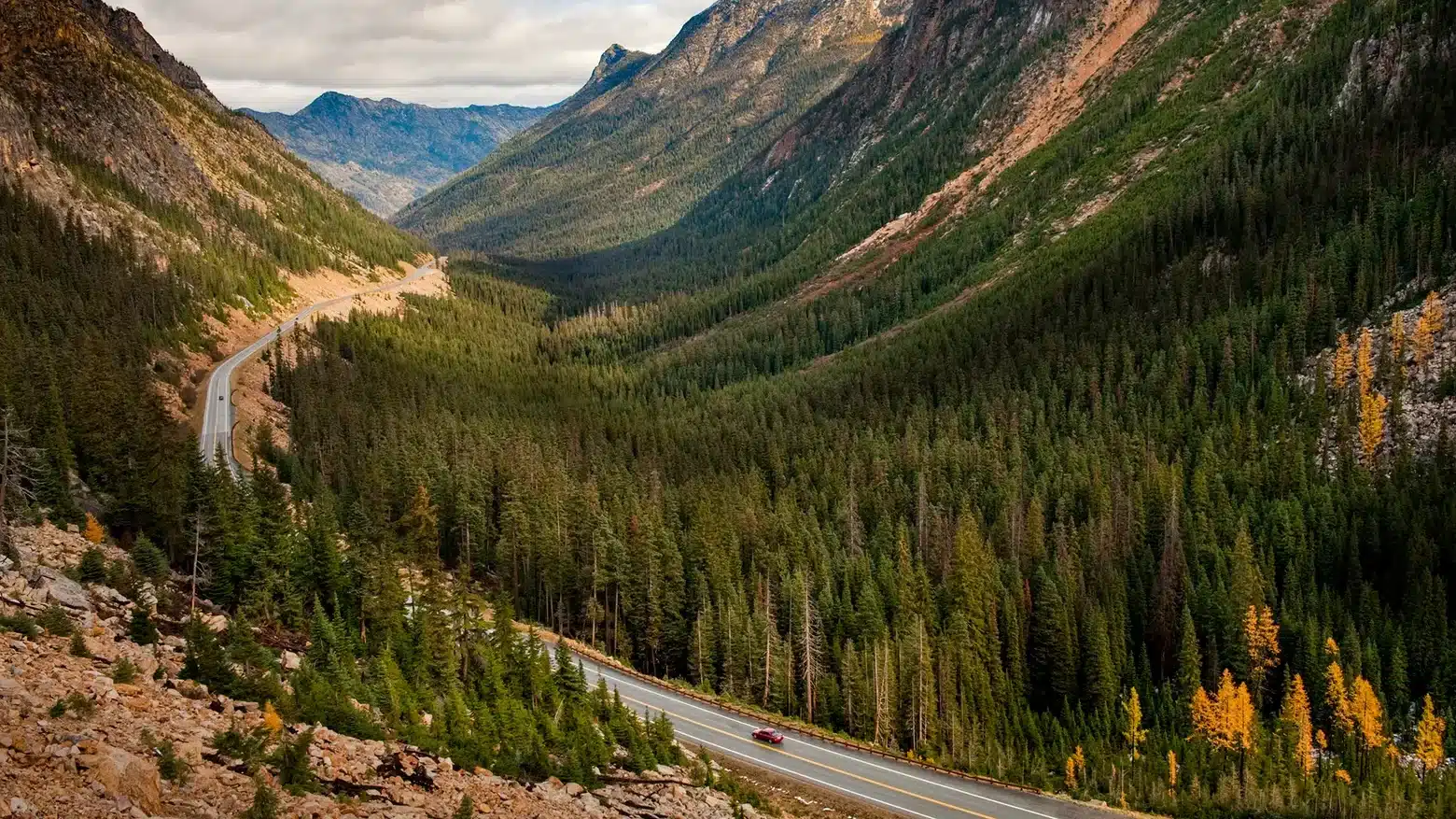
The Highland Scenic Highway climbs to over 4,500 feet through the Monongahela National Forest in Pocahontas County, and the sky from this ridgeline road through the Allegheny Highlands is the best in West Virginia for weather watching. The route runs along the crest of the mountains through spruce forest and highland meadows, with overlooks that provide views across miles of unbroken forest canopy where the weather systems are visible approaching from the west. The Allegheny Highlands create their own weather through orographic lifting, and the clouds that form along the ridgeline are at eye level from the highway, drifting through the spruce trees and across the road itself.
The fog in these highlands is among the most persistent and dramatic in the Appalachians. The valleys fill with cloud on cool mornings, and the view from the highway overlooks, looking down at a sea of white with the mountain peaks protruding, is an atmospheric experience that rivals anything in New England. The thunderstorms that develop along the Allegheny Front in summer are visible from the eastern overlooks as they organize and move through the mountain terrain, and the lightning during evening storms, flickering across the forested ridges, produces a light show that is amplified by the reflective spruce canopy. The winter weather, with snow and ice coating the spruce trees in rime, creates a frozen atmosphere that is otherworldly.
The Highland Scenic Highway covers 43 miles and is typically open from late April through November, though the upper elevations can close earlier in fall. The town of Marlinton, in the Greenbrier Valley below, has restaurants and lodging. The Cranberry Mountain Nature Center, along the route, has interpretive displays. The Elk River Touring Center in Slatyfork provides lodging and dining. This is the West Virginia drive where the Allegheny Highland weather is at its most dramatic and the ridgeline position puts you in direct contact with the atmospheric conditions rather than observing them from below.
Wisconsin: Highway 42 (Door Peninsula)
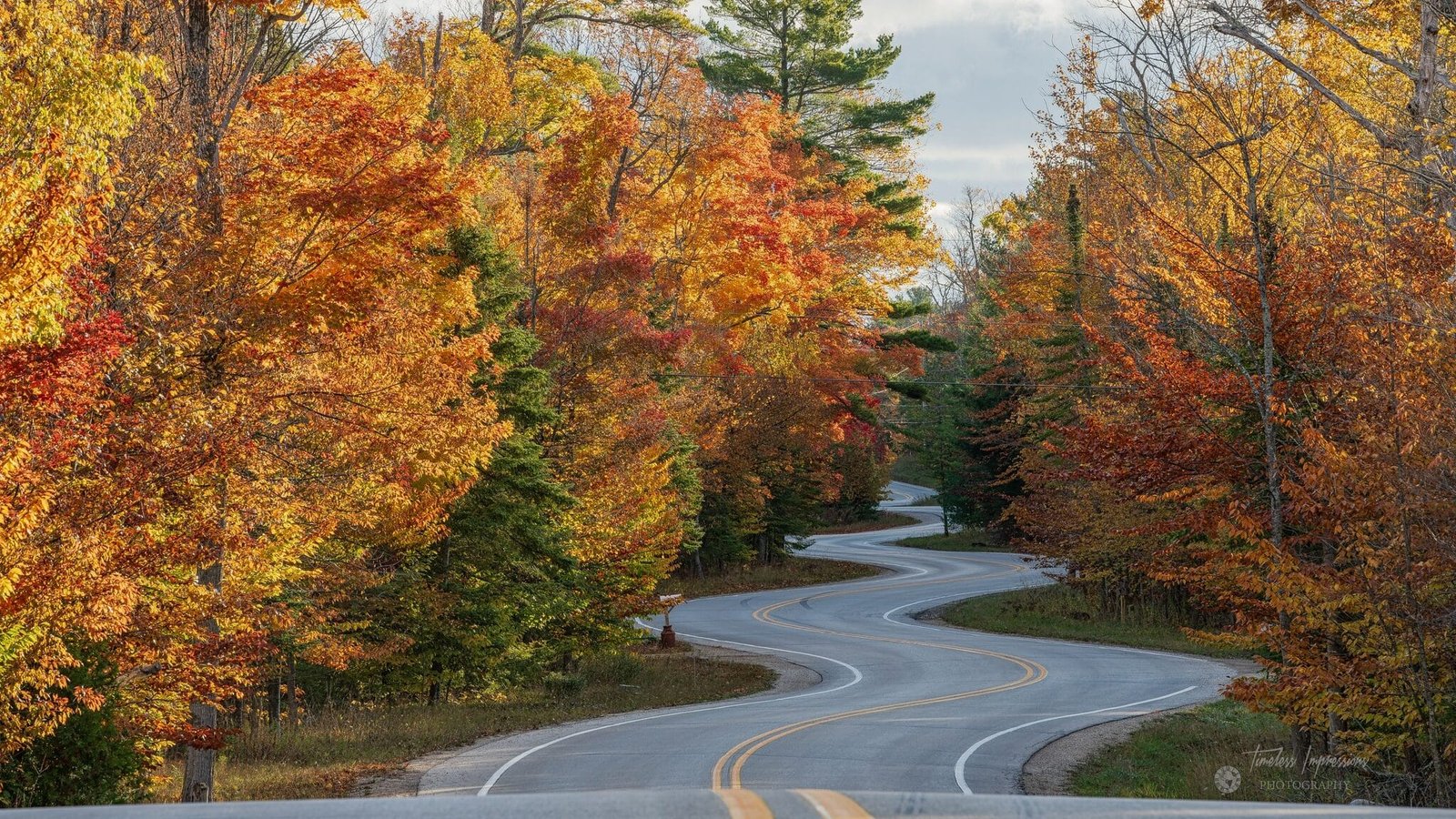
The Door Peninsula juts into Lake Michigan for about 70 miles between Green Bay to the west and the open lake to the east, and Highway 42, which runs up the bay side, offers sky watching shaped by the lake’s influence on the weather. The Lake Michigan weather machine generates lake-effect clouds, sea breezes, and storm systems that are visible from the peninsula in patterns unique to the Great Lakes. The peninsula is narrow enough that the weather coming off the lake is visible from the bay side and vice versa, and the contrast between conditions on the two sides can be dramatic, with fog on one shore and sunshine on the other.
The Door Peninsula’s numerous state parks and headlands provide viewing platforms for the lake weather. Peninsula State Park, near Fish Creek, has a tower with views across the bay and the islands where approaching weather is visible. The storms that cross Lake Michigan from the west hit the peninsula with particular force, and the wave action at Cave Point County Park, on the lake side, is especially dramatic during weather events. The fog that forms over the cold lake and drifts across the peninsula creates atmospheric effects that transform the landscape, with the lighthouses, the cherry orchards, and the limestone bluffs appearing and disappearing as the fog moves through.
Highway 42 runs from Sturgeon Bay to the tip of the peninsula at Northport, about 45 miles. The villages along the route, including Fish Creek, Ephraim, and Sister Bay, have restaurants and lodging. Al Johnson’s Swedish Restaurant in Sister Bay, with its grass-roofed building, is a landmark. The White Gull Inn in Fish Creek serves food and offers rooms. This is the Wisconsin drive where the Lake Michigan weather shapes the experience, and the peninsula position between the bay and the lake puts you at the intersection of two water bodies whose competing influences create a sky that is never the same twice.
Wyoming: Highway 120 (Meeteetse to Cody)
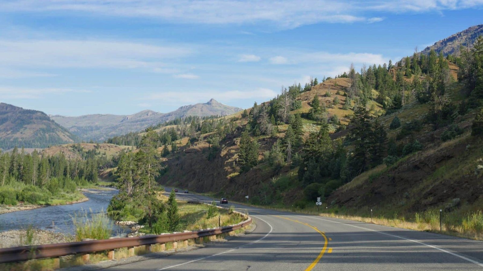
The road between Meeteetse and Cody in the Bighorn Basin of northwestern Wyoming passes through a landscape where the Absaroka Range rises to the west, the Bighorn Mountains close in from the east, and the basin floor between them provides a natural amphitheater for the sky. The basin is arid and open, with sagebrush and grass covering the terrain and the mountain ranges framing the view on both sides. The storms that develop over the Absarokas during summer are visible from this road as they build above the peaks and drift east across the basin, trailing rain and lightning behind them. The combination of the mountain-generated storms and the open-basin viewing creates a weather-watching experience that is uniquely Wyoming.
The Bighorn Basin has a continental climate with wide temperature swings, low humidity, and weather systems that arrive with a directness that more humid regions lack. The thunderstorms here are high-based and clean-looking, with the cloud structures visible in their entirety against the blue sky. The virga, the wind shear patterns in the anvil, and the mammatus formations on the underside of the anvil are all visible with a clarity that the eastern atmosphere cannot provide. The sunset light over the basin, when the storms are retreating and the low-angle sun catches the Absaroka peaks, produces some of the most extraordinary mountain-weather light in the northern Rockies.
The drive from Meeteetse to Cody covers about 32 miles through the basin, with the entire route offering mountain and sky views. Cody has extensive dining and lodging, including the historic Irma Hotel, built by Buffalo Bill Cody. Meeteetse is a small ranching town with the Meeteetse Chocolatier and a few other businesses. The road can be extended south from Meeteetse toward Thermopolis for additional basin-and-range sky watching. Highway 120 in the Bighorn Basin is the Wyoming drive where the mountain ranges and the open basin create a weather-watching theater that combines the best elements of mountain and plains sky observation in a single landscape.