
There is a reason people pull their cars over and stare at the sky when a big storm builds on the horizon. Thunderstorms are nature at its most dramatic, with towering clouds, flashing lightning, and a rumble that vibrates in your chest before it reaches your ears. Some people run from storms. Others chase them. And in every state, there is a spot where watching one unfold feels almost spiritual.
The best storm-watching locations share a few qualities: wide open views, elevation or vantage points, and weather patterns that produce the kind of storms worth watching. These are not places to be during a tornado warning. These are places where you can sit at a safe distance and watch the atmosphere put on a show.
From Great Plains supercells to coastal lightning displays, here is the best place to watch a thunderstorm in every state.
Cheaha Mountain, Alabama
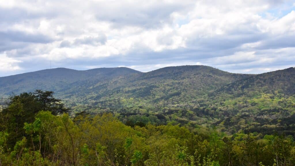
Alabama’s highest point rises 2,413 feet above the surrounding piedmont, offering a panoramic view that stretches for miles in every direction. When Gulf moisture pushes north during spring and summer, thunderstorms build along the ridgeline and march across the landscape in a display of vertical development that looks painted against the sky.
The observation tower at Cheaha State Park puts you above the tree canopy, where you can watch lightning crawl between cloud layers while the storm’s anvil spreads across the horizon. The sound arrives seconds after the flash, and the rumble echoes off the surrounding valleys in a way that flatland storms never replicate.
Spring storms here can turn severe, so the smart move is to watch from the lodge or the covered observation areas rather than the exposed summit. But the view of a line of storms approaching from the west across the Alabama landscape is one of the most impressive weather displays in the Southeast.
Turnagain Arm, Alaska
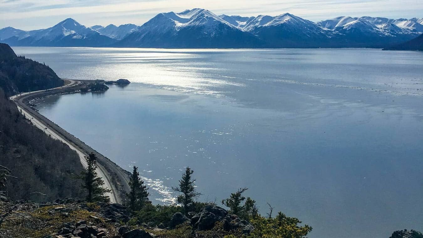
Alaska does not produce the towering thunderstorms that the lower 48 states are known for, but Turnagain Arm on the Seward Highway south of Anchorage delivers a different kind of weather drama. Storms roll in from the Gulf of Alaska with low, fast-moving clouds that slam into the Chugach Mountains, creating a wall of wind, rain, and mist that moves up the arm like a living thing.
The bore tide that pushes through Turnagain Arm during large tidal swings adds another element when combined with storm conditions. Waves, wind, and rain converge in a narrow fjord surrounded by glaciated peaks, creating a spectacle that is uniquely Alaskan.
Pull off at one of the highway viewpoints and watch the weather arrive. The clouds descend fast, the water turns steel gray, and the mountains disappear behind curtains of rain that sweep across the arm. Alaska’s storms are not about lightning and thunder. They are about raw power delivered at a scale that makes you feel appropriately small.
South Rim, Grand Canyon, Arizona
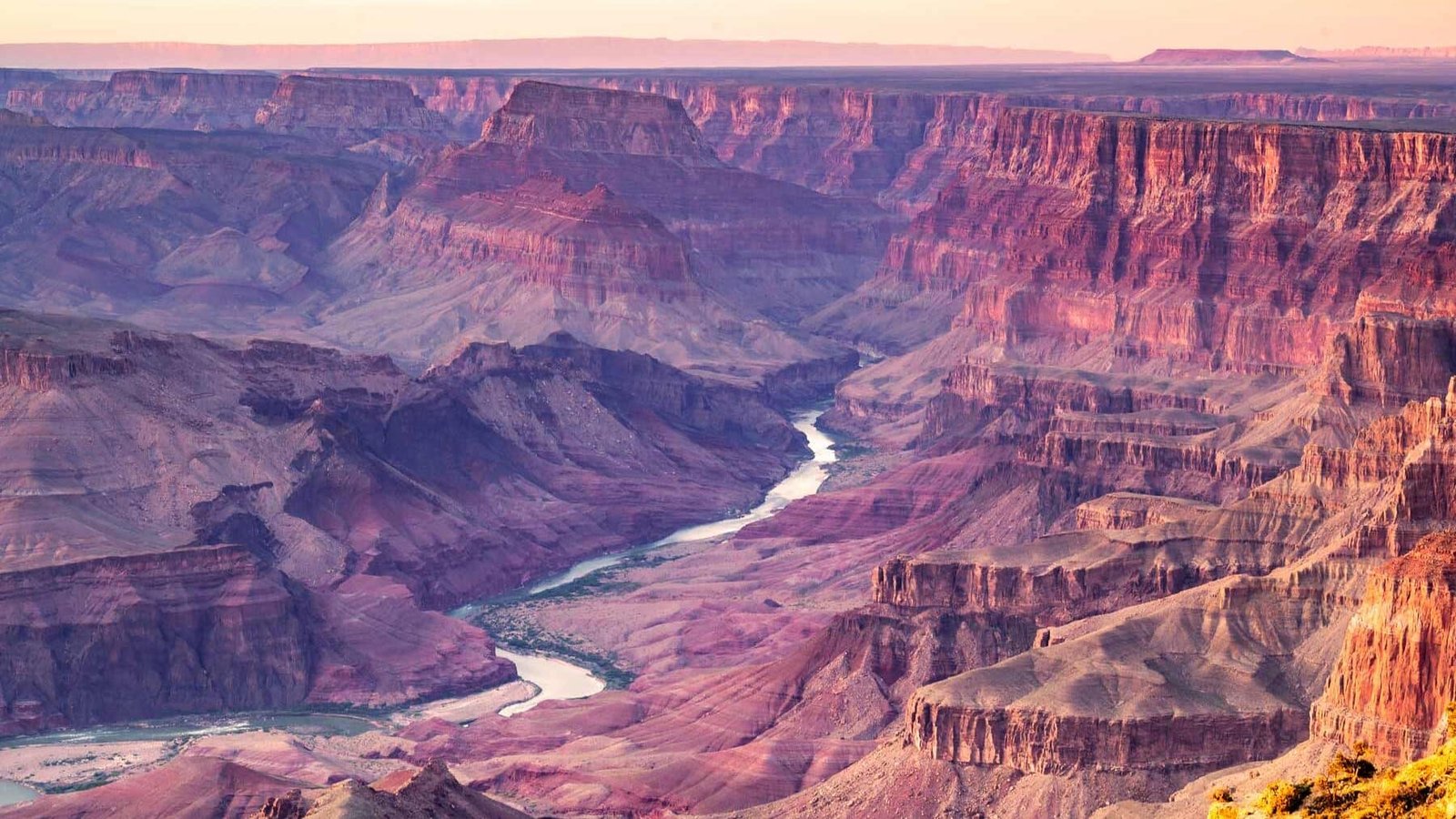
Monsoon season transforms the Grand Canyon into the greatest thunderstorm amphitheater on Earth. From July through September, afternoon storms build over the North Rim and march across the canyon, dropping curtains of rain that never reach the ground in the dry air below. These virga columns glow orange and purple in the late afternoon light, framed by the canyon walls in a scene that defies photography.
Lightning strikes the rim and the spires within the canyon, and the flash illuminates geological layers that are billions of years old. The thunder bounces off the canyon walls in rolling echoes that last ten seconds or more, creating a surround-sound experience that no speaker system can duplicate.
The South Rim viewpoints at Hopi Point and Yavapai Point offer unobstructed views that stretch 10 miles across the canyon. Watching a monsoon storm cross the Grand Canyon at sunset, with lightning in one direction and golden light in the other, is one of the most extraordinary weather experiences available anywhere in America.
Mount Magazine, Arkansas
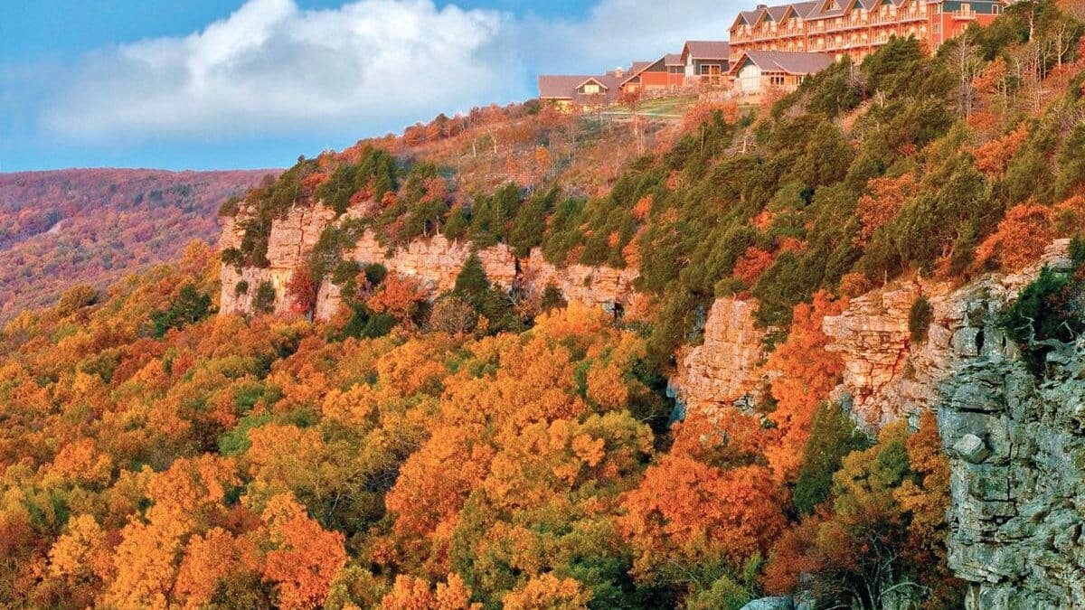
The highest point in Arkansas rises 2,753 feet above the Arkansas River Valley, providing a front-row seat to the severe weather that crosses the state during spring. The lodge at Mount Magazine State Park sits on the rim of the mountain with floor-to-ceiling windows that face west, directly into the path of approaching storms.
Supercell thunderstorms that form over eastern Oklahoma cross into Arkansas and pass below the mountain’s elevation, giving viewers the rare experience of looking down at a storm’s base while the updraft tower rises above. The rotating structure of a supercell is visible from this vantage in a way that ground-level observers cannot appreciate.
The Arkansas River Valley below acts as a channel that funnels storms through the gap between the Ozarks and the Ouachitas, concentrating weather activity along a predictable path. Mount Magazine sits directly above this channel, making it one of the best storm-watching positions in the central United States.
Joshua Tree National Park, California
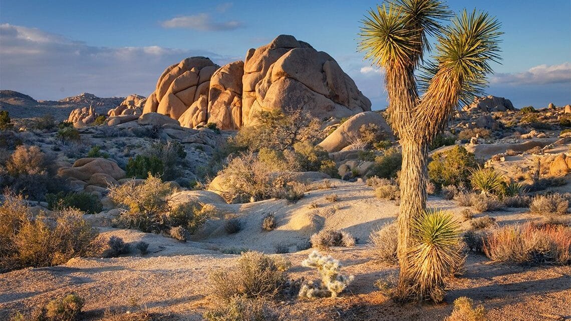
The high desert of Southern California produces summer thunderstorms that arrive with explosive suddenness. At Joshua Tree, the storms build over the mountains to the east and advance across the park with a speed that catches hikers off guard but rewards anyone positioned at a safe viewpoint with one of the most photogenic lightning displays in the West.
The iconic Joshua trees silhouetted against lightning-filled skies have become some of the most shared weather photographs on the internet. The park’s open terrain provides 360-degree views of approaching storms, and the dry desert air makes lightning visible from extraordinary distances.
Keys View, at 5,185 feet, offers a panoramic vantage that stretches from the Salton Sea to the San Gorgonio Pass. Watching a thunderstorm cross this landscape at sunset, with lightning forking between the mountains and the desert floor, is a reminder that even Southern California gets serious weather when the monsoon moisture pushes west.
Trail Ridge Road, Colorado
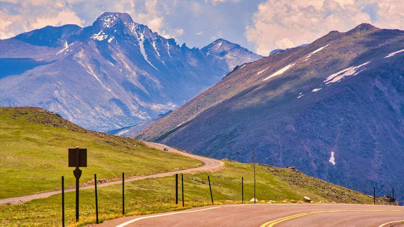
The highest continuous paved road in North America climbs above 12,000 feet in Rocky Mountain National Park, putting you at eye level with the thunderstorms that build over the Continental Divide every summer afternoon. The storms here are close, fast, and intense, with lightning that strikes the alpine tundra with enough frequency that the Park Service closes the road above treeline during active storms.
The trick is timing. Morning along Trail Ridge Road is clear and calm. By noon, cumulus towers start building over the peaks. By 2 p.m., those towers have become full thunderstorms with heavy rain, hail, and constant lightning. Watching this transformation from one of the pullouts below treeline is a masterclass in storm development.
The scale of the storms against the mountain backdrop is humbling. Clouds that tower 40,000 feet above the peaks dwarf everything human, and the thunder at altitude has a sharp, cracking quality that sounds different from the rolling rumble at lower elevations. Trail Ridge Road is a place where weather feels immediate, powerful, and close enough to respect.
Hammonasset Beach State Park, Connecticut
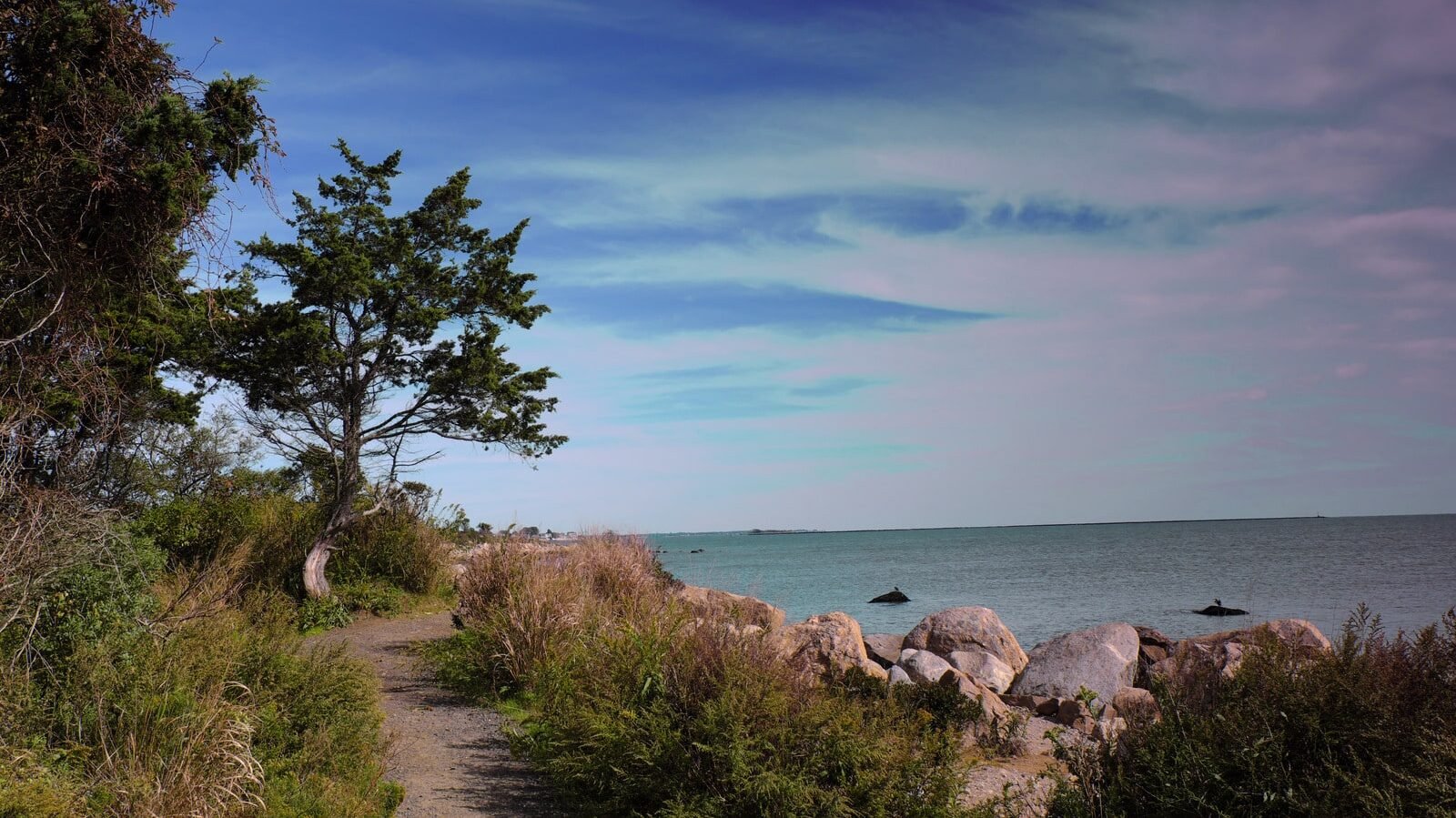
Long Island Sound produces summer thunderstorms that march across the water with a visual drama that inland locations cannot match. Hammonasset, Connecticut’s longest public beach, faces south across the sound, providing a wide-open view of storms approaching from the west and southwest.
Lightning over water creates reflections that double the visual impact, and the sound of thunder rolling across the sound arrives with a deep, prolonged quality shaped by the flat water surface. Storms that form over the Connecticut River valley move south and cross the coastline with visible structure that is easy to appreciate from the beach pavilions.
The best storms arrive in late afternoon, when sea breeze convergence triggers rapid development along the coast. You can sit under the pavilion roof, watch the sky darken over the sound, and feel the temperature drop 15 degrees as the outflow boundary from the approaching storm pushes ahead of the rain.
Cape Henlopen, Delaware
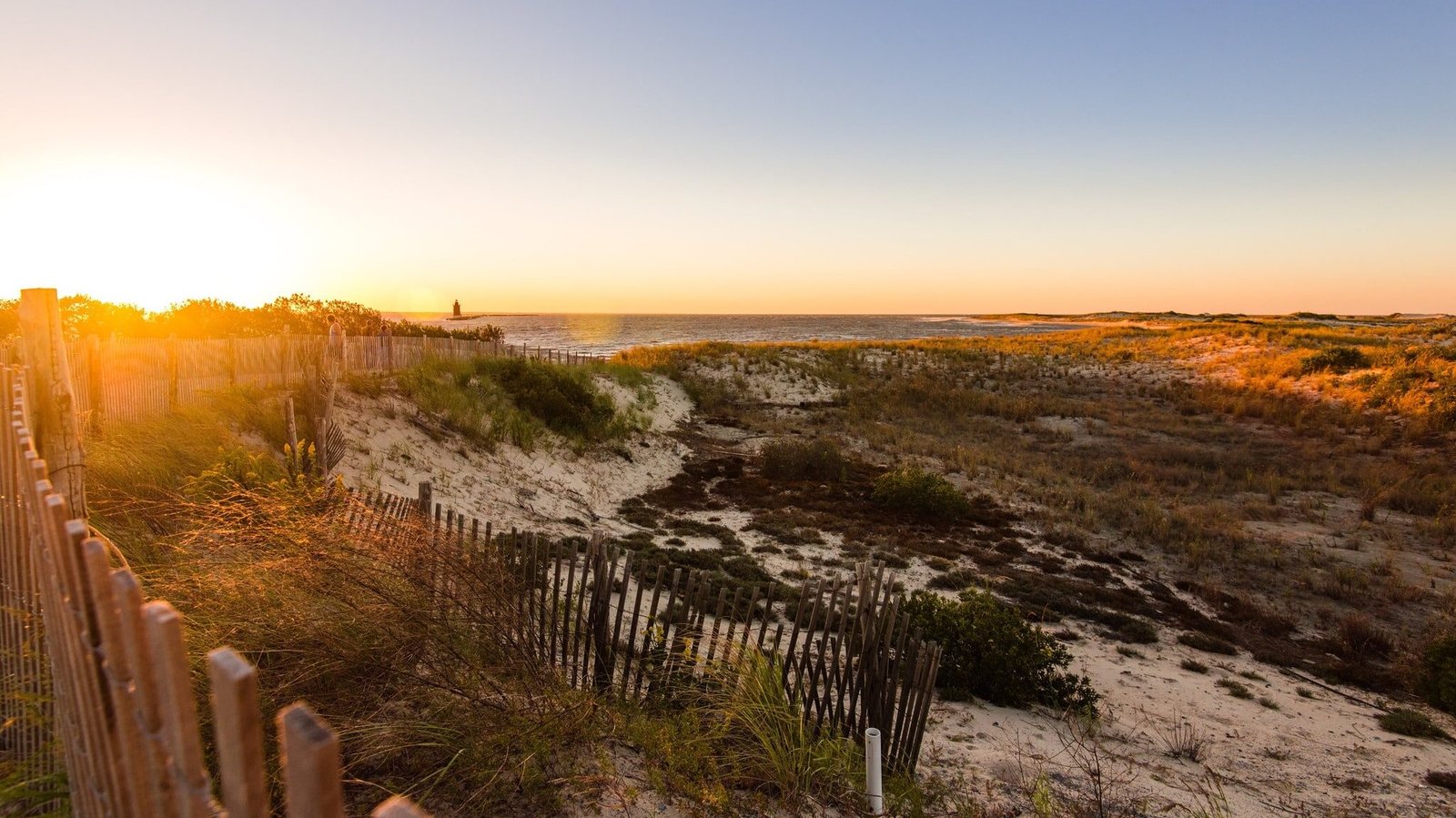
The point where Delaware Bay meets the Atlantic Ocean provides a unique vantage for watching storms that track up the coast. Cape Henlopen State Park offers elevated observation towers that were originally built as World War II fire-control stations, and they serve perfectly as storm-watching platforms.
Summer thunderstorms that form over the Delmarva Peninsula move east toward the coast, and the convergence of bay and ocean air can enhance them as they approach. Lightning over the water at dusk creates a display that photographers drive hours to capture.
Nor’easters provide a different kind of storm watching, with heavy surf, driving rain, and wind that tests the observation tower’s structural integrity. Cape Henlopen lets you watch weather arrive from the ocean with nothing between you and the horizon, a perspective that makes even a modest thunderstorm feel significant.
Sanibel Island Causeway, Florida
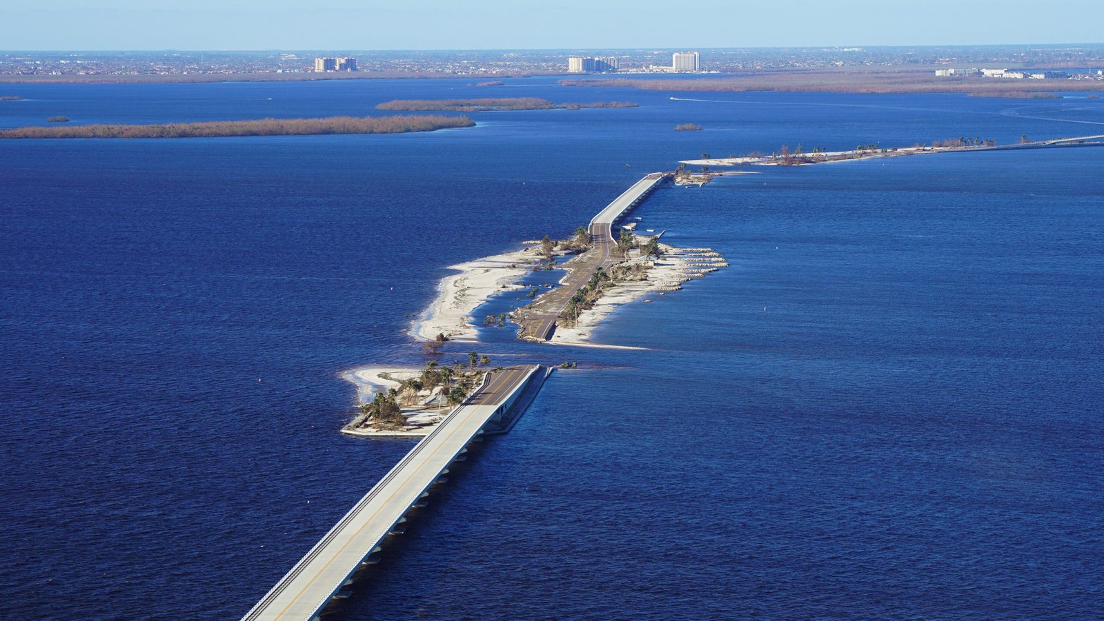
Florida produces more lightning per square mile than any other state, and the causeway connecting Sanibel Island to the mainland offers one of the best vantage points for watching the show. Summer afternoon storms build inland over the Everglades and march west toward the Gulf Coast, arriving at the causeway with towering anvil clouds and nearly continuous lightning.
The causeway is surrounded by water on both sides, giving you an unobstructed 360-degree view of storm development. You can watch individual cells build, mature, and collapse while new ones form behind them, a rotating carousel of thunderstorms that can last for hours during the wet season.
Pull into one of the parking areas along the causeway, stay in your car, and watch. The lightning frequency during a strong Florida storm can exceed 100 strikes per minute, and the reflection off the water turns the entire scene into something that feels more like a movie set than real weather. Florida storms are violent, beautiful, and perfectly watchable from the safety of the causeway.
Brasstown Bald, Georgia
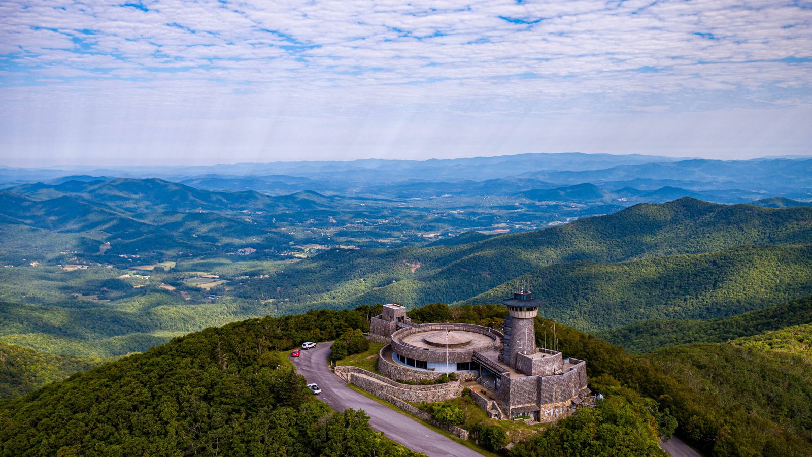
Georgia’s highest point at 4,784 feet provides a commanding view of the southern Appalachian Mountains in every direction. When summer thunderstorms build over the ridges, the view from Brasstown Bald lets you watch multiple storms simultaneously, tracking their movement across the layered mountain landscape like pieces on a chessboard.
The observation tower at the summit has glass walls that provide 360-degree views while keeping you sheltered from wind and rain. Park staff are experienced with storm activity and will advise on safety, but the tower is a legitimate structure that handles lightning exposure as part of its design.
Late afternoon storms are the best. The sun drops behind the western ridges while storms to the east are still lit from above, creating a contrast of golden light and dark cloud bases that makes the lightning more visible and the entire scene more dramatic. Brasstown Bald turns storm watching into an elevated experience in every sense of the word.
Mauna Kea Summit, Hawaii
At 13,796 feet, the summit of Mauna Kea sits above most weather, which means storm watching here is a top-down experience. Thunderstorms that form over the Big Island build below the summit, and you can look down at lightning illuminating cloud layers from above, a perspective that almost nobody outside of airline pilots gets to see.
The observatories on the summit close during storm activity, and driving conditions on the access road can deteriorate rapidly. But the Visitor Information Station at 9,200 feet provides a safer alternative where you can watch storms develop across the saddle between Mauna Kea and Mauna Loa with an elevation advantage that makes cloud development visible in real time.
Tropical thunderstorms in Hawaii are brief, intense, and often accompanied by rainbows that form in the clearing air behind the storm. Watching one from above, with the Pacific Ocean as a backdrop and volcanic terrain below, is a storm-watching experience that exists nowhere else in the United States.
Craters of the Moon, Idaho

The volcanic landscape of Craters of the Moon National Monument provides an otherworldly backdrop for summer thunderstorms. The black lava flows absorb heat during the day and create thermal updrafts that help trigger storm development over the Snake River Plain. When storms arrive, lightning against the dark volcanic terrain creates a scene that looks lifted from science fiction.
The monument’s open terrain provides long sightlines, and the lack of tall vegetation means you can see storm structure clearly from ground level. The lava formations add a foreground element that makes storm photography here unlike anywhere else in the country.
Summer afternoons are prime time. Storms build over the Pioneer Mountains to the north and move south across the lava fields with visible rotation and clearly defined precipitation cores. The combination of geological drama and atmospheric drama in a single landscape makes Craters of the Moon one of the most underrated storm-watching destinations in the West.
Starved Rock State Park, Illinois
The Illinois River valley channels storms through a corridor that Starved Rock overlooks from sandstone bluffs 125 feet above the water. The park’s canyons and rock formations add acoustic depth to thunder that echoes off the stone walls in a way that open terrain cannot match.
Spring storms that form over the western Illinois prairie move east along the river valley, and the park’s elevated position lets you watch them approach for miles before they arrive. The sandstone bluffs provide natural shelter, and the lodge offers covered viewing areas with views down the river valley.
After the storm passes, waterfalls in the park’s 18 canyons surge with runoff, adding a post-storm bonus that rewards anyone who sticks around. Starved Rock transforms thunderstorm energy into waterfall energy within minutes, making the whole weather cycle visible from a single location.
Indiana Dunes National Park, Indiana
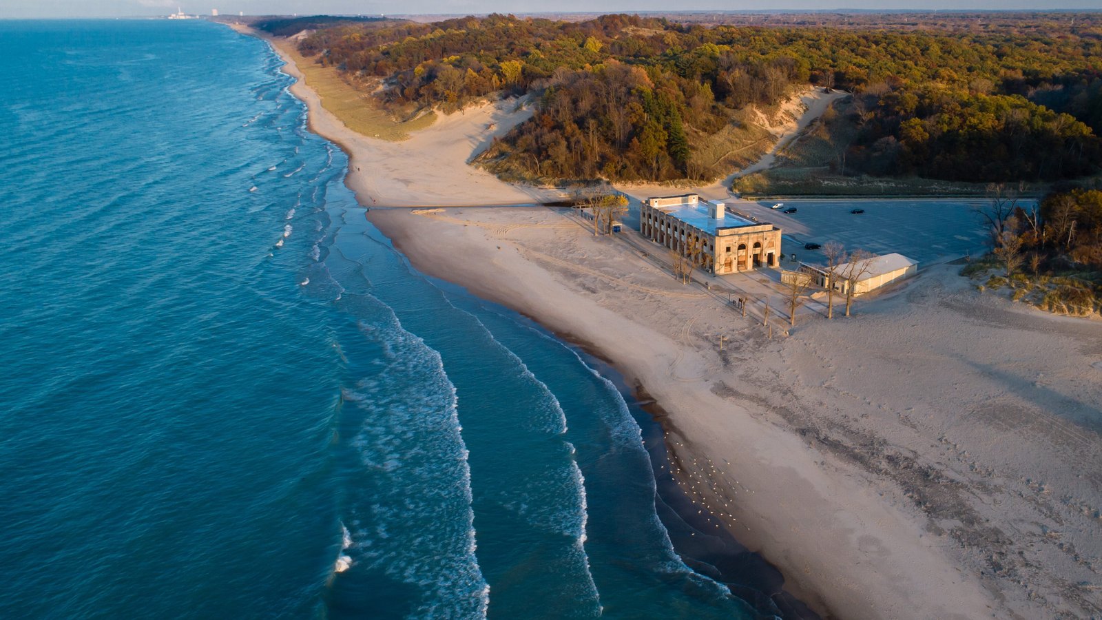
Lake Michigan produces thunderstorms that arrive at the Indiana shoreline with dramatic visual structure. The dunes provide elevated vantage points where you can watch storms cross the lake, with lightning reflected in the water and cloud bases that seem to skim the surface as they approach.
The contrast between the warm beach sand and the cooled air behind the storm front creates visible outflow boundaries that race across the water ahead of the rain. You can watch the wind shift, feel the temperature drop, and see the rain curtain approaching like a wall before it arrives.
Summer evening storms are the best, when fading daylight illuminates the storm’s upper structure while the base goes dark. The Lake Michigan shoreline turns every thunderstorm into a water-and-sky spectacle that flatland storms inland cannot match. Stay in your car at the beach parking areas and watch nature put on a show that costs nothing and impresses every time.
Effigy Mounds, Iowa

The bluffs above the Mississippi River at Effigy Mounds National Monument provide a sweeping view of the river valley that stretches into three states. When thunderstorms build over the Iowa prairie and move east toward the river, the bluff-top trails offer a vantage point where you can watch storms descend into the valley and cross the river into Wisconsin.
The ancient mounds on the bluffs add a layer of human history to the weather watching. People have stood on these same ridges watching storms approach for over a thousand years, and the experience connects you to something that feels much larger than a single afternoon of weather.
Late spring storms are the most dramatic, when moisture from the Gulf collides with cold air still lingering over the upper Midwest. The storms that result are tall, loud, and produce lightning that lights up the river valley from bluff to bluff. Effigy Mounds turns storm watching into something that feels almost ceremonial.
Flint Hills, Kansas

The Flint Hills of east-central Kansas may be the single best place in America to watch a thunderstorm. The tallgrass prairie provides an unbroken horizon in every direction, and the rolling terrain gives you just enough elevation to see storm structure from base to anvil top without obstruction.
Supercell thunderstorms that form over central Kansas cross the Flint Hills during late spring and early summer with visible rotation, dramatic lightning, and a presence that dominates the entire sky. Storm chasers consider the Flint Hills a prime intercept zone because the open terrain and road network allow you to position safely while maintaining visual contact with approaching storms.
The Tallgrass Prairie National Preserve near Strong City offers elevated viewpoints where the grass bends in the outflow wind and lightning illuminates a landscape that has looked essentially the same for thousands of years. Watching a supercell cross the Flint Hills at sunset, with the grass glowing gold beneath a purple storm base, is the kind of experience that turns casual weather watchers into lifelong chasers.
Natural Bridge State Park, Kentucky
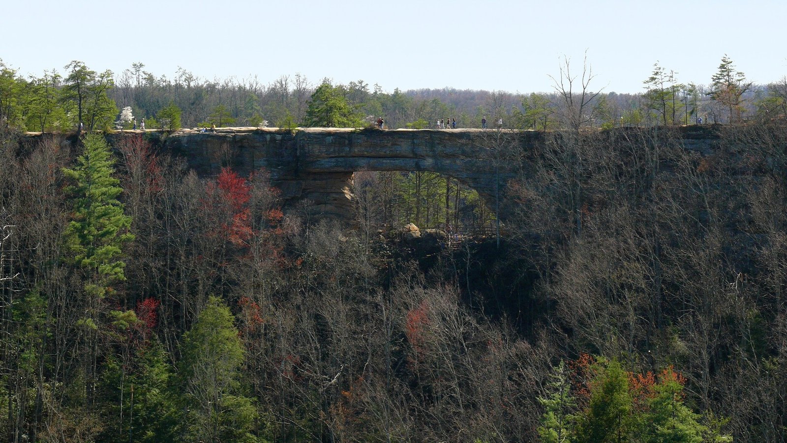
The sandstone arch at Natural Bridge rises 65 feet above the forest floor and provides a sheltered viewpoint for watching storms that build over the Daniel Boone National Forest. The surrounding ridges create a natural amphitheater where thunder reverberates between sandstone walls with a depth and resonance that enhances the experience.
Spring storms roll across the forest canopy below the arch, and lightning illuminates the Red River Gorge in brief, spectacular flashes that reveal the entire landscape for a fraction of a second before plunging it back into darkness. The experience of watching a storm from inside a natural rock arch adds a geological dimension that buildings cannot replicate.
The skylift to the top of the ridge operates during fair weather, but the hiking trail provides access when storms are approaching. Experienced visitors time their climb to arrive at the arch as the first rumbles echo through the gorge, positioning themselves under the natural shelter just as the sky opens up.
Atchafalaya Basin, Louisiana
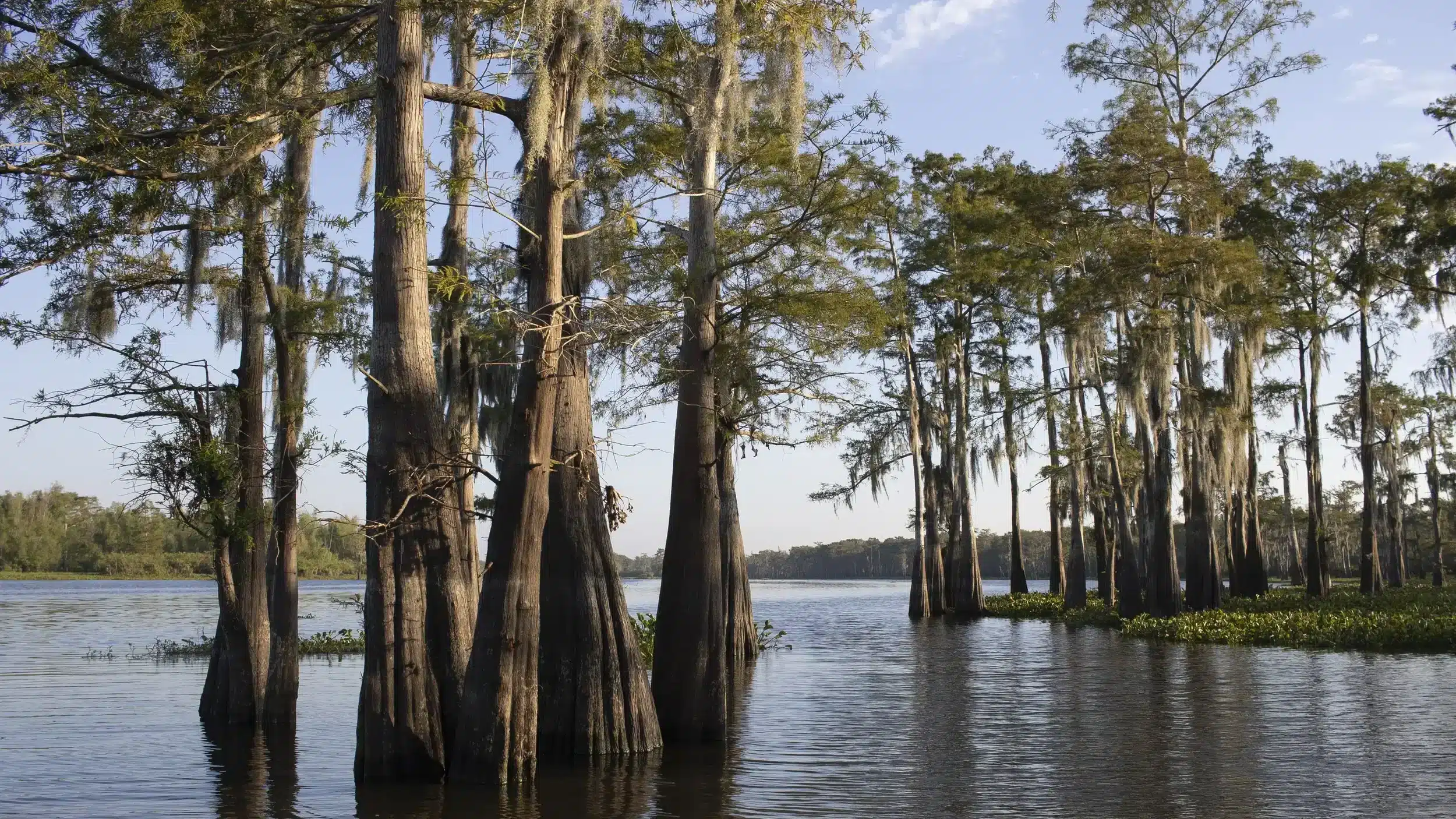
The largest river swamp in America creates its own weather. Moisture rising from the warm water fuels thunderstorm development that can seem to appear from nothing, building towers over the cypress canopy that reach full maturity in minutes. The basin stretches across south-central Louisiana, and storms that form over it are fed by an almost unlimited supply of water vapor.
Watching a storm from the elevated bridges and causeways that cross the basin provides a perspective that combines the drama of lightning with the eerie beauty of the swamp below. Spanish moss sways in the outflow wind, egrets scatter as the front approaches, and the water surface reflects every flash in a mirror that stretches to the horizon.
The Henderson Levee road on the east side of the basin provides safe, elevated viewing with the entire swamp spread out below. Summer storms here are frequent, intense, and photogenic in a way that only a landscape of water, cypress, and open sky can produce.
Cadillac Mountain, Maine
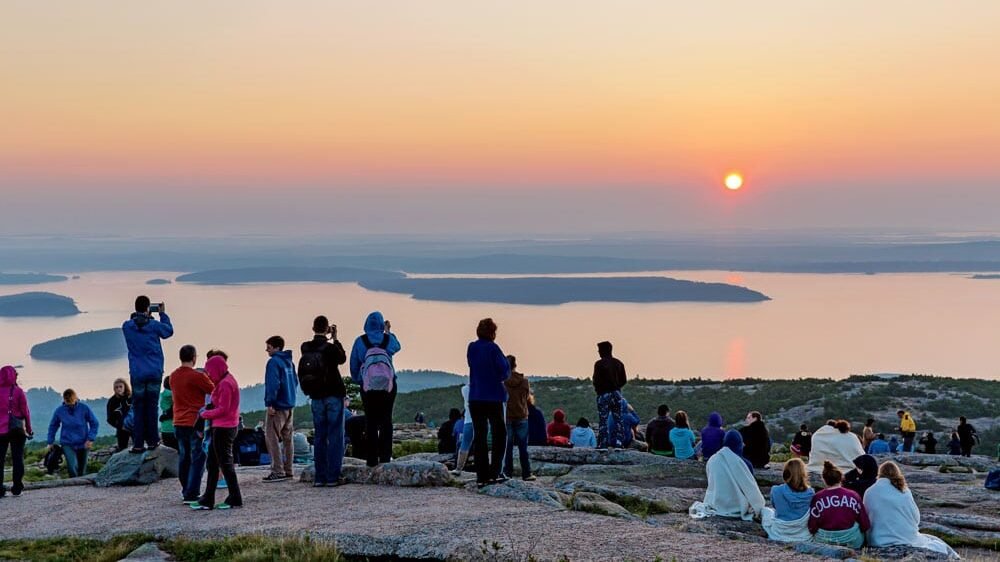
The highest point on the Atlantic coast north of Brazil offers a storm-watching experience that combines ocean and mountain drama. Cadillac Mountain in Acadia National Park rises 1,530 feet directly above the sea, and storms that approach from the west cross the island while you watch from above, with the Atlantic as a backdrop.
Summer thunderstorms that form over the Maine interior move toward the coast and occasionally reach Cadillac’s summit, where the exposed granite creates an environment where you can feel the storm’s energy in the rock beneath your feet. Smart visitors retreat to their cars when lightning is close, but the approach is the real show.
Nor’easters provide a different spectacle entirely. Watching a major coastal storm from Cadillac Mountain, with waves battering the shore 1,500 feet below and wind screaming across the summit, is a raw weather experience that the most dramatic inland locations cannot replicate.
Assateague Island, Maryland
The barrier island off Maryland’s eastern shore provides an unobstructed ocean horizon for watching storms approach from any direction. Summer thunderstorms that form over the Chesapeake Bay cross the Delmarva Peninsula and arrive at the coast with visible structure and lightning that reflects off the breaking waves.
Wild horses on the island continue grazing during approaching storms, providing a foreground element that photographers find irresistible. The combination of weather drama and wildlife creates images that go viral with regularity during summer months.
The national seashore’s beach access points offer parking areas where you can watch storms from the safety of your vehicle with the ocean on one side and the bay on the other. Assateague is narrow enough that you can sometimes see storms crossing the bay to the west while the eastern sky is still clear, giving you time to prepare for the show that is about to arrive.
Mount Greylock, Massachusetts
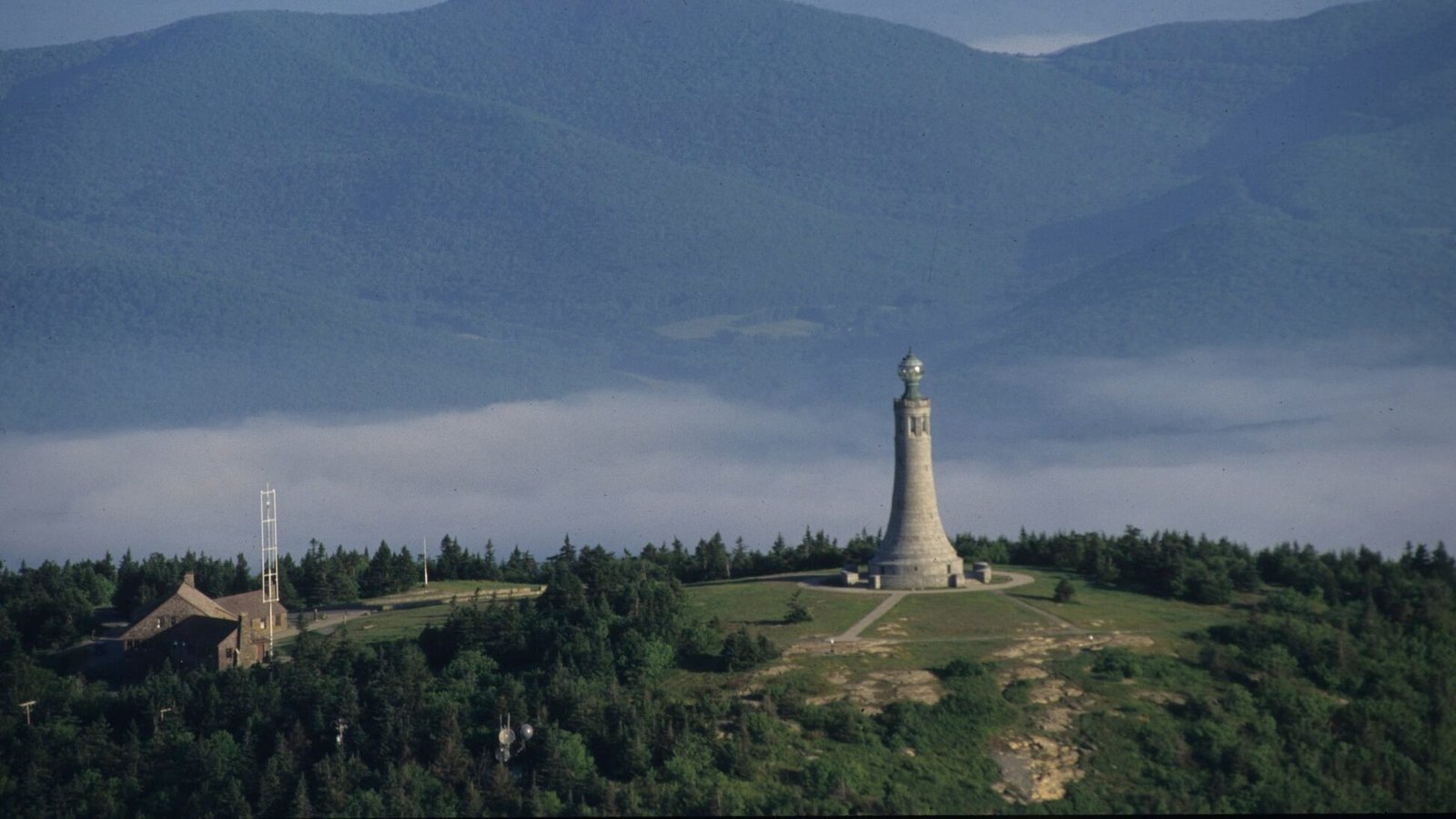
Massachusetts’ highest peak at 3,491 feet provides a summit view that extends across five states on clear days. When thunderstorms build over the Berkshire Hills, the summit tower offers a vantage point where you can watch cells develop and track their movement across the valley below.
The Veterans Memorial Tower at the summit is a stone structure that provides shelter during storms, and watching lightning illuminate the Connecticut River valley from inside the tower creates a framed view that feels almost theatrical. The stone walls muffle the wind while the windows provide panoramic views of the approaching weather.
Late afternoon storms during summer are the prime viewing window. The western approach is the most common storm track, and the tower faces that direction with windows that frame the entire horizon. Mount Greylock turns a New England thunderstorm into an experience that feels far more dramatic than the state’s modest geography might suggest.
Sleeping Bear Dunes, Michigan
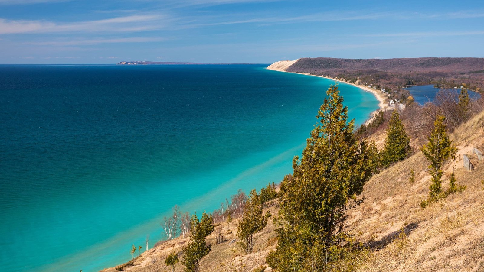
The massive sand dunes overlooking Lake Michigan provide an elevated beach vantage for watching storms cross the lake. The Empire Bluff Trail ends at a viewpoint 400 feet above the water, where you can see storms approaching from Wisconsin 30 miles or more away, giving you extended viewing time before they arrive.
Lake-effect weather creates unique storm patterns over Michigan, and the convergence zones where different air masses meet over the lake produce rapid thunderstorm development that can seem to materialize from clear sky. Watching this from the dune bluffs is a lesson in atmospheric physics delivered through pure visual spectacle.
Summer squall lines that cross the lake arrive at the Michigan shore with dramatic shelf clouds, strong outflow winds that kick up sand on the beach below, and lightning that connects lake surface to cloud in forks visible from the bluff-top. Sleeping Bear Dunes turns every lake storm into a wide-screen experience with a natural elevation that most beaches cannot offer.
Split Rock Lighthouse, Minnesota
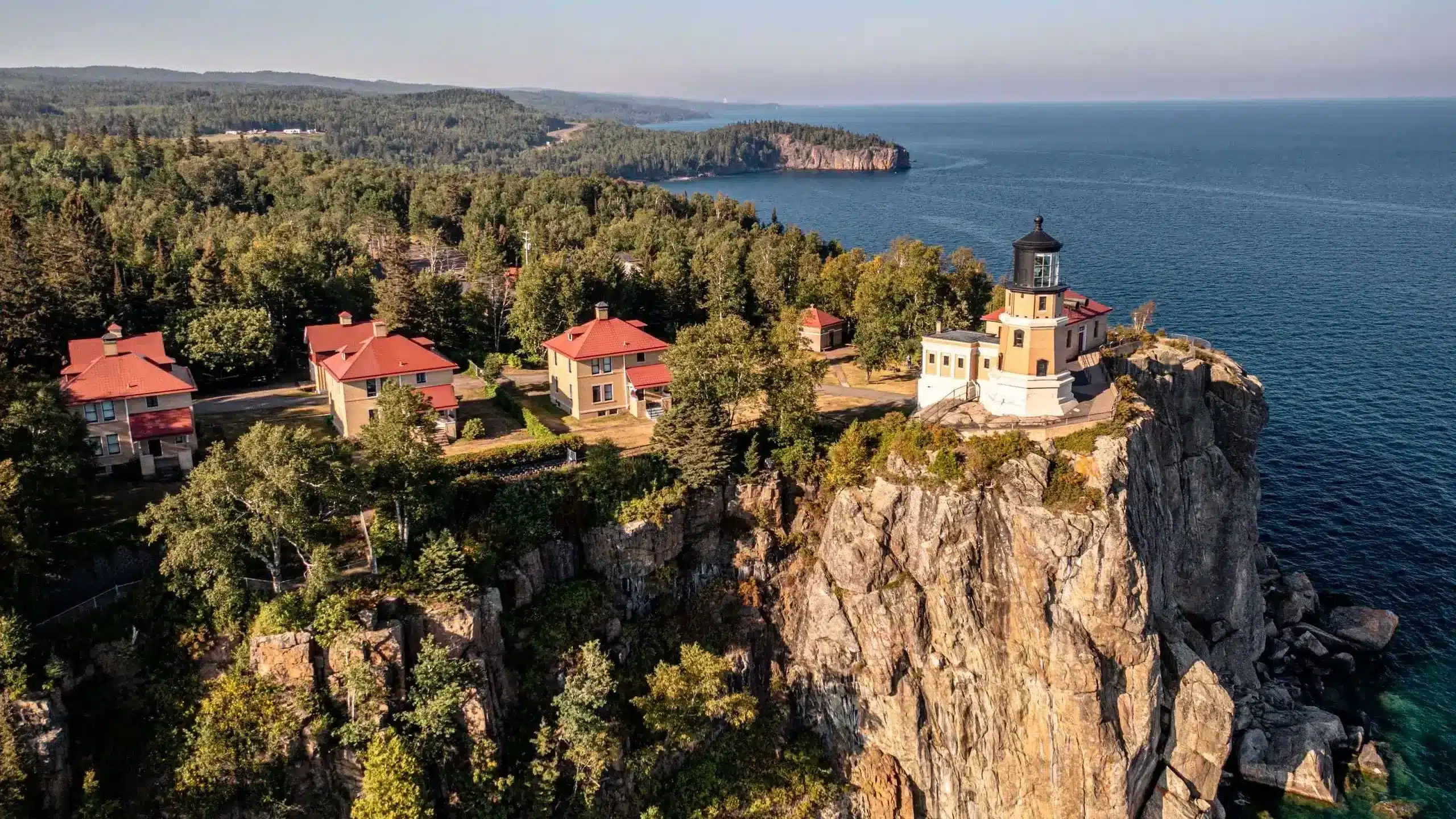
The historic lighthouse perched on a cliff 130 feet above Lake Superior has been watching storms arrive since 1910, and the view has not changed. Storms that cross the lake from the northwest arrive at the North Shore with a violence that justified building the lighthouse in the first place, after a 1905 storm sank or damaged 29 ships.
Summer thunderstorms over Lake Superior are different from inland storms. The cold water creates temperature contrasts that make the storms hit harder when they reach shore, and the open lake fetch allows wind to build without obstruction. Watching from the lighthouse grounds, you can see the leading edge of the storm cross the water as a visible line of turbulence that races toward you.
The lighthouse grounds provide a safe, elevated viewing area where you can watch storms approach and hit the cliff face with spray and wind. The combination of historic lighthouse, towering cliffs, and raw Lake Superior weather makes Split Rock one of the most dramatic storm-watching locations in the Midwest.
Natchez Trace Parkway Overlook, Mississippi
The Natchez Trace follows an ancient travel route through the Mississippi hills, and the overlooks along the parkway provide elevated views of the river valley and surrounding forest. When spring storms push through the Deep South, the overlooks near milepost 302 give you a wide view of approaching weather that builds over the Mississippi Delta and moves east.
The heavy, moisture-laden air of Mississippi produces storms that are visually dramatic even when they are not severe. Cloud bases hang low, rain curtains are thick and visible from miles away, and lightning in humid air produces brighter, more persistent flashes than dry-air storms.
Evening storms along the Trace are the best. The setting sun illuminates the western side of approaching storms while the leading edge goes dark, creating a contrast that makes the storm structure pop against the sky. Pull off at any overlook, roll down the windows, and listen to the thunder roll across the Mississippi bottomland.
Table Rock Lake, Missouri
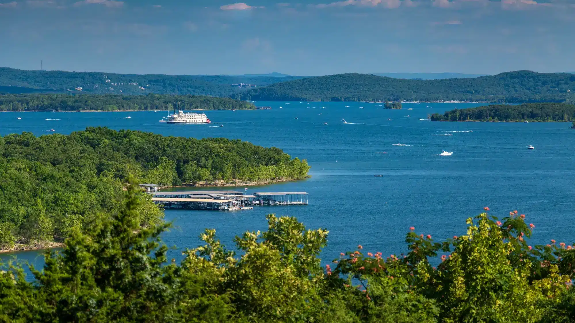
The Ozark Plateau produces severe weather that storm chasers track across Missouri every spring, and Table Rock Lake in the southwestern corner of the state provides a water-enhanced vantage point. The lake stretches across the hills with arms reaching into valleys that funnel storms toward the water.
Watching a supercell approach Table Rock Lake from the dam observation area gives you a panoramic view of the storm’s entire structure reflected in the lake surface below. The combination of vertical storm development above and mirror reflection below doubles the visual impact.
Spring and early summer produce the most dramatic storms, when Gulf moisture collides with cold fronts along the Ozark ridgeline. The terrain here is hilly enough to see storm structure clearly from elevated positions but open enough along the lake to provide wide horizon views. Table Rock Lake brings together water, hills, and big weather in a combination that makes Missouri storm watching genuinely world class.
Glacier National Park (Logan Pass), Montana
The Continental Divide at Logan Pass creates a collision point for weather systems that produce storms of startling beauty and intensity. Pacific moisture hits the mountain wall and rises rapidly, building thunderstorms that develop from clear sky to full maturity in under an hour. The scale of the mountains makes these storms look both enormous and close.
The Going-to-the-Sun Road provides pullouts where you can watch storms build over the peaks while remaining at a safe distance. Lightning strikes the mountain ridges with enough frequency during summer to start wildfires, and the sound of thunder in the mountain bowl creates echoes that layer on top of each other.
The visitor center at Logan Pass provides shelter and a viewing area at 6,646 feet, where you are close enough to the storm development to feel the temperature drop and smell the rain before it arrives. Glacier’s storms are mountain storms, fast-developing, unpredictable, and framed by scenery that makes every flash of lightning look like it was staged for a photograph.
Chimney Rock, Nebraska
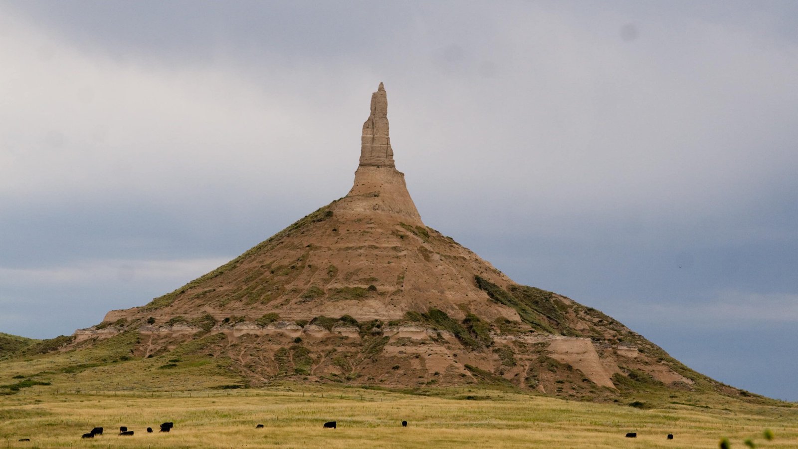
Rising 300 feet above the North Platte River valley, Chimney Rock has been a landmark for travelers since the Oregon Trail days. It also happens to sit in one of the most active severe weather corridors in the Great Plains. Supercell thunderstorms that form over the Nebraska panhandle cross this area during late spring and summer with visible rotation and spectacular lightning.
The open terrain and the landmark spire in the foreground create a storm-watching composition that is hard to beat. Photographers have captured some of the most iconic storm images in American meteorology with Chimney Rock silhouetted against approaching supercells.
The visitor center provides a safe indoor viewing area with windows facing west toward the most common storm approach. Watching a wall cloud pass over Chimney Rock while lightning illuminates the bluffs along the river is an experience that connects you to every pioneer who watched the same sky from the same spot 170 years ago, except they were probably more scared and less impressed.
Valley of Fire State Park, Nevada

The red sandstone formations of Valley of Fire glow in a way that makes every storm look like a special effects sequence. Summer monsoon thunderstorms approach from the south, and the contrast between the dark storm base and the bright red rock below creates a color palette that looks intentionally designed.
Lightning against the red formations produces photographs that do not need editing. The dry desert air makes lightning visible from extraordinary distances, and the open terrain provides sightlines that stretch 50 miles or more. Flash flood warnings during monsoon season remind you that the beauty comes with real power behind it.
The White Domes area provides an elevated vantage with formations that frame the southern horizon where most storms approach. Late afternoon is prime time, when the low sun angle lights the rocks from the side while the storm fills the sky above. Valley of Fire turns every thunderstorm into a production that the best theaters in Las Vegas could not compete with.
Mount Washington (summit area), New Hampshire
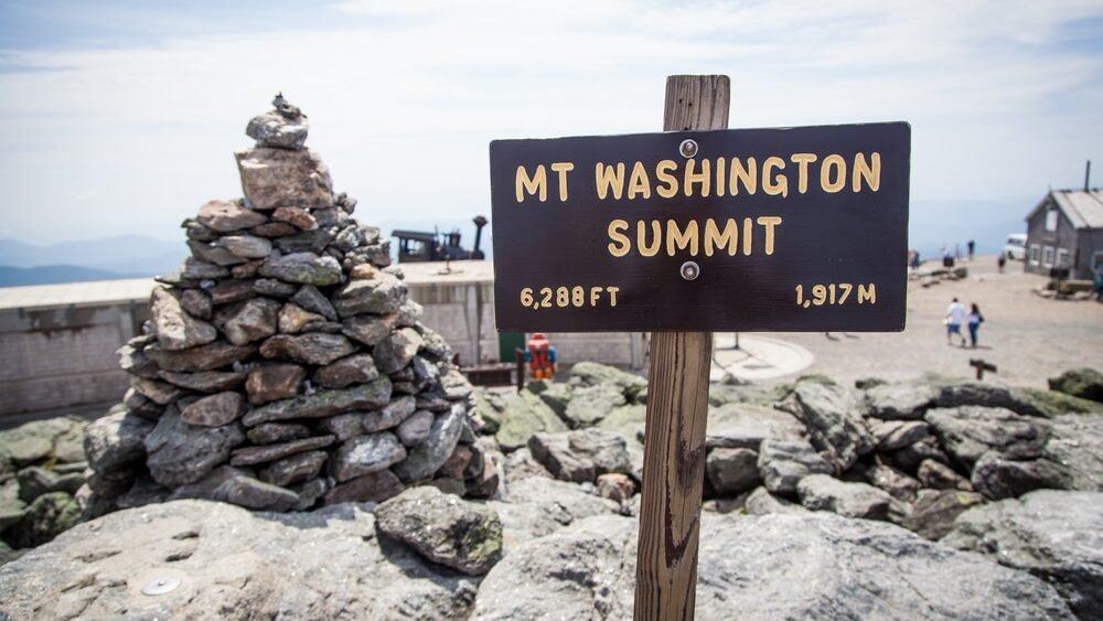
The mountain with the worst weather in the eastern United States produces storms that are more about wind and raw power than visual drama. But watching a thunderstorm approach Mount Washington from the lower slopes or the auto road provides a perspective on atmospheric violence that gentler mountains cannot offer.
Storms hit the Presidential Range with wind speeds that accelerate over the ridgeline, and the temperature drops that accompany frontal passages can be measured in tens of degrees within minutes. The observatory staff at the summit have documented weather that rivals polar expeditions, and watching a storm arrive at that elevation feels more like witnessing an atmospheric assault than a weather event.
The safe viewing zones are lower on the mountain, where the auto road provides pullouts with views up toward the summit. Watching clouds pour over the ridge and accelerate down the eastern slope while lightning flashes above the treeline is a reminder that New Hampshire’s mountains produce weather that demands respect.
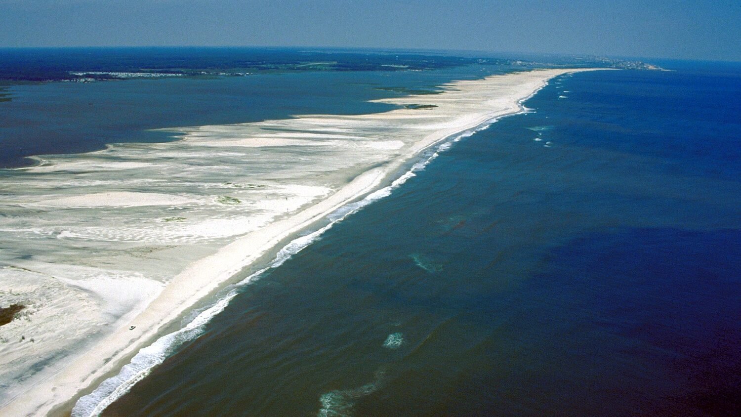
Island Beach State Park, New Jersey
The undeveloped barrier island on the central Jersey Shore provides an oceanfront storm-watching experience without the boardwalks and buildings that obstruct views at most beach towns. The park stretches for 10 miles with nothing but dunes, beach grass, and open water, creating a natural viewing platform for storms approaching from any direction.
Summer thunderstorms that form over the New Jersey Pine Barrens move east toward the coast and arrive at Island Beach with visible structure that is easy to read against the ocean horizon. Lightning over the water reflects off the surf, and the sound of thunder mixes with breaking waves in a combination that is unique to coastal storm watching.
The park’s southern tip, where Barnegat Inlet meets the ocean, provides 270-degree water views that make approaching storms visible from miles away. Watching a storm cross the inlet while fishing boats race for harbor adds human drama to the atmospheric display.
Sandia Peak, New Mexico
The Sandia Mountains rise 5,000 feet above Albuquerque, and the peak at 10,678 feet provides a storm-watching platform that overlooks the entire Rio Grande valley. Monsoon thunderstorms build over the mountains to the south and west, crossing the valley in a parade of cells that can last from early afternoon until dark.
The Sandia Peak Tramway carries you to the summit, where a restaurant and observation deck face west over the valley. Watching storms cross the mesa landscape below while lightning strikes the volcanic formations on the horizon is a uniquely New Mexican experience that combines desert beauty with atmospheric power.
The monsoon season from July through September produces afternoon storms with clockwork reliability. The dry air below the cloud base makes the rain shafts visible as distinct columns, and virga that evaporates before reaching the ground creates ghostly curtains that drift across the valley. Sandia Peak turns the New Mexico monsoon into a nightly show that residents of Albuquerque never tire of watching.
Whiteface Mountain, New York
The fifth-highest peak in New York rises to 4,867 feet in the Adirondacks, and the summit road provides access to a viewing platform where summer thunderstorms that build over the St. Lawrence valley become visible as they approach from the northwest. The castle-like summit structure provides shelter while windows offer views in every direction.
Storms in the Adirondacks develop rapidly over the lake-dotted terrain, and the elevated position at Whiteface lets you watch cells build from fair-weather cumulus to full thunderstorms in real time. The process takes about 30 minutes on an active day, and seeing it from above the surrounding terrain provides a perspective that ground-level observers cannot access.
Lake Placid sits below to the south, and watching a storm cross the lake while lightning reflects off the water from your mountain perch creates a layered visual experience: forest, lake, storm, sky. Whiteface earns its place as the best storm-watching location in a state that has a surprising amount of dramatic weather in its northern mountains.
Jockey’s Ridge, North Carolina
The tallest living sand dune on the Atlantic coast rises 80 feet above the Outer Banks at Nags Head, providing an unobstructed view of both the ocean to the east and Roanoke Sound to the west. Summer thunderstorms approach from the mainland side, and watching them cross the sound toward the dune creates an approaching-wall-of-weather effect that is dramatic and slightly unnerving.
The dune provides elevation in a landscape that is otherwise completely flat, and the 360-degree view means you can track storms from their initial development over the piedmont to their arrival at the coast. Lightning over the sound reflects off the water, and the wind that precedes the storm front whips sand off the dune crest in visible streamers.
Retreat to your vehicle before the storm arrives, because the dune is fully exposed and lightning on an open sand hill is not a survival strategy. But the approach, watched from the dune summit, is one of the most visually complete storm-watching experiences on the East Coast.
Theodore Roosevelt National Park, North Dakota

The badlands of western North Dakota provide a landscape so alien that every thunderstorm looks like it belongs in a movie. The painted buttes, eroded spires, and banded sediment layers create a foreground that makes lightning photography almost unfairly dramatic. Summer storms cross the park from the west, and the open terrain provides sightlines that extend to the curve of the earth.
The Painted Canyon Overlook on I-94 provides an accessible viewpoint where you can watch storms approach across the Little Missouri River badlands. The layered terrain creates visual depth that makes the storm’s movement obvious, and the buttes catch the last light of the setting sun while the storm behind them goes dark.
North Dakota’s storms are serious weather. Supercells, tornadoes, and hail all occur in this region during June and July. Watching from a safe, elevated position with a vehicle nearby is the smart approach. The badlands add a prehistoric quality to storm watching that makes you feel like you are witnessing something that has been happening in this landscape for millions of years, because you are.
Hocking Hills, Ohio
The sandstone gorges and waterfalls of Hocking Hills create a natural sound chamber that amplifies thunder into something you feel in your chest. Ash Cave, the largest recess cave in Ohio, provides a natural shelter 700 feet long and 90 feet deep where you can watch rain pour over the lip of the overhang while staying completely dry.
The acoustics inside the cave transform thunder from a distant rumble into a resonant boom that echoes off the sandstone walls. Lightning flashes illuminate the waterfall that cascades over the cave entrance, creating a strobe effect that makes the falling water appear to freeze in midair.
Hocking Hills is not Great Plains storm watching. The storms here are smaller and less severe. But the experience of sitting inside a cave while a thunderstorm rages outside, with amplified sound and a waterfall light show at the entrance, is a storm-watching experience unlike anything the open prairie can offer.
Wichita Mountains, Oklahoma

The ancient granite peaks of the Wichita Mountains rise abruptly from the southwest Oklahoma plains, creating a vantage point that overlooks some of the most prolific severe weather terrain in the world. Mount Scott, at 2,464 feet, provides a summit road and parking area with 360-degree views that storm chasers consider one of the best positioning tools in tornado alley.
From the summit, you can watch supercells develop over the Red River valley to the south and track their movement northeast across the open terrain. The granite boulders provide a foreground that anchors photographs, and the bison herds in the wildlife refuge below add an element that connects the scene to the original Great Plains landscape.
Storm season in Oklahoma runs from April through June, and the Wichita Mountains sit in the convergence zone where dryline storms form with the most intense structure. Watching a supercell from Mount Scott, with visible rotation and a clear base, is the storm-watching experience that every weather enthusiast puts on their life list.
Crater Lake, Oregon
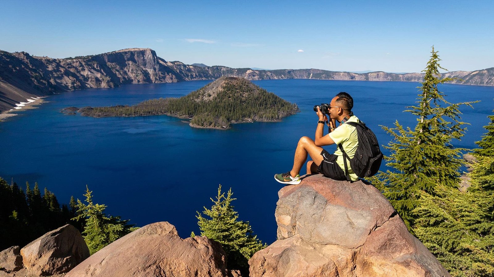
The deepest lake in America sits inside a volcanic caldera at 6,178 feet, and summer thunderstorms that build over the Cascades create a visual spectacle that combines geological and atmospheric drama. Lightning striking the rim or the water surface of the impossibly blue lake produces images that look digitally enhanced but are completely real.
The Rim Drive provides multiple viewpoints where you can watch storms approach from any direction, and the elevation ensures that you are close to the storm base as it passes. Rain on the lake surface creates visible patterns that move across the water, and the caldera walls amplify thunder in a natural echo chamber.
Crater Lake’s remoteness means fewer people witness its storms compared to more accessible locations, which is part of the appeal. A thunderstorm over Crater Lake feels like a private showing of atmospheric power, performed against a backdrop of volcanic history that stretches back 7,700 years.
Hawk Mountain Sanctuary, Pennsylvania
The Appalachian ridge at Hawk Mountain rises 1,500 feet above the surrounding farmland, providing a vantage point that bird watchers have used for decades. The same characteristics that make it ideal for watching raptors ride thermals also make it excellent for watching thunderstorms develop along the ridge.
Summer storms that form over the Susquehanna valley move east and hit the ridge with updrafts enhanced by the terrain. Watching storms build against the Appalachian ridgeline from the North Lookout provides a geological perspective on weather development, where you can see how the terrain forces air upward and triggers storm growth.
The rocky outcrop at the lookout provides a natural seating area (retreat to shelter when lightning is close), and the view extends across multiple ridges to the east, where you can watch storms move through the parallel valleys like waves moving through channels. Hawk Mountain turns Pennsylvania storm watching into a ridgetop experience with Appalachian character.
Beavertail State Park, Rhode Island
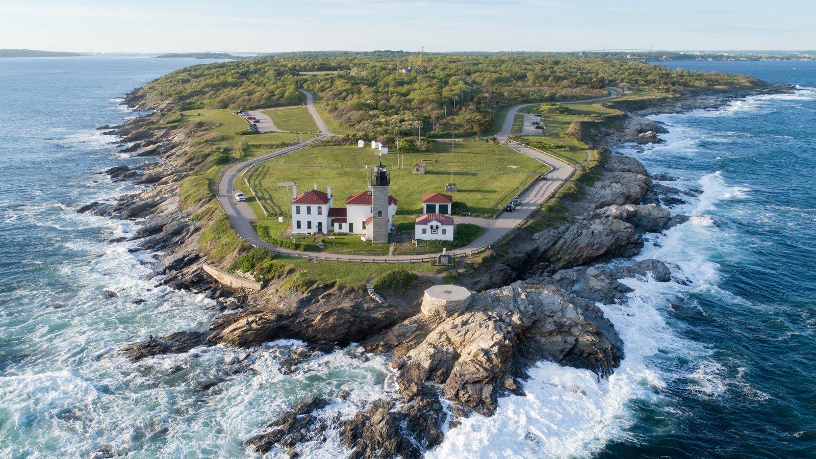
The southernmost point of Conanicut Island juts into Narragansett Bay, providing an ocean-facing vantage where you can watch storms approach from the mainland while waves crash on the rocks below. The lighthouse at Beavertail has stood since 1749, watching storms arrive from the west across the bay with a perspective that combines maritime and atmospheric drama.
Summer thunderstorms that build over Connecticut cross the bay and arrive at Beavertail with visible structure that stands out against the ocean horizon. The flat water of the bay reflects lightning from below while the cloud-to-ground strikes illuminate the rocky coastline.
The park’s stone walls and picnic shelters provide minimal cover, so watching from your vehicle is the smart choice during active lightning. But the approach phase, when you can see the storm crossing the bay while the sky above Beavertail is still clear, is some of the best storm watching in the smallest state.
Caesars Head State Park, South Carolina
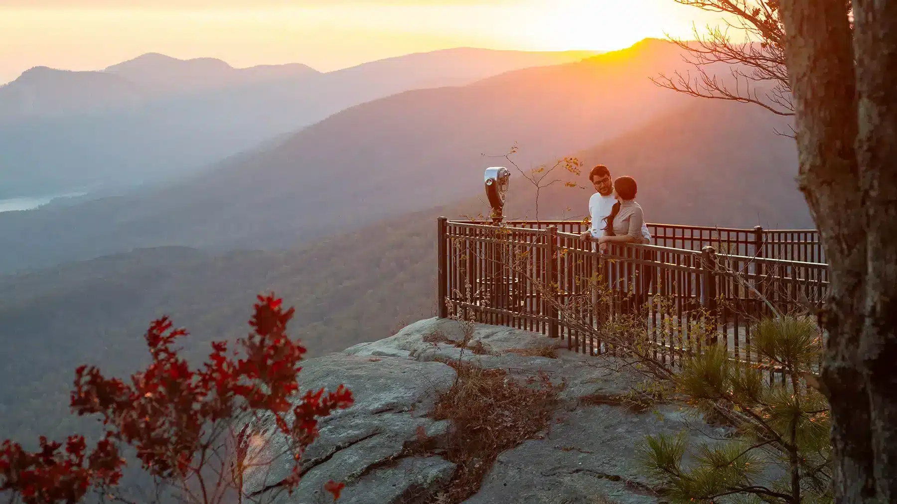
The Blue Ridge escarpment drops 2,000 feet from the mountain plateau to the piedmont below, and Caesars Head sits right on the edge. When afternoon thunderstorms build over the South Carolina lowlands, you can stand at the overlook and watch them develop below your feet, with the storm tops rising toward your elevation as they mature.
The view from Caesars Head stretches 30 miles on clear days, and approaching storms are visible from the moment they begin building until they hit the escarpment with updrafts boosted by the terrain. Hawks and vultures ride the same updrafts ahead of the storms, circling at eye level in a display that is equal parts weather and wildlife.
The escarpment creates its own weather effects, with orographic lift enhancing storm development and downslope winds creating turbulence that makes the experience visceral. Caesars Head turns every approaching thunderstorm into a natural IMAX experience viewed from a cliff-edge seat.
Badlands National Park, South Dakota

The eroded landscape of the Badlands creates a foreground for storm watching that rivals anything in the American West. Painted spires, layered buttes, and deep canyons catch storm light in ways that change the landscape’s appearance minute by minute as clouds build and shift above.
The Ben Reifel Visitor Center and the Pinnacles Overlook both provide viewpoints where you can watch storms cross the White River valley from the west. Lightning against the badlands formations creates photographs that look like magazine covers, and the thunder echoes off the canyon walls with a resonance that the flat surrounding prairie cannot produce.
South Dakota storms mean business. The same supercells that produce tornadoes in nearby counties cross the Badlands with hail, heavy rain, and spectacular lightning. Watching from the shelter of a vehicle at an overlook, with the alien terrain lit by flashes, is an experience that combines primal weather drama with a landscape that already looks like another world.
Clingmans Dome, Tennessee
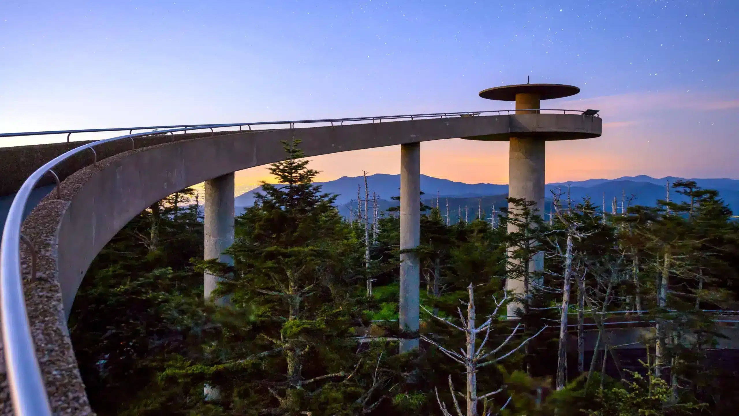
The highest point in the Great Smoky Mountains rises to 6,643 feet, and the observation tower at the summit provides a 360-degree view that extends into seven states on clear days. When thunderstorms build over the mountains during summer, the tower puts you at cloud-base level, where the mechanics of storm development are visible in a way that lower elevations cannot reveal.
Storms in the Smokies form rapidly as warm, humid air from the valleys rises along the mountain slopes. You can watch cumulus towers explode upward from the valleys below, transitioning from puffy white clouds to dark, lightning-producing storms in under thirty minutes. The speed of development here is remarkable and visible in real time from the summit.
The access road to Clingmans Dome closes in winter, but summer afternoon storms are frequent enough that most visits during June through August will include weather worth watching. The combination of elevation, humidity, and terrain makes the Smokies one of the most active storm-producing regions in the eastern United States, and the dome puts you above it all.
Palo Duro Canyon, Texas
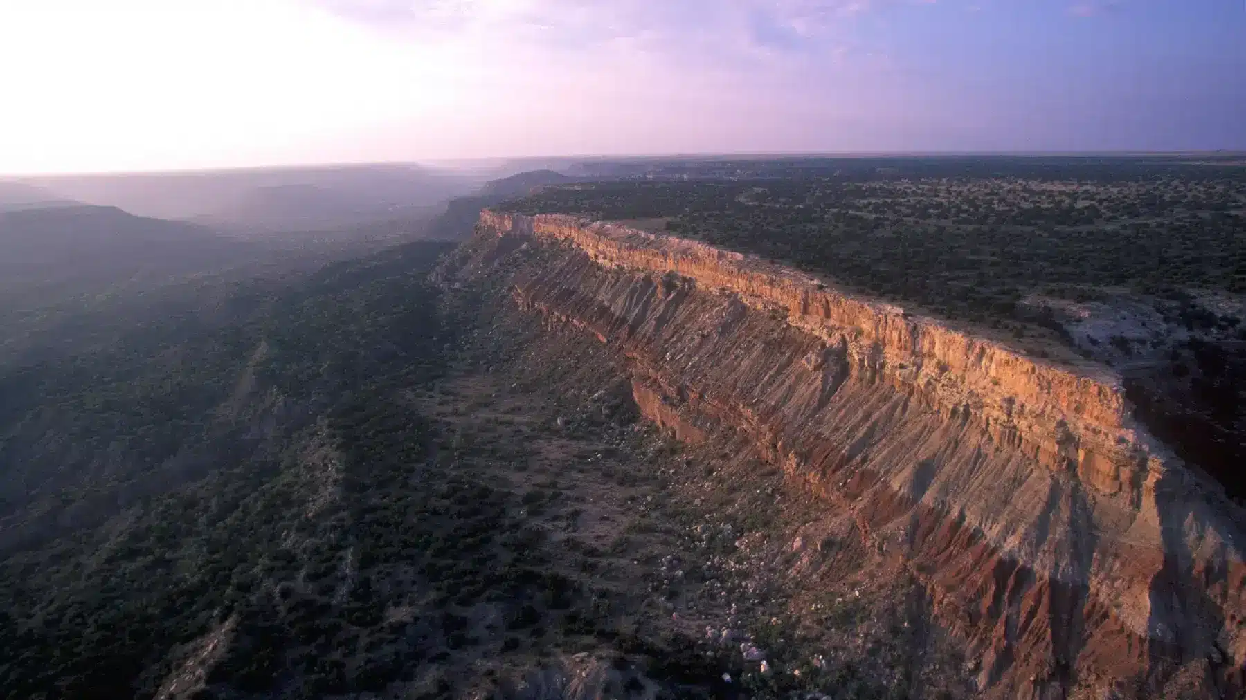
The second-largest canyon in the United States carves through the Texas Panhandle and creates a natural amphitheater for watching the severe storms that cross the Great Plains every spring. The rim of Palo Duro sits at about 3,500 feet, and the canyon drops 800 feet below, providing a vantage point where you can watch storms approach across the flat plains above while the canyon walls frame the view below.
Spring supercells that cross the Panhandle are among the most impressive storms on Earth, with rotating updrafts, massive hail cores, and lightning frequencies that light up the sky continuously for hours. The canyon provides shelter from the most extreme outflow winds, while the rim offers unobstructed views of the approaching weather.
The Lighthouse Trail and the rim drive both provide positions where the canyon and the storm are visible simultaneously. Watching a supercell cross the flat horizon above Palo Duro while the setting sun paints the canyon walls in orange and red is a Texas-scale experience that combines geological and atmospheric drama on a canvas that only the Great Plains can provide.
Dead Horse Point, Utah
The overlook at Dead Horse Point State Park sits 2,000 feet above the Colorado River and provides views that stretch from the La Sal Mountains to the canyonlands below. Summer monsoon storms build over the mountains and cross the canyon country with lightning that illuminates 2,000-foot-deep gorges in single, dramatic flashes.
The dry desert air makes lightning visible from 100 miles away, and the open terrain at the overlook provides a nearly 360-degree view of storm development. You can track multiple cells simultaneously as they move across the red rock landscape, each one producing its own curtain of virga and rain.
Monsoon storms over canyon country are brief, intense, and visually spectacular. The combination of red rock, blue-white lightning, and the Colorado River curving far below creates a storm-watching experience that combines vertical geological drama with horizontal atmospheric drama in a way that is uniquely Utah.
Mount Mansfield Summit (via Toll Road), Vermont
Vermont’s highest peak offers a summit road that provides access to views extending across the Green Mountains and into the Champlain Valley. Summer thunderstorms that build over the Adirondacks cross Lake Champlain and hit the Green Mountains with energy enhanced by the lake’s warm water surface.
Watching storms approach from the summit toll road provides a perspective where you can see the storm cross the lake, hit the foothills, and intensify as it climbs the mountain slopes. The process is visible in a way that valley-floor observers never see, with cloud bases lowering and precipitation intensifying as the terrain forces the air upward.
The summit is fully exposed and not a safe place during active lightning. The toll road’s lower pullouts provide safer viewing positions with excellent western exposure. Vermont’s storms are modest by national standards, but the mountain setting and lake-enhanced dynamics make them more visually interesting than their size suggests.
Shenandoah National Park (Skyline Drive), Virginia
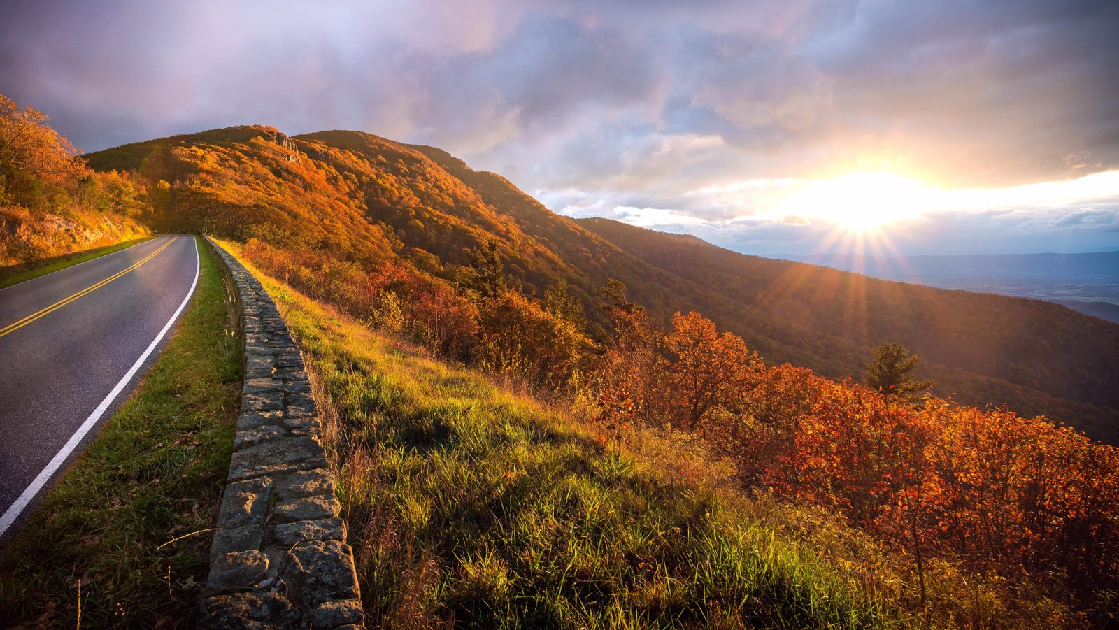
Skyline Drive runs 105 miles along the crest of the Blue Ridge Mountains, providing over 75 overlooks where you can watch storms develop in the Shenandoah Valley below. The elevation along the drive ranges from 2,000 to 4,000 feet, putting you at the level where storm bases form and develop.
Summer afternoon storms build over the valley floor as heat and humidity combine, and from the overlooks, you can watch the entire life cycle of a thunderstorm from initial cumulus development to maturity and dissipation. The valley acts as a natural container, and storms that form within it are visible from above in a way that feels like watching a science demonstration.
Thornton Gap and Big Meadows are two of the best positions for western exposure, where approaching storms cross the valley with visible rain shafts and lightning that illuminates the entire landscape. The stone walls at the overlooks provide a foreground element, and the layered ridges extending into the distance create depth that makes every storm look more dramatic than it would from flat ground.
Cape Disappointment, Washington
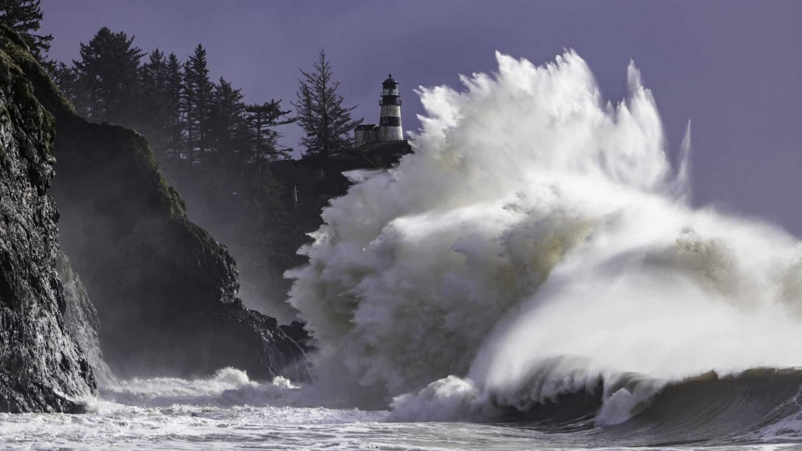
Named for its weather by frustrated explorers, Cape Disappointment sits where the Columbia River meets the Pacific Ocean in one of the most violent wave environments in North America. Winter storms that cross the Pacific arrive here with full force, producing waves that break over the lighthouse and wind that bends old-growth trees permanently landward.
The Lewis and Clark Interpretive Center sits on the headland above the cape, providing a viewing area where you can watch Pacific storms arrive with a power that Atlantic storms rarely match. The scale of the waves, the force of the wind, and the darkness of the approaching clouds make Cape Disappointment storm watching a genuinely intense experience.
This is not a summer thunderstorm viewing spot. Cape Disappointment is for people who want to see the raw power of Pacific winter weather hit the coast with nothing between the storm and the continent. The interpretive center provides shelter while walls of water explode against the cliffs below. It is dramatic, humbling, and unlike anything the interior of the country can produce.
Seneca Rocks, West Virginia
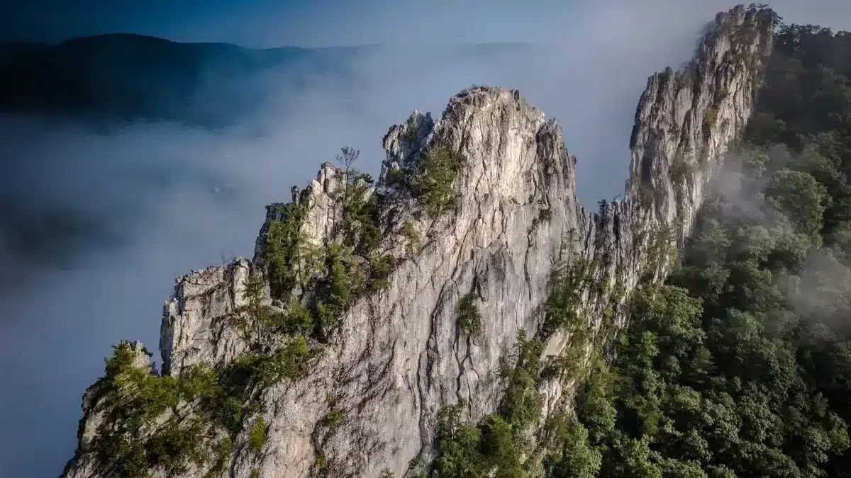
The dramatic fin of Tuscarora sandstone rises 900 feet above the North Fork River valley, and storms that build over the Allegheny Mountains approach the rocks with a visual drama enhanced by the vertical terrain. Lightning striking near the rock face illuminates the layered sandstone in a flash that makes the formation look like it is on fire for a fraction of a second.
The observation area at the base of the rocks provides a sheltered viewpoint where you can watch storms develop along the mountain ridgeline and descend into the valley. The narrow valley amplifies thunder into deep, resonant booms that roll between the mountains for ten seconds or more after each flash.
Rock climbers on the face evacuate when storms approach, creating a visible scramble down the routes that adds human drama to the atmospheric display. Seneca Rocks turns every thunderstorm into a geological event, where the weather interacts with 440-million-year-old stone in a collision that has been happening since long before anyone was around to watch.
Devil’s Lake State Park, Wisconsin
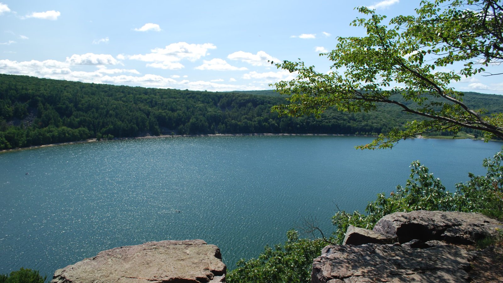
The quartzite bluffs that ring Devil’s Lake rise 500 feet above the water, creating a natural bowl that traps and amplifies thunderstorm energy. Storms that form over the Wisconsin River valley descend into the Devil’s Lake basin with visible intensity, and the bluffs channel wind and sound in ways that make even moderate storms feel powerful.
The South Shore bluff trail provides an elevated viewpoint where you can watch storms cross the lake from the north, with the dark water reflecting lightning and the bluffs funneling the wind into gusts that whip spray off the lake surface. The enclosed geography creates a microclimate where storms behave differently than they do on the open terrain nearby.
Summer evening storms are the best. The bluffs catch the last light while the storm behind them goes dark, and the lake surface acts as a mirror that doubles every lightning flash. Devil’s Lake is a geological feature that makes weather more interesting, amplifying storms that might pass unnoticed in flat terrain into events that the surrounding campgrounds remember and discuss for days.
Grand Teton National Park (Oxbow Bend), Wyoming
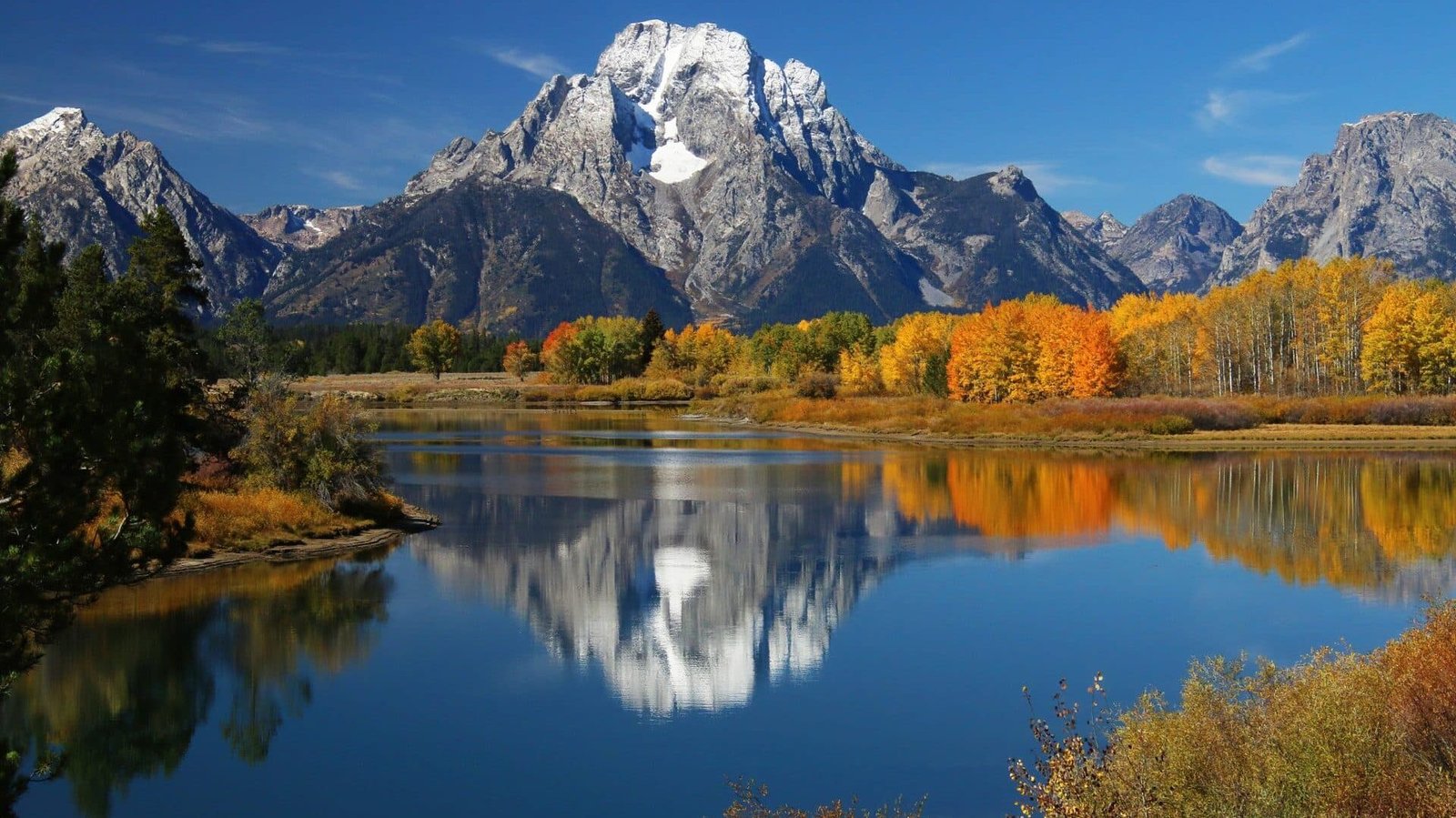
Oxbow Bend on the Snake River provides one of the most photographed mountain views in America, and when thunderstorms build over the Teton Range, the view becomes one of the most dramatic storm-watching locations on Earth. The still water reflects the mountains and the storm simultaneously, creating a mirror image that doubles the visual impact of every lightning flash and cloud formation.
Summer afternoon storms build rapidly over the Tetons, triggered by solar heating of the steep mountain slopes. You can watch cumulus towers rise from behind the peaks and grow into full thunderstorms in thirty minutes, all reflected in the calm water of the bend. The speed and proximity of the development makes the process feel personal and immediate.
The pullout at Oxbow Bend is accessible from the main park road and provides a safe viewing position set back from the water. Watching a storm cross the Grand Teton while moose feed in the shallows and lightning illuminates the glacier-carved peaks is a storm-watching experience that combines every element of the American West into a single, unforgettable frame.