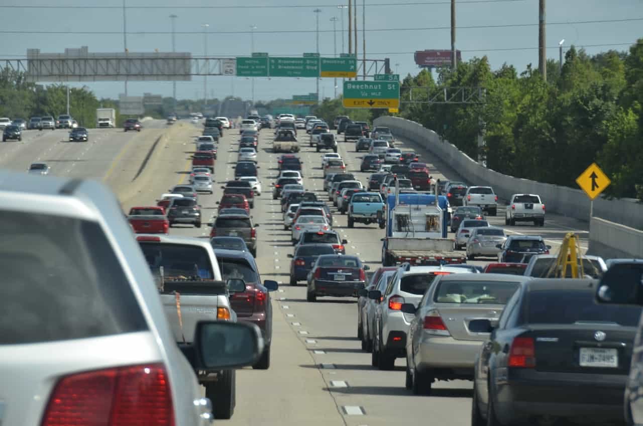
Traffic and weather are a bad combination in ways that go well beyond the obvious. Most drivers know that snow slows things down and that heavy rain makes the highway feel more treacherous than it should. What is less appreciated is the scale of the problem, the precise mechanics behind it, and the uneven way it plays out across the country depending on geography, climate, and the nature of the road network underneath.
The Federal Highway Administration estimates that roughly 23 percent of all non-recurring traffic delays in the United States are caused by adverse weather. That translates to more than 544 million vehicle-hours of delay every year from fog, snow, and ice alone, and that figure does not include rain. Weather-related crashes account for about 12 percent of all vehicle accidents annually, killing an average of more than 3,800 people per year and injuring another 268,000. The financial toll runs into the tens of billions, with state and local agencies spending over $2.3 billion each year just on snow and ice control operations.
These numbers are worth sitting with, because they make a straightforward point: weather is not a footnote in the story of American traffic. It is one of the central characters.
How Weather Degrades a Road Network
To understand why some storms cause gridlock while others are merely inconvenient, it helps to understand the two separate mechanisms through which weather degrades road performance: capacity reduction and incident generation.
Capacity reduction is the more predictable of the two. When precipitation falls or visibility drops, drivers collectively reduce their speeds, increase following distances, and change lanes less aggressively. These are individually rational responses, but in aggregate they reduce the number of vehicles a given road segment can move per hour, which transportation engineers call throughput capacity. Research published by Iowa State University and synthesized by FHWA found that heavy rain reduces freeway capacity by 10 to 17 percent and speeds by 4 to 7 percent. Heavy snow has a far more dramatic effect: capacity falls by 19 to 27 percent and speeds by up to 40 percent. Low visibility conditions, including dense fog, reduce capacity by roughly 12 percent.
The capacity numbers matter because road networks in congested metropolitan areas are already operating close to their limits during peak hours. A road running at 90 percent of capacity under clear conditions does not have much headroom. Shave 20 percent off that capacity with a snowstorm and you have pushed the system into breakdown, the point where traffic stops flowing predictably and delays cascade backward through the network. A road that was merely busy becomes a parking lot, and it recovers slowly even after weather clears, because the queue built up during the storm takes time to dissipate.
Freeway capacity reduction by condition
Source: FHWA / Iowa State University
Freeway speed reduction by condition
Source: FHWA / Iowa State University
The second mechanism is incident generation. Adverse weather increases the frequency of crashes, breakdowns, and roadway obstructions, each of which creates a new layer of capacity reduction on top of the weather itself. An accident that might take 20 minutes to clear in dry conditions can tie up traffic for an hour in heavy rain because emergency responders also travel more slowly and the scene takes longer to process. The interaction between the two mechanisms is nonlinear: storms do not impose a fixed tax on travel time. They push road networks into a different operating regime, where small disruptions cascade into large ones and the ripple effects persist well beyond the storm itself.
Rain: The Overlooked Threat
It is tempting to think of winter weather as the dominant driver of weather-related traffic problems, because ice and snow are vivid and memorable. But rain causes more total disruption than any other weather condition. Over the five-year period from 2019 to 2023, NHTSA data analyzed by FHWA found that rain or mist was a factor in 77 percent of all weather-related crashes, roughly 574,000 accidents per year. Freezing precipitation accounted for 18 percent, and fog for 4 percent.
Share of weather-related crashes by condition (2019–2023 avg.)
Source: NHTSA FARS via FHWA Road Weather Management Program
The reason rain dominates is simple: it is far more frequent than snow or fog and covers a much larger geographic area. Rain falls in every state, in every season, and at all hours of the day, and it does not deter most drivers the way a snowstorm would. Wet pavement reduces tire-road friction significantly, and the first hour after rain begins is often the most dangerous, as road oils accumulated on dry pavement are lifted to the surface before being washed away. FHWA research notes that even a light rain raises travel time delay by 12 to 20 percent before any accidents occur. Multiply that across millions of vehicle-miles driven in a major metropolitan area on a typical rainy afternoon, and you can see why cities like Houston, Miami, and Atlanta face meaningful weather-driven congestion throughout the year, well outside of winter.
Winter Weather and the Northern Tier
For the states that receive regular snowfall, the congestion calculus is different in kind, not just degree. A winter storm does not merely slow traffic. It can shut down road networks entirely, generate hundreds of accidents over a matter of hours, strand commercial vehicles on interstate highways, and create delays that persist for days. State and local agencies spend an estimated $5 billion annually repairing road infrastructure damaged by snow and ice.
Illinois is a clear example. Chicago ranked as the most congested city in the United States in 2025, with drivers losing an average of 112 hours to traffic delays, according to INRIX data. A significant portion of that total is weather-driven. The city’s geography compounds the problem: with Lake Michigan blocking the eastern side entirely, traffic must move through a concentrated set of north-south and east-west corridors with no practical alternatives. When a winter storm arrives, those corridors are the only options regardless of conditions, and the system has no slack to absorb the load.
New York and the broader Northeast face a structurally similar problem, though the mix of weather threats differs. Winter storms along the I-95 corridor from Philadelphia to Boston produce some of the most severe congestion events in the country. These cities were built with dense, pre-automobile road networks that have limited capacity under the best conditions. A nor’easter that drops a foot of snow on Philadelphia or Boston effectively reduces the road network to a fraction of its normal throughput, and recovery is slow because temperatures stay below freezing for hours or days afterward. By 2025, Philadelphia had climbed to third among the most congested U.S. cities, with drivers losing 101 hours annually, a figure that has been rising.
The Mountain West: Elevation as a Multiplier
Colorado illustrates a category of weather-traffic problem that is distinct from both the Northeast and the Sun Belt. The state saw the largest single-year increase in congestion in the United States in 2024, with drivers losing 44 hours to delays, a 19 percent jump in one year. Denver’s I-25 and I-70 are the focal corridors, and the interaction between commuter traffic and ski season visitors on I-70 creates conditions that do not appear anywhere else in the country.
The issue is elevation change. I-70 west of Denver climbs rapidly into the Rockies, gaining thousands of feet within a few miles of the metro area. At these elevations, winter storms produce snow that accumulates faster than in most of the country, often within hours. Visibility drops quickly, road surfaces become treacherous, and there are no parallel alternatives. When conditions deteriorate beyond a threshold, CDOT closes I-70 entirely. This happens multiple times per season, with backups that can extend 20 miles from the closure point. Unlike commuter traffic, which follows predictable rhythms, ski traffic is driven by weekend and forecast patterns that bunch demand in ways that do not respond to typical congestion management strategies.
The Mid-Atlantic: Where Weather Types Collide
The Washington-Baltimore region, spanning Maryland and Virginia, sits in one of the most meteorologically complex positions in the eastern United States. It is far enough north to receive significant winter precipitation but warm enough that the line between rain, freezing rain, and snow is perpetually uncertain. The mid-Atlantic is prime territory for wintry mix events, and ice storms specifically, that are in many respects more dangerous to road networks than straightforward snowstorms. Ice coats road surfaces that are essentially unnavigable for normal vehicles without specialized tires, and it arrives with less warning than major snow events.
INRIX data places the Washington, D.C. metropolitan area, which includes substantial portions of both Maryland and Virginia, among the ten most congested in the country, with drivers losing an average of 62 hours to delays in 2024. By 2025 the region ranked eighth nationally. Northern Virginia alone is home to three of the most consistently congested highway corridors on the East Coast: I-66 outside the Capital Beltway, where traffic volumes in Fairfax County have historically approached 220,000 vehicles per day with peak-direction speeds dropping below 20 mph; the I-495 Capital Beltway through Tysons and Springfield; and I-95 through Woodbridge and Stafford.
Weather plays a specific and well-documented role in amplifying this baseline congestion. The Virginia Department of Transportation has found that even moderate winter precipitation events, the kind that would barely register as a news story in Minneapolis, can trigger a cascade of accidents along Northern Virginia’s interstate corridors that takes hours to clear. Part of the reason is that the region’s drivers are less acclimated to winter driving than those in true snow belt cities, and part of it is that the road network is already operating near capacity before the storm begins. Virginia’s Department of Rail and Public Transportation (DRPT) has flagged weather-related congestion as a significant factor in its transportation planning, pointing to the need for transit alternatives that can continue to function during weather events that shut down or severely degrade the highway system.
The mid-Atlantic’s particular susceptibility to ice storms is a function of its latitude and the typical structure of winter systems that affect the region. When a warm, moist air mass overrides colder surface air settled in from Canada, the resulting temperature profile produces freezing rain over a wide area. The liquid falls as rain, passes through a shallow layer of below-freezing air near the surface, and freezes on contact with road surfaces. Bridges and elevated sections of highway freeze first. Exposed to cold air on all sides without the thermal mass of the ground beneath them, they ice over before surface roads deteriorate, which is why ice events in the Washington-Baltimore corridor so consistently begin with bridge closures and overpass accidents.
The Southeast and the Unpreparedness Problem
There is a category of weather-traffic interaction that does not appear cleanly in aggregate statistics because it is driven by the mismatch between what a weather event is and what a region’s infrastructure and population are prepared for. Nowhere is this more apparent than in the Southeast.
Atlanta ranks among the most congested cities in the country in clear conditions, and its road network, built around the I-285 Perimeter and the I-75/I-85 Connector, moves enormous volumes of traffic with limited redundancy. When unusual weather arrives, the results can be catastrophic. The January 2014 ice storm that shut down Atlanta’s interstate system, stranded thousands of children at schools, and left drivers sleeping in cars overnight on I-285 was not an exceptional storm by northern standards. What made it a disaster was the combination of a near-capacity road network, drivers without experience in icy conditions, vehicles without winter tires, and road treatment resources that were simply not scaled for the event. Drivers caught in similar situations benefit from keeping a severe weather emergency kit in the car. The same precipitation on Minneapolis would have produced minor delays.
Florida presents a different version of the same phenomenon, driven by tropical rather than winter weather. Intense convective storms, which develop rapidly over sun-heated land and can produce rainfall exceeding two inches per hour, are common on summer afternoons, which is exactly when commuter traffic peaks. Miami’s I-95 corridor, running through a narrow coastal strip with few alternatives and real flooding risk during intense events, is particularly exposed. Miami ranked sixth in the country for congestion in 2024, losing roughly 68 hours per driver annually, and a meaningful fraction of that total occurs on storm-affected afternoons when 20 minutes of heavy rain turns a congested highway into something much worse.
Fog: The Underrated Hazard
Fog deserves separate treatment because it operates differently from precipitation. Where rain and snow affect traction and driver visibility indirectly, fog acts directly on sight distance in a way that can be far more disorienting. Research suggests that when visibility drops below roughly 1,000 feet, most drivers reduce their speed by 15 to 40 percent, a wide range that reflects how inconsistently drivers respond to fog. Some slow dramatically while others maintain speed, creating large speed differentials that significantly raise rear-end collision risk. Dense fog events have been responsible for some of the largest multi-vehicle pileups in American history, most on rural interstates where traffic moves fast and drivers have no warning before entering a fog bank.
California’s Central Valley is among the most fog-prone stretches of interstate in the country. Tule fog, which forms in the San Joaquin Valley during winter under stagnant high-pressure systems, can persist for days and reduce visibility to near zero over long stretches of State Route 99. It has been responsible for some of the most severe weather-related crash events in the state’s history. The complicating factor from a traffic management perspective is that fog is highly localized. A section of freeway 10 miles from a dense fog bank can be operating normally, with no warning to drivers of what lies ahead. This is precisely the scenario that produces catastrophic speed differentials: cars entering a fog bank at 70 mph into a queue of nearly stopped traffic.
The Most Congested States
When measured by annual hours lost per driver, the metric used by INRIX’s Global Traffic Scorecard that compares peak-hour travel times against free-flow conditions on the same corridors, a clear picture of the most congested states emerges. The ranking below is state-level, derived from INRIX city data for each state’s most representative urban area or areas. States where multiple metro areas contribute materially (Texas, California) rank accordingly.
Most congested states: hours lost per driver per year
Source: INRIX 2024 Global Traffic Scorecard · Virginia (#10) highlighted
What the chart above cannot fully convey is how unevenly weather distributes within each state’s congestion total. Illinois’s 102 hours includes a disproportionate weather component driven by Lake-effect snow and Arctic air masses. Virginia’s 62 hours includes severe weather-amplification events concentrated in winter and early spring, when the mid-Atlantic’s wintry mix season produces some of the most chaotic driving conditions in the eastern United States. Florida’s 68 hours includes a summer convective storm component that has no equivalent in northern states. The raw hours-lost figure is a useful summary statistic, but the causes behind it are as varied as the weather itself.
The Climate Change Variable
The distribution of weather hazards across the country is also not static, and the trends are moving in the wrong direction for congested road networks. The Fourth National Climate Assessment concluded that heavy precipitation events, the kind that can flood roadways, reduce visibility to near zero, and trigger widespread accidents, are increasing in frequency across most of the United States and are projected to continue doing so. For road networks already operating near capacity, more frequent intense rain events mean more frequent instances of the capacity reduction and incident cascades described above.
The winter weather picture is more complicated geographically. Warming temperatures are pushing the snow-rain transition line northward, which may reduce the frequency of significant snow events in mid-latitude cities while increasing the frequency of ice events, specifically freezing rain and sleet, which are arguably more hazardous to road traffic because they are harder to treat effectively and produce less predictable driver behavior. The mid-Atlantic corridor, which already sits in the zone where wintry mix events are common, is particularly exposed to this shift. In the Mountain West, changing temperatures at lower elevations are likely to widen the envelope of possible winter storm types on mountain highways, making conditions on corridors like I-70 in Colorado harder to predict and manage.
What This Means in Practice
Weather is best understood as a systemic amplifier of congestion rather than a separate problem. A road network that functions adequately in clear conditions but is already near capacity during peak hours is highly vulnerable to weather disruption. Every hour of delay that bad weather adds to an already-congested system costs drivers time and money and raises crash risk.
The most congested metropolitan areas in the country, New York, Chicago, Los Angeles, Boston, Philadelphia, the Washington-Baltimore corridor, are also the areas where baseline congestion already leaves the system with minimal slack. When weather reduces capacity by 15 or 20 percent on a network running at 90 percent capacity on a clear day, the resulting delays are not 15 to 20 percent worse. They cascade nonlinearly, multiplying delays many times over.
There are operational strategies that help. Road weather radar information systems give traffic managers better real-time data. Variable speed limits allow managed reductions ahead of dangerous conditions. Coordinated driver messaging through platforms like VDOT’s 511 system in Virginia, combined with increased pre-treatment of road surfaces with anti-icing compounds before winter events begin, has genuinely reduced weather-related crash rates on instrumented corridors. But these tools operate at the margin. The fundamental interaction between weather and road capacity is a physics problem, and no amount of operational management fully resolves it. The states with the worst traffic are not simply dealing with too many cars. They are dealing with road networks that were built for conditions that no longer describe the full range of what falls from the sky. If you regularly drive in any of these states, checking a reliable weather app before you leave and using our road trip weather guide for longer drives can meaningfully change the kind of day you have.
Traffic congestion data draws on the INRIX 2024 and 2025 Global Traffic Scorecards. Weather impact statistics are sourced from the Federal Highway Administration’s Road Weather Management Program, the National Academies’ 2004 report “Where the Weather Meets the Road,” research published by Iowa State University’s Center for Transportation Research and Education, and NHTSA crash data for 2019–2023.