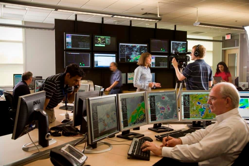
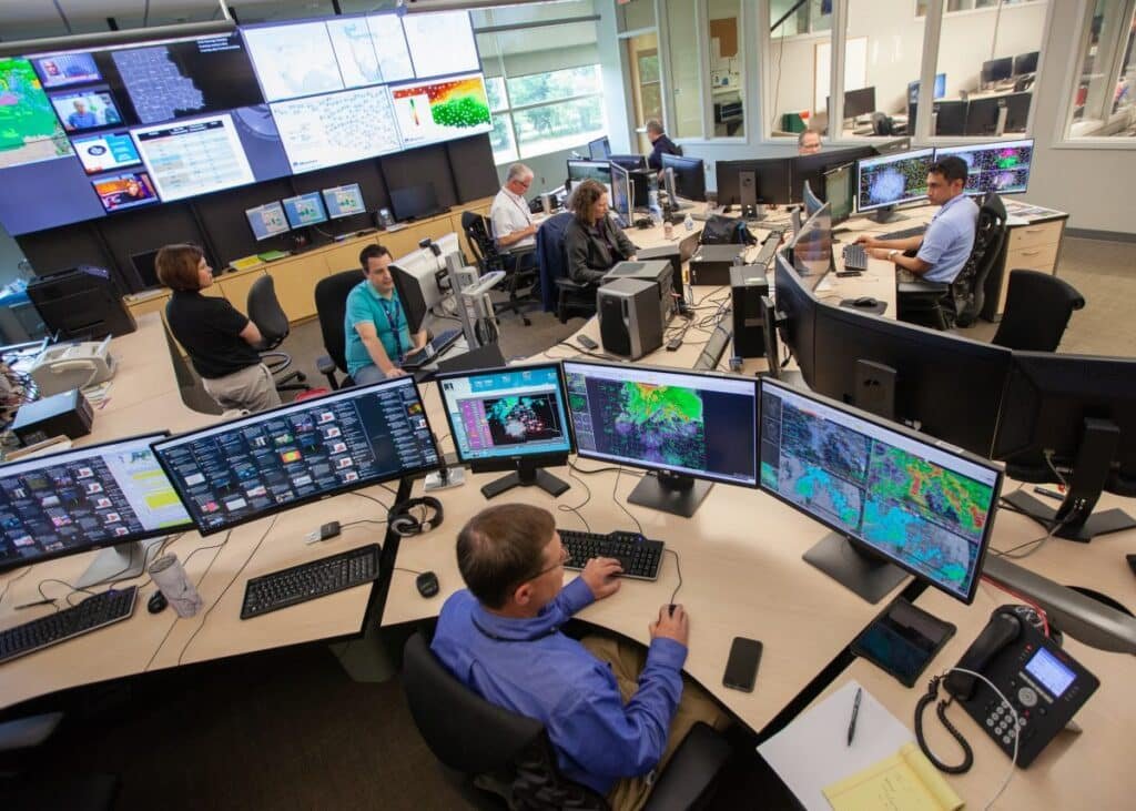
Most people experience a severe weather event from their living room, watching the radar on their phone and waiting for the sirens. On the other side of that experience, in a windowless room somewhere in your county or region, a meteorologist is making decisions that will determine whether you get a warning with enough time to act or find out about the tornado after it has already passed.
Here is what actually happens inside a National Weather Service forecast office when a major storm is developing, and why the job is more complicated than most people realize.
The day starts hours before the storm does
Severe weather forecasting is not reactive. By the time a tornado warning gets issued, meteorologists have been watching the setup develop for 12 to 24 hours or more. The morning shift on a potentially active severe weather day begins with a detailed review of the atmospheric setup: the position of the dryline separating moist Gulf air from dry western air, the strength and height of the capping inversion that prevents thunderstorms from firing too early, the wind shear profile that will determine whether storms rotate, and the timing of whatever trigger will finally release the convection.
The Storm Prediction Center in Norman, Oklahoma issues Convective Outlooks at least three times daily that categorize the severe weather risk across the country at different time horizons, from two days out to the day of. Local forecast offices use those outlooks as a starting point and refine them with local terrain knowledge, historical storm behavior in their specific area, and the model data available to them. A forecaster in the Kansas City office knows things about how storms behave when they cross the Missouri River valley that no model fully captures, and that local knowledge matters on high-end severe weather days.
By midday on an active setup day, the forecast office will have issued a public severe weather statement explaining the day’s threat to anyone who checks the NWS website. The afternoon shift, which handles the peak severe weather window, arrives early to receive a thorough briefing from the morning team before taking over the workstation.
The difference between a watch and a warning matters more than most people know
A tornado watch means conditions are favorable for tornado development across a large area, typically several counties or parts of multiple states, over the next few hours. It is issued by the Storm Prediction Center, not local forecast offices, and covers a region where the atmosphere is primed but nothing has happened yet. A watch is the time to locate your shelter, charge your phone, and pay attention. It does not mean a tornado is imminent.
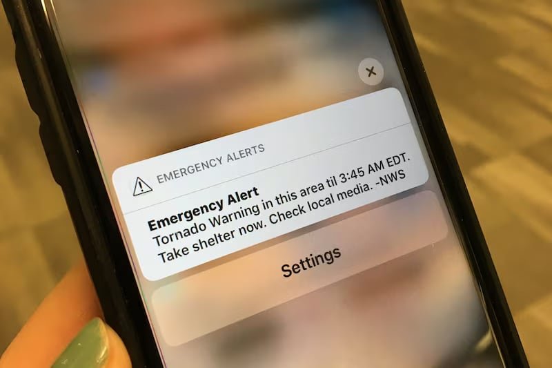
A tornado warning means a tornado has been detected on radar or spotted by a trained observer and is occurring right now or is imminent in a specific location. Warnings are issued by local forecast offices for specific areas, typically a county or part of a county, and have a lead time that currently averages around 13 minutes nationally. That 13-minute average represents a significant improvement over the near-zero warning time that existed before the Doppler radar network was built in the 1990s, but 13 minutes is not as much time as most people think it is when it arrives unexpectedly.
Tornado emergencies, a relatively new product the NWS issues when a confirmed violent tornado is threatening a significant population, represent a step above a standard tornado warning. The language is intentionally more urgent, the geographic specificity is higher, and the message is designed to communicate that this particular event represents a threat to human life at a level that demands immediate action rather than a watch-and-see response.
What the meteorologist is actually looking at on the radar
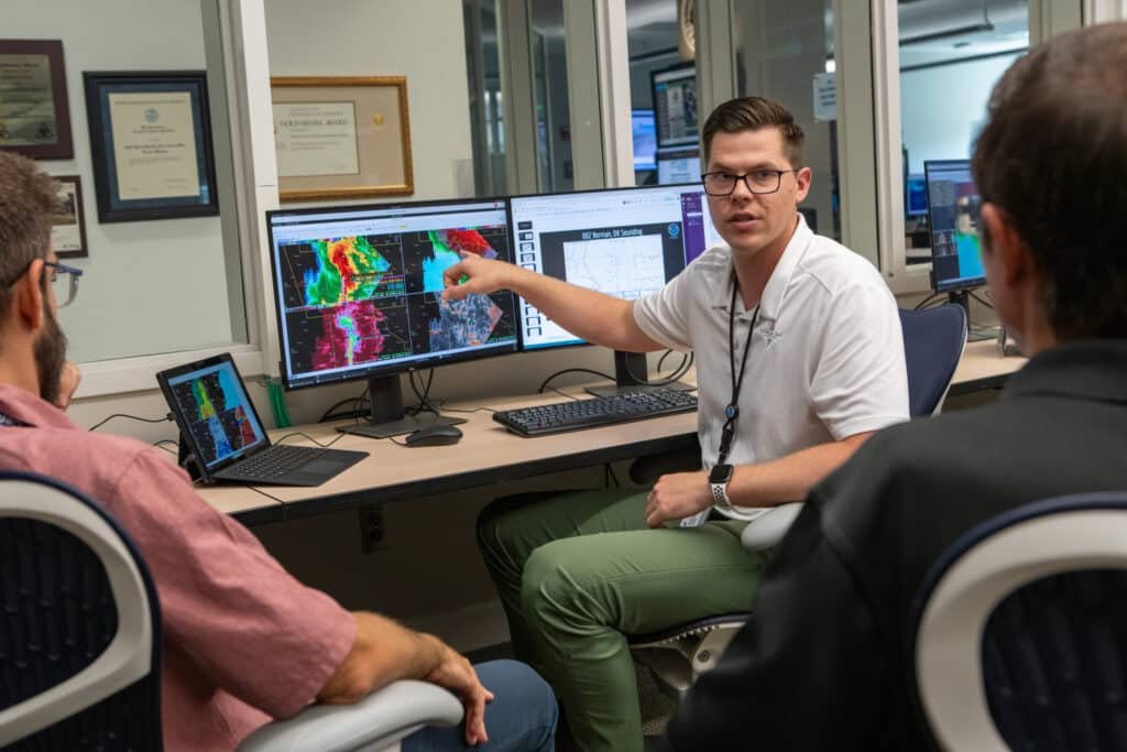
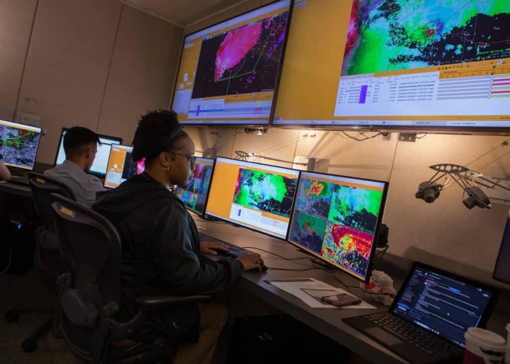
The radar images most people see on weather apps are simplified versions of what a forecaster is actually analyzing. During active severe weather, a meteorologist is simultaneously looking at reflectivity, which shows precipitation intensity, and velocity, which shows wind speed and direction inside the storm. The velocity scan is where rotation becomes visible, appearing as a tight couplet of green and red pixels close together: wind moving toward the radar in green, wind moving away in red, both happening in the same small area at the same time, indicating a rotating column of air.
A well-defined rotation signature on velocity radar is what triggers a tornado warning when no spotter has visually confirmed a funnel. The forecaster is looking at a feature that is essentially invisible to everyone outside the office and making a time-sensitive decision about whether to issue a warning that will interrupt television programming, activate sirens across multiple counties, and potentially cause tens of thousands of people to take cover. Issuing a warning that turns out to be wrong has costs in public trust and warning fatigue. Not issuing a warning that should have been issued has costs measured in human lives.
Modern dual-polarization radar, upgraded across the national network starting around 2012, added a new dimension to that analysis by measuring not just where precipitation is and how fast it is moving, but what shape the precipitation particles are. This allows forecasters to distinguish between rain, hail, and debris lofted by a tornado, meaning it is now possible to confirm a tornado is on the ground by detecting the debris it is throwing aloft on radar without requiring a visual confirmation from a spotter on the ground.
Storm spotters are the human layer the radar cannot replace
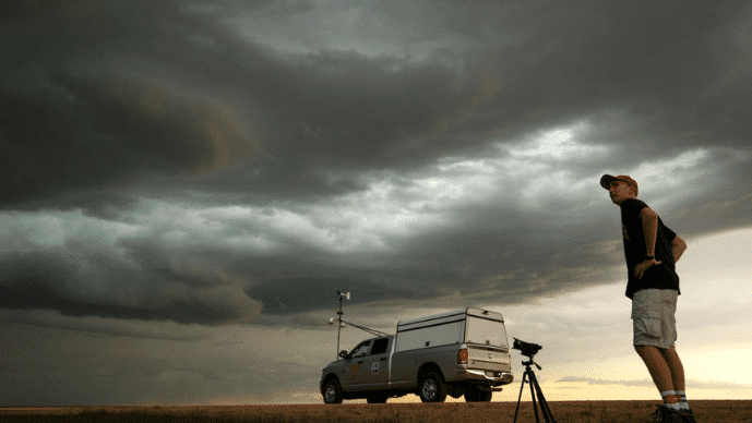
The National Weather Service coordinates a network of trained volunteer storm spotters across the country through a program called SKYWARN. These are ordinary people, farmers, truck drivers, emergency managers, amateur radio operators, who have completed training in identifying significant weather features and reporting them accurately to the local forecast office. During active weather, spotters position themselves in safe locations with clear views of developing storms and relay real-time ground observations by radio and phone.
A spotter report of a wall cloud with visible rotation, or a confirmed funnel cloud descending from the base of a storm, carries weight in the warning decision process that a radar signature alone sometimes cannot provide. Radar sees through precipitation and measures motion indirectly. A trained human eye watching the storm from five miles away sees things the radar cannot resolve, particularly at low levels where the most dangerous activity occurs and where the radar beam overshoots the ground due to the curvature of the Earth.
During major outbreak events, the volume of spotter reports coming into a forecast office can be overwhelming. Meteorologists must quickly assess incoming reports for accuracy, timeliness, and geographic precision while simultaneously analyzing a radar display showing multiple dangerous cells moving simultaneously. The cognitive load on a forecaster during an active severe weather event in a populated area is genuinely extreme, which is why forecast offices are staffed up on days when the setup warrants it and why the forecasters who work those shifts describe certain days as defining experiences in their careers.
The hardest decision is not whether to warn but when to stop
Warning fatigue is a real and documented problem in tornado meteorology. Communities that have received multiple warnings without experiencing significant tornadoes show measurably reduced compliance with subsequent warnings, meaning people are less likely to take shelter when a warning is real if they have experienced several that were not. The forecaster issuing a warning knows this and weighs it against the risk of issuing too few warnings and missing the event that kills people.
The 2011 Joplin tornado offered a painful case study. The National Weather Service issued a tornado warning 24 minutes before the EF5 struck the city, which was significantly above the national average lead time. Surveys of survivors found that many residents did not take immediate action because they had received multiple tornado warnings earlier in the season that produced nothing significant. The warning existed. The behavior change it was designed to produce did not occur at the scale that would have saved additional lives.
The post-event analysis that happens after every major weather event is one of the least-publicized parts of the forecasting process and one of the most important. Forecast offices review every warning issued, every spotter report received, every decision made during the event, and evaluate what worked, what did not, and what changes in procedure or communication might improve outcomes next time. The meteorologists who issued the warnings during Joplin, Tuscaloosa, and other major events have thought extensively about what those days mean for how warnings are issued and communicated. That ongoing process of self-evaluation is what has driven the improvement in average tornado warning lead time from near zero in 1980 to over 13 minutes today.
What happens after the storm passes
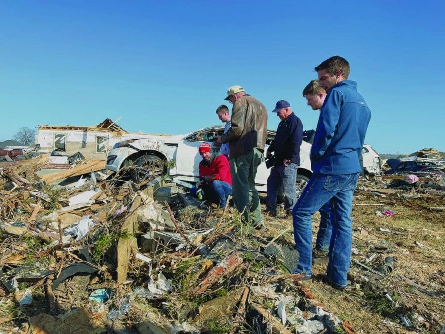
Once the immediate threat has cleared, the work is not finished. Forecast offices issue post-storm surveys, sending meteorologists into the field to walk tornado damage paths, assess wind speeds from structural damage patterns, and assign official intensity ratings to confirmed tornadoes. A tornado’s EF rating, from EF0 to EF5, is not determined from radar but from ground truth: what structures were destroyed, how were they constructed, what does the damage pattern tell us about wind speed at that point in the path.
These surveys can take days for major events across large damage areas. The surveys from the April 27, 2011 outbreak required weeks of field work to document 62 separate tornadoes across Alabama alone. The resulting data goes into the Storm Data database, which is the historical record researchers use to study tornado climatology, building code standards, and warning effectiveness. Every tornado that has ever been officially rated was assessed by a meteorologist walking the damage path and making judgments about what they saw on the ground.
The meteorologists who do that work after a major event are often the same people who issued the warnings the night before, who worked through the night as the event unfolded, and who are now documenting what happened to the communities they served. It is not a job that ends when the radar screen goes quiet. The consequences of weather events play out for weeks and months after the storm, and the people who watched it develop from the beginning tend to follow those consequences to their conclusion.